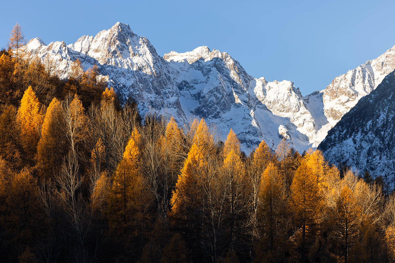
Néal Lake and Néal Pass Circuit
It is on the border between the Durance and the Queyras Regional Park that this hike will lead you to discover an authentic corner of the Hautes-Alpes. Little known to hikers, Néal Lake is nevertheless well worth the detour, with its emerald water fringed with small white flowers known as cottongrass. A magnificent view over the Écrins will reward your final efforts at the Néal pass.
Description
- At the entrance to the hamlet of Le Cougnet, take the right-hand path that climbs through the meadow just before the first chalets.
- Continue to the Néal mountain hut, then keep climbing through a few switchbacks to a junction at 2,418m.
- Turn right towards Lac de Néal, which is 500m from the junction.
- Upon reaching the lake, continue straight ahead along the path, then turn right at the junction to climb up to the Col de Néal.
- Enjoy the viewpoint before descending by the same path as the ascent.
- Departure : Entrance of the hamlet Le Cougnet
- Arrival : Entrance of the hamlet Le Cougnet
- Towns crossed : La Roche-de-Rame and Arvieux
Altimetric profile
Recommandations
Check weather conditions before setting off on a hike
Emergency contacts: Mountain Rescue: 112
Respect the work of farmers, landowners and property owners
Close all gates behind you
Take all your litter home
Do not cut across meadows
Information desks
23 Avenue de la République, 05120 L'Argentière-La Bessée

Vallouise Park house
, 05290 Vallouise
Information, documentation, models, exhibitions, screenings, product sales and works of the Park. Guided tours for school, reservation required. The new Park House opened in Vallouise since June 1, and offers visitors an interactive permanent exhibition inviting to explore the area and its heritage. A temporary exhibition space will allow a renewed offer. Finally, the device is completed by an audiovisual room to organize screenings and conferences Free admission. All animations of the Park are free unless otherwise stated.
Transport
Public transport >> www.pacamobilite.fr
Consider carpooling >> www.blablacar.fr
For more information, contact the Tourist Information Office nearest to the start of the hike.
Access and parking
15.8km from L'Argentière-la-Bessée, take the N94 to La Roche de Rame, then turn left before the bridge crossing the Bouchouse torrent, heading towards Le Bathéou. Continue along the forest road to the Bel Pinet junction, then follow the signs for "le Lauzet par le Calvaire". Continue to the hamlet of Le Cougnet.
Parking :
More information
details.BAMwidget
Source

Report a problem or an error
If you have found an error on this page or if you have noticed any problems during your hike, please report them to us here: