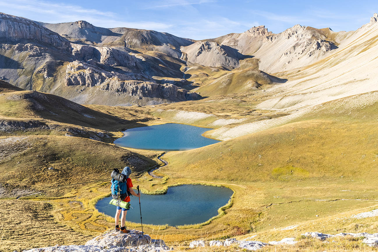
Ascension Lake Loop
Nestled in a natural setting, this route will reveal the magnificent Lac de l'Ascension. From conifer forest to alpine valley, passing by the river, this loop offers a variety of atmospheres. An open view over the Durance valley and the majestic Mont Pelvoux will accompany you throughout this full-day journey.
Description
- At the Lauzet chalets, turn left onto a forest road that crosses the Bouchouse torrent via a footbridge.
- At Le Giet, take the right-hand path signposted "lac de l'Ascension via le Peyron 2h15". Continue to the Collet du Peyron, Lac Escur and then Lac de l'Ascension.
- After this last lake, keep to the left-hand path to reach the Alpavin mountain hut.
- Continue descending to a junction at the small flat area of Pra Chapelle. Turn left onto a path that climbs back up 120m in elevation.
- Continue straight ahead along the forest track to return to Le Lauzet.
- Departure : Le Lauzet Car Park
- Arrival : Le Lauzet Car Park
- Towns crossed : La Roche-de-Rame
Altimetric profile
Recommandations
Check weather conditions before setting off on a hike
Emergency contacts: Mountain Rescue: 112
Respect the work of farmers, landowners and property owners
Close all gates behind you
Take all your litter home
Do not cut across meadows
Information desks
23 Avenue de la République, 05120 L'Argentière-La Bessée

Vallouise Park house
, 05290 Vallouise
Information, documentation, models, exhibitions, screenings, product sales and works of the Park. Guided tours for school, reservation required. The new Park House opened in Vallouise since June 1, and offers visitors an interactive permanent exhibition inviting to explore the area and its heritage. A temporary exhibition space will allow a renewed offer. Finally, the device is completed by an audiovisual room to organize screenings and conferences Free admission. All animations of the Park are free unless otherwise stated.
Transport
Public transport >> www.pacamobilite.fr
Consider carpooling >> www.blablacar.fr
For more information, contact the Tourist Information Office nearest to the start of the hike.
Access and parking
15.8km from L'Argentière-la-Bessée, take the N94 to La Roche de Rame. Turn left before the bridge crossing the Bouchouse torrent, heading towards Le Bathéou. Continue along the forest road to the Bel Pinet junction, then follow the signs for "le Lauzet par le Calvaire".
Parking :
4 points of interest
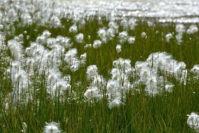
Des linaigrettes - Mireille Coulon - Parc national des Écrins  Flora
FloraCotton grass
On the water's edge, in the wet meadow, plants with a cottony head sway gently. This is cotton grass, a plant which has insignificant rudimentary flowers but it has fruits that have feathery tufts which aid their dispersal by the wind. The fruits are grouped in such a way that their tufts form a very appealing «pompom»! These plants are well adapted to the mountain climate.
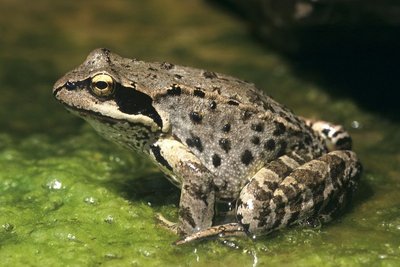
Une grenouille rousse - Mireille Coulon - Parc national des Écrins  Fauna
FaunaThe common frogs
The common frog has adapted to high altitudes and can occupy waters up to an altitude of 2,800 metres. It is capable of surviving the harsh winters by sheltering from freezing temperatures under a rock or tree stump. This amphibian is the most common frog in the mountains and is recognisable by its chocolate coloured mask which highlights its golden eyes. Interestingly, the tadpoles mature very slowly: it takes two years for them to become adults.

Lac de l'Ascension - Jan Novak Photography  Lake
LakeThe Lac de l'Ascension
La Roche-de-Rame lies between two small valleys where the municipality's alpine pastures are located: the Bouchouse and L'Ascension valleys. The latter only has one sheepfold and a number of lakes, including the Lac de l'Ascension, lying at an altitude of 2,306 metres.
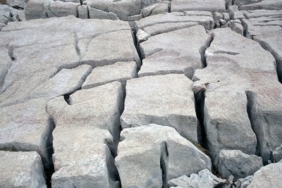
Lapiaz - Christian Couloumy - Parc national des Écrins  Geology and geography
The limestone pavement
The limestone pavement is a more or less horizontal geological surface formation created in compact limestone. It is the result of the dissolving of the carbonate substances in the limestone by cold water flowing over it, which leads to the formation of crevices, gullies and cavities. Numerous limestone pavements were formed when the large Quaternary glaciers melted (cold water!), but they continue to be eroded when the snow melts.
More information
details.BAMwidget
Source

Report a problem or an error
If you have found an error on this page or if you have noticed any problems during your hike, please report them to us here: