RANDOLAND : Champcella
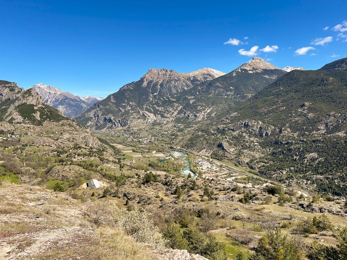
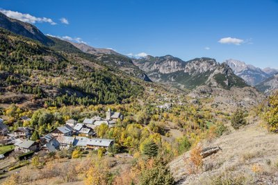
Champcella is made up of 17 small hamlets that stretch across an altitude of approximately 1,150 to 1,630 meters, and its inhabitants are called the "Champcellouires". It is a village with a rich agricultural tradition that is pleasant to live in and filled with walking paths ready to reveal its many stories and legends.
Equip yourself with the "Randoland" leaflet, available for purchase at the Tourist Office, to solve puzzles and observe elements of the local heritage.
Description
The walk starts at the church, where you should begin by observing the building to solve the first riddle.provence-alpes-cotedazur
- With your back to the church, take the road heading uphill and look for the "Mont Analogue" marker on your left after 30 meters.
- Continue uphill through the village, passing the town hall and the lodge, to reach the Place du Général Guieu, home to the war memorial, a cross, and the communal wash house.
- Turn right after the wash house onto Rue de la Cime de Ville and observe the house on your left just past number 39.
- Follow the dead-end street, then take the first path on the left running along a meadow; at the road, turn left, then right at the intersection to reach the Croix des Chapelles.
- Continue uphill, turn left at the junction toward "les Pasques," and take a break on the bench about 130 meters further along the right side of the path.
- Stay on the left-hand path that climbs past two large boulders, then continue left after 30 meters until you reach the Croix de la Gardette.
- Turn back, go about 100 meters, turn left, and walk past the pines, cairn, and two small rocks to join the trail that circles the Croix de la Gardette massif and leads back to the village.
- At the bottom of this path, walk between the houses to observe the facade of number 54, then turn right at the war memorial to return to the church.
- Departure : Église (church), Champcella
- Arrival : Église (church), Champcella
- Towns crossed : Champcella
Altimetric profile
Recommandations
Before setting out on a hike, check the weather conditions. Be especially vigilant with children, particularly in non-pedestrian areas. The route is undertaken entirely at your own risk, and Randoland and the Tourist Office accept no responsibility in the event of an accident.
Mountain rescue: 112
Please respect the work of farmers, operators, and landowners.
Close all gates behind you.
Take all your rubbish with you.
Do not cut across the route through the meadows.
Transport
Public transport >> https://services‑zou.maregionsud.fr/fr/
Think car‑pooling as well >> www.blablacar.fr
For more information, contact the nearest Tourist Information Office to the starting point of the hike.
Access and parking
From Gap
At the roundabout in Saint-Crépin, take the third exit to join the D138 towards Champcella.
From Briançon
On the N94 road, before reaching La Roche-de-Rame, turn right onto the D38 towards Champcella.
Parking :
Sensitive areas
Peregrine falcon
- Impacted practices:
- Aerial, Vertical
- Sensitivity periods:
- FebMarAprMayJun
- Contact:
- Parc National des Écrins
Julien Charron
julien.charron@ecrins-parcnational.fr
1 point of interest
Champcella - Jan Novak Photography  History
The fields of Champcella
The name Champcella came from champ caché, or hidden field. And it's true that, nestling on a flat ledge, the village cannot be seen from the Durance valley. As you gain height above the village, a number of clues as to its past agricultural tradition are still in evidence. The crops have disappeared, replaced by meadows, but the old walls, canals and stone piles - formed by the patient clearing of stones from the fields - are a reminder of bygone times.
details.BAMwidget
Source

Report a problem or an error
If you have found an error on this page or if you have noticed any problems during your hike, please report them to us here: