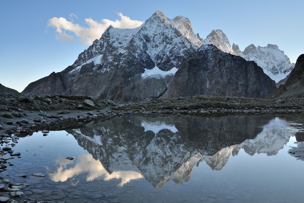
The Tuckett refuge
The former Tucket refuge was built in 1886 to replace a shelter below a rock that was used by early mountain-climbers and bears witness to the pioneering age of Alpine mountain-climbing in Vallouise in the second half of the 19th century.
Description
From the chalet-hotel, head north-east across the footbridges over the Momie torrent and the Noir glacier. The path then rises towards a group of smooth, polished and mottled rocks. The path passes the fork towards the Glacier Noir trail (to the left).
- Then take the winding path upwards. Cross the footbridge over the Glacier Blanc torrent and follow the path running along the left bank of the torrent and rising to the old Tuckett refuge.
- Take the same way back down to the Pré de Madame Carle car park.
- Departure : Pré de Madame Carle, Pelvoux
- Towns crossed : Vallouise-Pelvoux
Altimetric profile
Recommandations
Summer route: make sure the access road to Pré de Madame Carle is open and that the footbridges over the torrents have been put back.
There has been a charge for parking in the Pré de Madame Carle town car park since 2013.
Information desks
Information center Pré de Mme Carle (summer only)
Pré de Madame Carle, 05340 Pelvoux
Information, documentation and exhibition on glaciers, sale of products and works of the Park. Occasional wildlife sightings to the telescope. Free admission. All animations of the Park are free unless otherwise stated.
Transport
Coach stop: Pré Madame Carle
Access and parking
23 km from L'Argentière-la-Bessée along the D994E, you arrive in Vallouise. Then cross Pelvoux, Ailefroide and take the D204T to Pré de Madame Carle.
Parking :
11 points of interest
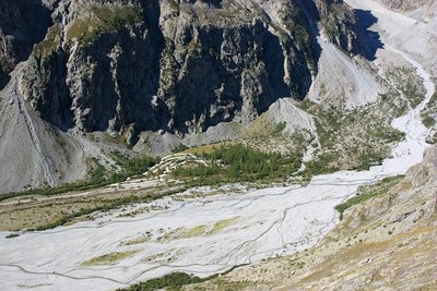
Les torrents en tresse du pré de Madame Carle - PNE - Maillet Thierry  Geology and geography
Weaving torrents
A constantly changing environment, the weaving torrents are formed from the ancient remains of a glacial lake. They are made of interlaced lakes with arms of water that fluctuate depending on level of flood water in a zone where the slope because suddenly very gentle... Materials carried by the torrents over the steep slopes are deposited here creating islets which are eroded and built up again in time. These natural habitats which are rare and fragile shelter unusual plants. The weaving torrents give an unusual character to the landscape at the bottom of the glacial valleys. Their aspect is greatly enhanced when seen from the surrounding summits and glacial cross cliffs.
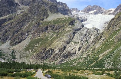
Le pré de Madame Carle et le glacier Blanc - PNE  Glacier
The Glacial valley
The particularity of this valley is that it shelters both a white glacier which stays covered with ice and a black glacier composed of ice covered with rocks... Their glacial tongues fluctuate depending on climatic conditions, which greatly effects the shape of the landscape. A lithography dating from 1854 shows the two glaciers joined at Pré de Madame Carle, ten years before the first ascent of the Barre des Ecrins. They white glacier lost more than 2 kilometers in length between 1885 and the 2000s.
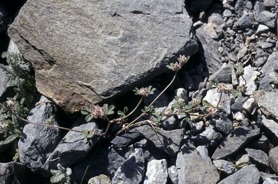
Trèfle des rochers - PNE - Nicolas Marie-Geneviève  Flora
FloraRock clover
Tiny clover dominates the alluvions or moraines in continual movement; the rock clover reproduces from seed each year unlike other alpine plants which are generally perennial. This strategy enables it to colonize areas which are always changing. It is a rare species protected nationally.
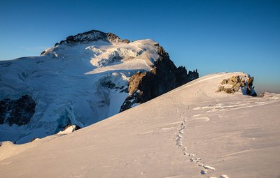
Barre des Écrins depuis Roche Faurio - Thibaut Blais  History
The Barre des Ecrins
The Barre des Ecrins (at an altitude of 4 102m , situated in the direction of the Black Glacier) was climbed for the first time in 1864, from the North side, by Edouard Whymper accompanied by Moore, Walker as well as his guides Almer and Michel. The Southern slope, was climbed for the first time by Henri Duhamel in 1880, with his guides Pierre Gaspard father and son from Bérarde. Then then came the time of a search for increasingly more difficult routes, In 1893, Auguste Reynier with his guides Joseph Turc and Maximin Gaspard, opened the way which now carries his name on the South-East face. The Southern column was opened in 1944 by Jeanne and Jean Franco.
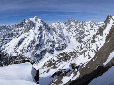
Le Mont Pelvoux et la Barre des Ecrins - Thierry Maillet - Parc national des Ecrins  Top
TopThe highest summit in the Ecrins
On the borders of the Isère and the Hautes-Alpes, little known and once called the "pointe des Arsines", the Barre des Ecrins was once misnamed by the cartographers. So the Pelvoux was considered to be the highest point in the region and also in France at a time when the Savoie was independent. Also when in 1828 Capitaine Durand, a cartographer, made the first ascent of Pelvoux he was convinced that the status of the highest summit should be attributed to the Barre des Ecrins (4 102m).
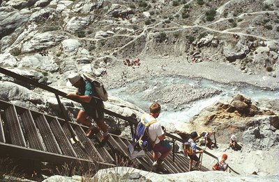
Ancien échelle menant au refuge (démontée en 2008) - PNE - Faure Joël  Glacier
The White Glacier and movement
The White glacier has been monitored for a century. At the end of the 19th century, the White glacier Blanc joined the Black glacier at the Pré de Madame Carle. The path following the right bank and the moraine and crosses under the White glacier refuge. During the 20th century, the two glaciers constantly recede. This glacial decline was interspersed with advances with a spectacular one in the 1980s. Two markers of these impressive movements are the measures of the speed of the flow by posts as well as the scale put in place at the beginning of the 1980s. The debate concerning this operation has started again. should it be continued, should it be preserved ? The scale, which was no longer usable became dangerous, and was finally dismantled in 2008 because the old itinerary has been freed from ice and can now be used... One part has been preserved at the house of the mountains at Ailefroide. While we speak of eternal snows, the glacier fluctuates according to the changes in climate.
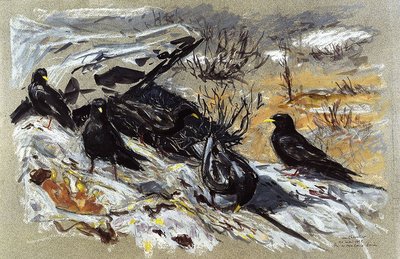
Visite des chocards au Pré de Madame Carle - PNE - Chevallier jean  Fauna
FaunaYellow billed Chough
A great diver and acrobat in the mountain tops, the yellow billed chough is also very clever at gleaning the remains of hikers’ picnics. It mainly moves in groups and brightens its passage with little fluted cries which are easily recognizable. It is as much a companion to experienced mountaineers as those just out for the day.
Accenteur alpin - PNE - Coulon Mireille  Fauna
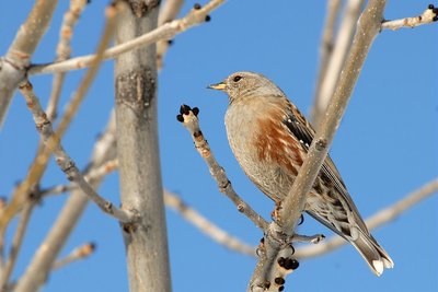
FaunaAlpine Accentor
The Alpine Accentor, is more discreet that the Yellow billed Chough, the same size as a sparrow is another inhabitant of these altitudes. It is never far away... On the top a few black stripes decorate its ash coloured feathers. Red flames characteristically mark its flanks It trots on the short grass in the alpine prairies and crows on the bare stone. It comes to peck the crumbs around the refuge. When winter comes it migrates towards the vallies. This transhumance even extends to the rocks of the littoral. When the snow melts, along the banks of snow, It is an impressive predator catching the small invertebrates numbed by the cold.
Collembole au microscope - PNE - Delenatte Blandine  Glacier
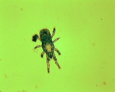
Life on the White Glacier
Life nestles everywhere. There is no exception ! Unicellular algae are capable of developing on the surface of the snow giving the snow banks a pink coloration. The animal world is represented by the springtail (collembole), a primitive insect that measures between 1 and 2 mm, and which lives in little pools in the ice. It feeds on little nutritive particles carried by the wind. Its development takes place between 0 and 4°c. As soon as the temperature reaches 12°C, it burrows down in order to satisfy its thermic requirement indispensable for its survival... Sometimes other animals adventure out putting their lives in danger.
Carrotage au glacier Blanc - PNE - Chevalier Robert  Glacier
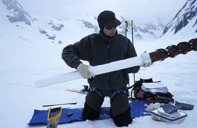
Glacier monitoring
Each year, the Ecrins National Park makes photographic records, mass balances, monitors the glacial front and takes topographical measurements. In the context of precocious evolution of the climate, it is an important program in the domain of high European mountains.
Le refuge Tuckett en 1985 - PNE - Couloumy Christian  Hut
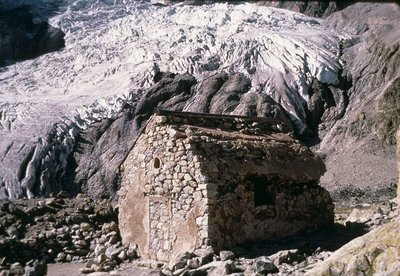
HutTuckett Refuge
The refuge is an ancient witness to the pioneering days of mountaineering in Vallouise in the second half of the 19th century... At that time it was situated at the foot of the glacier. It was built in 1886 to provide shelter under the rock for the first mountaineers. With its small dimensions, and materials of stone and wood, it represents a historical reference. Its remains shelter an exhibition retracing its history.
Source

Report a problem or an error
If you have found an error on this page or if you have noticed any problems during your hike, please report them to us here:

