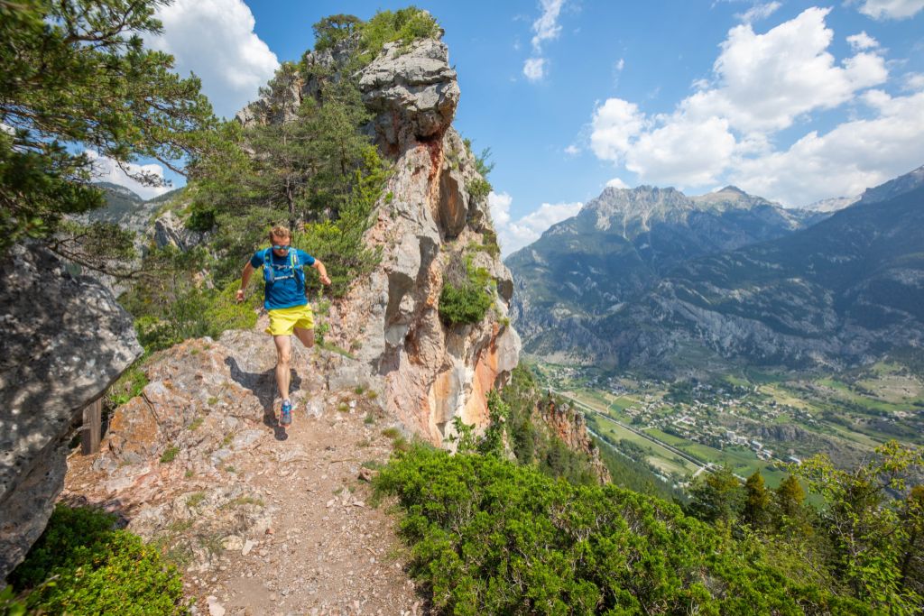
Our ancestors, those trail runners (trail route no. 6)
“How keenly we feel the presence of our forebears, whether in historical sites like Rama or simply the evidence of their everyday lives: old tracks, low walls, pens and their lovely houses in the hamlets we have passed through.” Marie-Geneviève Nicolas, park ranger at the Parc National des Écrins
Description
- Take the uphill track on the right and then join the path leading to the Col de l'Aiguille. After the pass, head downhill again towards Pallon.
- Just outisde the hmalet of Pallon, take the path leading down to Rama.
- Below the chapel, cross the bridge spanning the Biaysse. After the bridge, turn right and right again onto the track leading to the hamlet of Le Chambon. Then follow the road to Champcella.
- In the village of Champcella, turn right to join a track leading towards the houses of Les Seyes. When you come to a cross, take the path on the left and, further up, the track on the right.
- In Les Seyes, follow the road to Les Faures, where you continue on a path on the left, which leads to the track further uphill. Follow the track until you reach the Col des Combes, where you have to take the downhill path on the left leading down to Freissinières.
- Follow the path on the left to join a track which brings you back to your starting point.
- Departure : Valley Centre ("Maison de la Vallée"), Freissinières
- Arrival : Valley Centre ("Maison de la Vallée"), Freissinières
- Towns crossed : Freissinières and Champcella
Altimetric profile
details.BAMwidget
Recommandations
Before setting off, it is very important to check the opening periods for this route on the website: https://stationdetrail.com/fr/stations/le-pays-des-ecrins/parcours
Share your photographs on social networks with #stationdetrailecrins
Check weather conditions before setting off.
Rescue services contact details: Secours Montagne (Mountain Rescue): +33 (0)4 92 22 22 22 or 112
Show consideration for the work of farmers, livestock keepers and owners
Close all gates behind you
Take your litter home
Do not take shortcuts across pastureland
The trail routes are also suitable for walking
 In mountain pastures, protection dogs are there to protect the herds from predators (wolves, etc.).
When I hike I adapt my behavior by going around the herd and pausing for the dog to identify me.
Find out more about the actions to adopt with the article "Protection dogs: a context and actions to adopt".
Tell us about your meeting by answering this survey.
Information desks
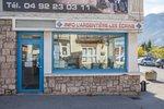
23 Avenue de la République, 05120 L'Argentière-La Bessée

Vallouise Park house
, 05290 Vallouise
Information, documentation, models, exhibitions, screenings, product sales and works of the Park. Guided tours for school, reservation required. The new Park House opened in Vallouise since June 1, and offers visitors an interactive permanent exhibition inviting to explore the area and its heritage. A temporary exhibition space will allow a renewed offer. Finally, the device is completed by an audiovisual room to organize screenings and conferences Free admission. All animations of the Park are free unless otherwise stated.
Transport
Public transport >> www.pacamobilite.fr
Consider car-sharing >> www.blablacar.fr
For more information, ask at the Tourist Information Office nearest to the trail starting point.
Access and parking
11.5 km from L'Argentière-La Bessée, take the N94 and the D38.
Parking :
15 points of interest
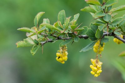
Épine-vinette en fleurs - Mireille Coulon - Parc national des Écrins  Flora
FloraThe common barberry
The common barberry is a bush with long thorns arranged in threes, and with oval serrated leaves. In spring, it produces clusters of yellow flowers, which later develop into red, oval and elongated berries. These tart fruits are edible and can be made into jellies... if you have the patience to gather them! This shrub grows almost everywhere.
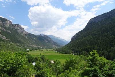
La vallée de Freissinières - Office de tourisme Pays des Écrins  History
The Freissinières valley
The valley was created as the result of glacial overdeepening, that is to say, when the glacier came to a halt against the Pallon hard rock bar, it created a depression. When the glaciers retreated, a lake was left behind this rock bar and was gradually filled up by alluvial deposits. From a historical point of view, the Protestant pastor Félix Neff fundamentally altered life in the valley in 1826 by founding a training college for primary school teachers, developing irrigation processes and teaching new crop growing methods, among other things…
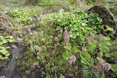
Pétasite hybride - Ludovic Imberdis - Parc national des Écrins FloraThe petasites hybridus or butterbur
The ditches on the Freissinières plain are edged by a plant with very broad leaves: the petasites hybridus or butterbur, also called the devil's hat in French. In Ancient Greek, the petasos was a round felt hat. Nobody knows whether the devil wears this hat, but the plant is certainly used as a herbal remedy. Very common in the lowlands, it is quite rare in the Pays des Écrins although other species of petasites do grow at higher altitude.
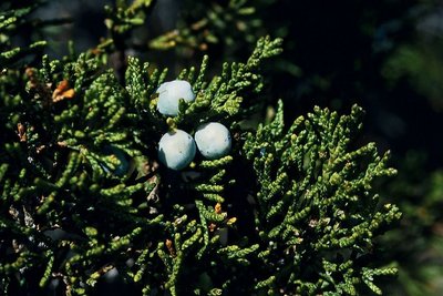
Le genévrier sabine - Bernard Nicollet - Parc national des Écrins FloraThe savin juniper
A low spreading shrub, the savin juniper is very common in stony meadows and uncultivated land on warm slopes. Its dark, matte green leaves in the form of small scales, overlap along the branches. So it isn't spiky... but you still need to be cautious as it is very toxic. For seasoning dishes, better to gather the fruits of the common juniper!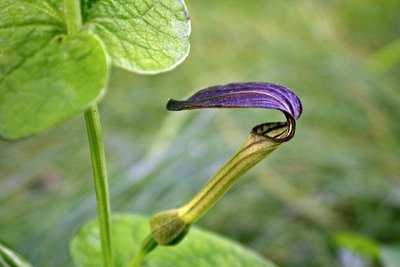
L'aristoloche pistoloche - Damien Combrisson - Parc national des Écrins FloraThe Aristolochia pistolochia
The hamlet of Pallon is in a sunny location. Around the village, a curious plant with long brown trumpet-like flowers grows on the edges of the stone piles in the fields and meadows: the aristolochia pistolochia or birthwort. Of Mediterranean affinity, this plant benefits from the hot dry climate here and is virtually at its northern boundary. It is the host plant of the caterpillars of a rare and protected butterfly: the Spanish festoon.
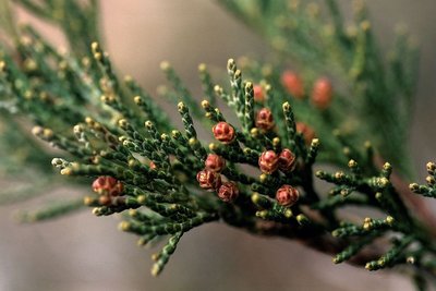
Genévrier thurifère (fleurs femelles) - Bernard Nicollet - Parc national des Écrins FloraJuniperus thurifera or Spanish juniper
This small tree is present in North Africa, the Iberian Peninsula and in a few departments in southern France, including the Hautes-Alpes. It is regarded as a relic from a warmer period far back in history. It has found a refuge in well exposed situations, on warm sunny slopes. Its needles are in the form of scales, lying against the branches. It is a monitored species.
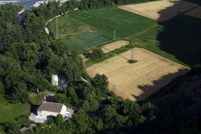
Plaine de Rame et la Chapelle pris de la cime des Rampes - Jean-Philippe Telmon - Parc national des Écrins HistoryThe lost village
In ancient times, the Durance valley was a key communication corridor. Rama was a kind of staging post on the Roman road. In the Middle Ages, Rama was a small town with a noble's château. But the village was devastated by the capriciousness of the Durance and the Biaysse rivers on numerous occasions and the inhabitants gradually deserted the site, moving to neighbouring villages. The attachment of the parish of Rame to that of La Roche in 1446 is indicative of this decline.
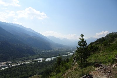
La vallée de la Durance - Office de tourisme Pays des Écrins  Geology and geography
The high Durance valley
Protected from Atlantic influences by the Massif du Pelvoux, the high Durance valley has a very dry climate with wide seasonal temperature fluctuations. It has grasslands very similar to the steppes of Central Europe which are rare in France. It is part of the Natura 2000 “Steppique durancien et queyrassien” (Durance and Queras valley steppes) site.
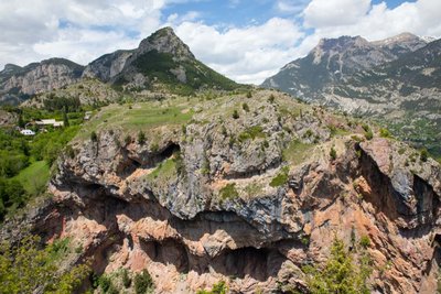
Le sentier du Gouffre - Thibault Blais Photographie HistoryThe Sentier du Gouffre - the ravine path
The Sentier du Gouffre has sometimes been described as a Roman road, but we do not know the exact route the Roman road followed. One thing is certain, it used to be used by the villagers to reach their fields and vineyards, and for any other journeys they had to make.
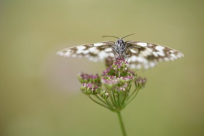
Le demi deuil - Mireille Coulon - Parc national des Écrins  Fauna
FaunaThe marbled white
Numerous butterflies can be seen enjoying the sunshine along the way. One is very easy to recognise. Completely black and white, maybe the person who gave it its French name demideuil («half in mourning) was a pessimist! In England, however, its name "marbled white" puts the emphasis on its white colour. It is a common butterfly and its caterpillars feed on grasses.
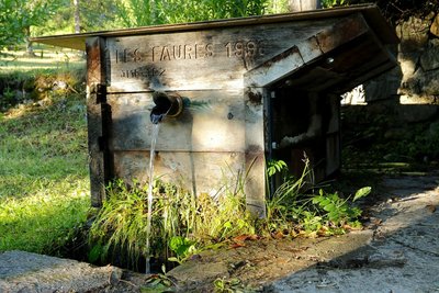
Fontaine des Faures - Telmon Jean-Philippe - Parc national des Écrins  Vernacular heritage
Les Faures
This hamlet of just a few houses is in the municipality of Champcella. The name Faure is common in the south-east of France and originates from the Occitan language. It means blacksmith. It is also frequent in place names, and there are many places called «les Faures», where the blacksmith lived.
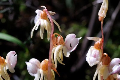
L'épipogon sans feuilles - Mireille Coulon - Parc national des Écrins FloraCool forest
Here, the drought-sensitive fir has established itself among the larches. This forest harbours treasures such as the very rare ghost orchid and the shield-moss, a unique little moss - also rare - which grows on wood in an advanced state of decomposition and thus signals that the natural cycle of the forest is unimpaired.
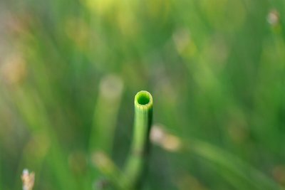
Section de feuille de prêle des rivières - Cédric Dentan - Parc national des Écrins FloraThe horsetail
On the banks of a stream, on the edge of a ditch a plant grows which resembles a large bottle brush... or a horse's tail, depending on your imagination. It's the field horsetail, a plant related to ferns. It is known for its medicinal properties because it is rich in silica, a powerful remineraliser for the bones, cartilage and skin. There are several species of horsetail.
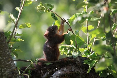
Ecureuil roux - Marc Corail - Parc national des Écrins FaunaThe red squirrel
Elegant and alert, a squirrel crosses the track, followed by its long feathery tail. Red? This one is dark brown. In the mountains this rodent has adopted a “solar panel” strategy, on the principle that dark colours absorb the heat more efficiently. It is active during the day and does not hibernate, although it does minimise its activity on days when the weather is bad. It is a protected species.
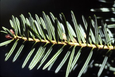
Aiguiles de sapin - Parc national des Écrins FloraThe fir
The fir thrives on this north-exposed slope, called the ubac. Its needles have two white stripes on their undersides. They are arranged on either side of the boughs, and not all the way around them, which distinguishes it from the spruce. The elongated cones stand upright, rather than hanging downwards. They grow in large number, often mingling with larch trees under whose shade they can grow. By contrast, the larch - the "tree of light" - cannot grow under the cover of fir trees.
More information
Source

Report a problem or an error
If you have found an error on this page or if you have noticed any problems during your hike, please report them to us here: