Les Tenailles (trail route no. 12)
This challenging trail is popular because of the diversity of its tracks: narrow steep paths, alpine meadow plain, forest road, balcony path, earth track, all supplemented by beautiful panoramic vistas like the view from the Croix de la Salcette!
Description
Starting from the campsite, head towards the village of Prelles on the road running alongside the railway line.
- Go past the railway line and the N94 to reach Prelles (exercise caution: a dangerous and busy road) and then carry on through the village. Follow signs for Sachas via the D336.
- At the bend, keep an eye out for a path on the right. Take this and follow the banks of the Sachas mountain stream.
- Cross the mountain stream and carry on towards Ratière. The path crosses the Pra Piouzéou mountain stream and runs through Les Banchets. Skirt around Ratière.
- Take the path on the right and carry on until you reach the Col de la Trancoulette. At the pass, turn left to start the descent.
- Turn left to continue the descent and skirt around Le Clot des Amandiers.
- At the mountain stream La Trancoulette, continue right to the Croix de la Salcette, below Les Tenailles de Montbrison. Carry on towards the hamlet of Bouchier, and then drop back down to Prelles and back to your starting point.
- Departure : Camping de l’Iscle de Prelles, Saint-Martin-de-Queyrières
- Arrival : Camping de l’Iscle de Prelles, Saint-Martin-de-Queyrières
- Towns crossed : Saint-Martin-de-Queyrières, Puy-Saint-André, and Les Vigneaux
Altimetric profile
Recommandations
The N94 is a dangerous and busy road, take care when crossing it.
Before setting off, it is very important to check the opening periods for this route on the website: https://stationdetrail.com/fr/stations/le-pays-des-ecrins/parcours
Share your photographs on social networks with #stationdetrailecrins
Check weather conditions before setting off.
Rescue services contact details: Secours Montagne (Mountain Rescue): +33 (0)4 92 22 22 22 or 112
Show consideration for the work of farmers, livestock keepers and owners
Close all gates behind you
Take your litter home
Do not take shortcuts across pastureland
The trail routes are also suitable for walking
Information desks
23 Avenue de la République, 05120 L'Argentière-La Bessée
Vallouise Park house
, 05290 Vallouise
Information, documentation, models, exhibitions, screenings, product sales and works of the Park. Guided tours for school, reservation required. The new Park House opened in Vallouise since June 1, and offers visitors an interactive permanent exhibition inviting to explore the area and its heritage. A temporary exhibition space will allow a renewed offer. Finally, the device is completed by an audiovisual room to organize screenings and conferences Free admission. All animations of the Park are free unless otherwise stated.
Transport
Public transports >> www.pacamobilite.fr
Consider car-sharing >> www.blablacar.fr
For more information, ask at the Tourist Information Office nearest to the trail starting point.
Access and parking
10 km from L'Argentière-La Bessée, take the N94.
Parking :
Sensitive areas
- Impacted practices:
- Land, Vertical
- Sensitivity periods:
- JanFebMarAprMayJunJulAugSepOctNovDec
- Contact:
LPO PACA antenne de Briançon
0492219417
hautes-alpes@lpo.fr
Golden eagle
- Impacted practices:
- Aerial, , Vertical
- Sensitivity periods:
- JanFebMarAprMayJunJulAug
- Contact:
- Parc National des Écrins
Julien Charron
julien.charron@ecrins-parcnational.fr
10 points of interest
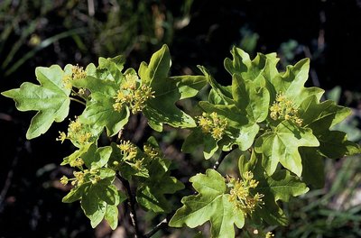
Érable champêtre - Nicollet Bernard - Parc national des Écrins  Flora
FloraThe field maple
This is the smallest member of the family of forest maples, growing to a height of 8 to 15 metres. It can live for up to 150 years. Its leaves have five round lobes; they are winged with wings sticking out in opposite directions. It is not fussy as to the dampness of the soil and it can withstand cold temperatures and drought. It is also an excellent bee forage plant, which can be enhanced by the proximity of a hive.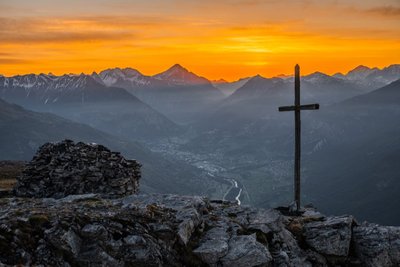
Lever de soleil à la Croix de la Salcette - Thibault Blais Photographie  Panorama
The Croix de la Salcette
The highlight of this trail, overlooked by the southern, colourful foothills of the Montbrison massif (Tête d'Aval, Tête d'Amont, Les Tenailles), the Croix de la Salcette offers both the gentleness of a vast alpine grassland and a splendid panorama of the upper reaches of the Durance valley.
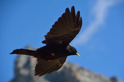
Chocard à bec jaune en vol - Mireille Coulon - Parc national des Écrins  Fauna
FaunaThe alpine chough
This small black corvid sports a yellow beak and red legs. It likes to fly in groups of several dozen or even several hundred individuals. Common in the mountains and a great acrobat, it can often be spotted whirling around cliffs or skimming over the alpine grasslands. It often hangs around picnics to gather up the crumbs!
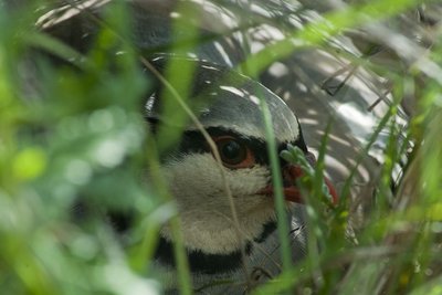
Perdrix batavelle - Mireille Coulon - Parc national des Écrins  Fauna
FaunaThe rock partridge
At the approach of intruders, rock partridges fly away with a great whirring of wings from the rocky ground where they had hitherto passed unnoticed. This bird favours south-facing slopes which are rocky and well exposed to the sun. During the mating season, at dawn the male produces an echoing, rasping and rhythmic call. It is a species in sharp decline.
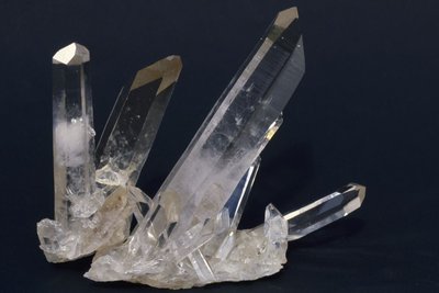
Quartz - Jean-Pierre Nicollet - Parc national des Écrins  Geology and geography
The quartzite
The path passes along the edge of a big cutting, with boulders of quartzite. This is a metamorphic, siliceous rock which is very hard and formed by grains of quartz welded together. It originates from sand deposited 230 million years ago in the still-shallow waters of the nascent Alpine ocean, and brought here by the erosion of the surrounding topography.
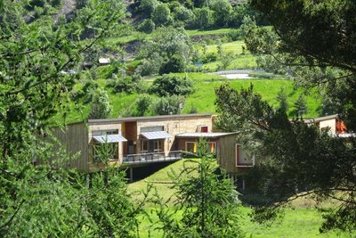
L'école éco-construite de Saint-Martin-de-Queyrières - Office de tourisme Pays des Écrins  Know-how
The eco-constructed school
The school in Saint-Martin-de-Queyrières is built out of materials that are safe and sustainable. The building is of bioclimatic design, that is to say, the architecture is adapted to the characteristics of the climate of the local area in which it is sited, in order to obtain the most natural ambient comfort possible. The environment provides power and resources through, for example, the capture of solar energy, the use of air circulation techniques, rainwater harvesting etc.
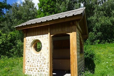
Cabane éco-construite - Office de tourisme Pays des Écrins  Know-how
Eco-construction
On this path, you will pass by some eco-constructed cabins. One of them is made from larch, a wood that is naturally resistant to bad weather and insects and needs no previous treatment. The other is constructed according to the “post-beam” principle, which is reminiscent of half-timbered construction. This is characterised by an exposed supporting framework. The beams support the roof, and these beams are in turn are supported by the posts.
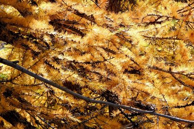
Un mélèze - Hélène Quellier - Parc national des Écrins  Fauna
FaunaThe larch, a tree unlike any other
The symbol of the Southern Alps, this softwood tree loses its leaves in winter, and is swathed with gold and lights up the mountains in autumn. The larch forests are maintained by the grazing of flocks. Without them, other trees like the fir or other pine trees could grow, creating a different kind of forest. A pioneer species, the larch establishes freely in light conditions. Its solid rot-proof wood has always been used in the construction of houses.
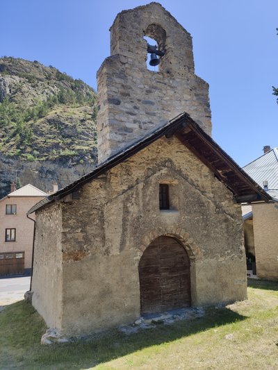
La chapelle Saint-Jacques-de-Prelles - Office de tourisme du Pays des Écrins  Architecture
The chapel of Saint-Jacques-de-Prelles
The chapel of Saint-Jacques-de-Prelles was built in the Middle Ages, in 1502, on the ancient pilgrims' way from Italy to Santiago de Compostella. It is surmounted by an arcade bell tower, decorated at the top with blind arcades with pointed arches. A number of wall paintings depicting historical episodes adorn the interior of the chapel, likely dating from the fifteenth century. They were restored in 1955. This chapel was listed as a Historical Monument in 1906 and it contains objects also listed as Historical Monuments, such as the bell which dates from 1639 or the eighteenth century silver, gold and brass ciborium.
GR 653D - Office de tourisme du Pays des Écrins  History
The GR 653D
The GR 653D is the Via Domitia. It is the second stage of the pilgrims' way to Santiago de Compostella, the Way of Saint James. This Grande Randonnée follows the route of the Via Domitia, an ancient Roman road built from 118 BC onwards. It linked Italy to the Iberian Peninsula, crossing Narbonese Gaul. 20 days should be allowed to travel its 459 kilometres of paths.
Source

Report a problem or an error
If you have found an error on this page or if you have noticed any problems during your hike, please report them to us here:

