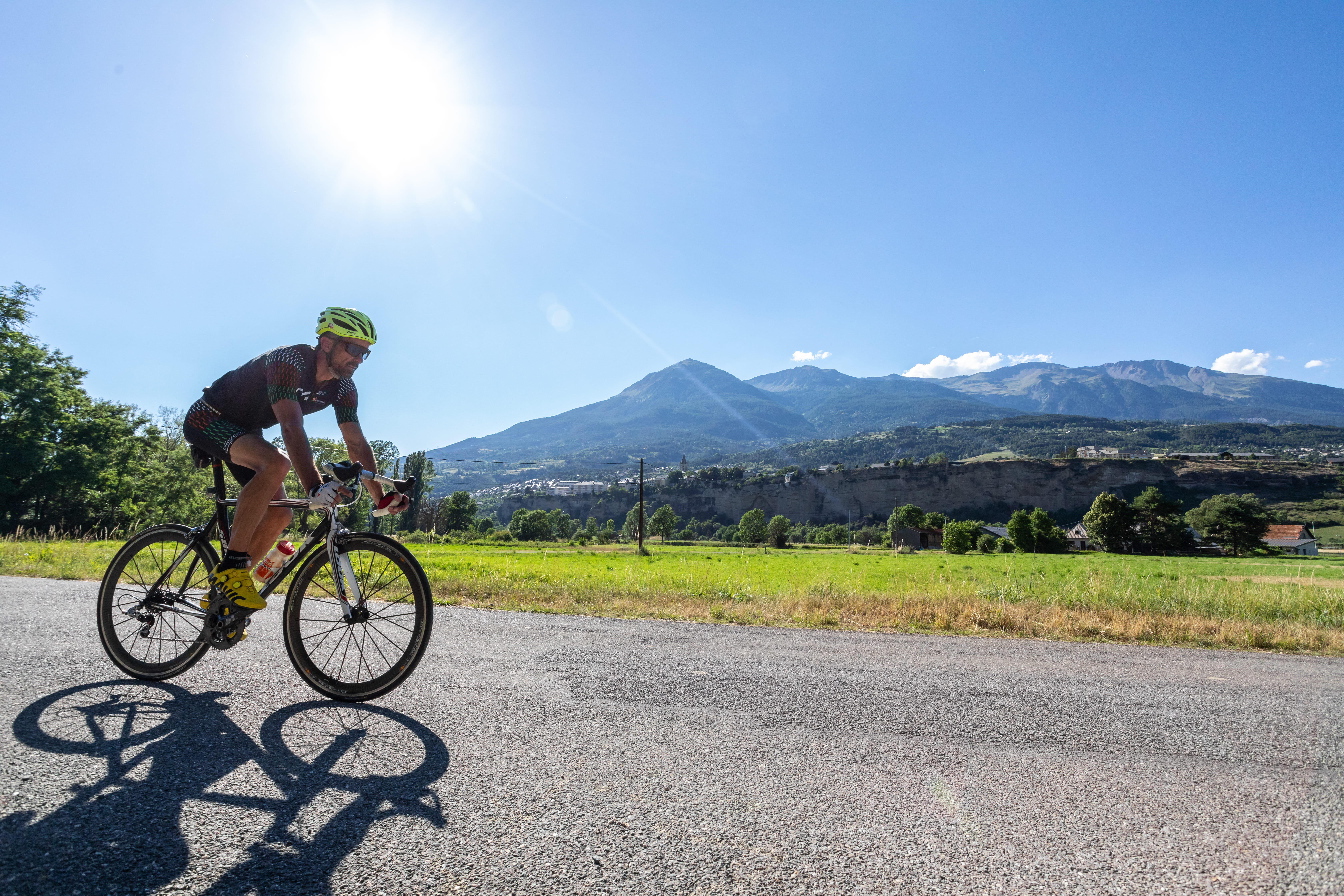
La Durance by Bike: Chorges – Tallard
From Chorges, this stage opens out onto quiet rural roads, passing through meadows, hamlets and the agricultural landscapes of the Val d’Avance. The terrain becomes gentler without entirely flattening out, revealing views of the Champsaur ridges, Céüse and the mineral outlines of the Dévoluy massif.
After crossing Gap, an urban pause at the heart of the route, the itinerary returns to more bucolic surroundings along the Luye, before a final climb towards Châteauvieux. The descent to Tallard already opens the gateway to Provence, with the château in sight and the Durance close by.
Description
The horizon opens up, the sun beats down as you leave the shade of the trees behind, and the route now winds along small country roads, heading into a world of fields and herds: the rural, agricultural Hautes-Alpes.
At La Bâtie-Neuve, perhaps a short pause, before moving into another valley to reach the Val d’Avance and a gentle climb towards La Bâtie-Vieille, in deep tranquillity and under the watchful presence of the peaks rising behind you: the Champsaur ridges, the first sentinels of the Écrins. At the top, the Dévoluy awaits, along with the striking cliffs of the Pic de Bure. Céüse seems to dance above Gap. Here, you can take whichever detours you like through the rolling landscapes of the Gap hinterland, between fields, meadows and woodland.
In Gap, a town rebuilt many times over, take time to wander, brush past the cathedral and the historic centre, drift towards Charance, or recharge for the road ahead: linger on a café terrace or stop by Mobil’idées, another participatory and solidarity-based bike repair workshop, for a quick boost.
A small town, Gap is left behind in just a few minutes of pedalling, following the Luye towards Châteauvieux.
One last climb of the journey leads up to the village… and into a new world scented with Provence.
The Château de Tallard draws you down the descent. You let yourself be carried along — and rightly so: it guides you back towards the Durance, which you may well have missed.
- Departure : Chorges
- Arrival : Tallard
- Towns crossed : Chorges, La Bâtie-Neuve, Ancelle, Forest-Saint-Julien, La Rochette, and Gap
Altimetric profile
Recommandations
Signposting
The route is continuously signposted from Briançon to Sisteron, using standard cycle route signage featuring the “Durance à Vélo” route logo.
Surface / safety
La Durance by Bike is a cycle route that follows a network of paved secondary roads. You will be sharing the road with motor vehicles. This is not a route on dedicated cycle paths.
To ride safely and comfortably on the road, suitable equipment is essential. From tyres and mechanical components to clothing, choose your gear according to your level and the type of ride planned.
Useful accessories such as saddle bags, spare parts to improve your ride, and clothing adapted to road cycling should not be overlooked. Both the cyclist’s equipment and the bike itself need to be carefully prepared.
Specific road cycling gear is designed for this type of practice. Cycling shorts, a cycling jersey, gloves, glasses and a helmet suitable for road biking are strongly recommended.
Information desks

Tourist office Chorges
Grand rue, 05230 Chorges
October to may : Monday to Saturday, 9.00 - 12.30 & 13.30 - 17.00.
April, may, june & september : Monday to Saturday, 9.00 - 12.30 & 14.30 - 18.00
July and August : Monday to Saturday, 9:00 – 12.30 & 14.30 – 19.00 Sunday 9.30 – 12.30
Closed on Thursdays outside French holidays’ periods
Closed on French national holidays, except 14th of July and 15th of August
Sensitive areas
Golden eagle
- Impacted practices:
- Aerial, , Vertical
- Sensitivity periods:
- JanFebMarAprMayJunJulAug
- Contact:
- Parc National des Écrins
Julien Charron
julien.charron@ecrins-parcnational.fr
Short-toed snake eagle
- Impacted practices:
- Aerial,
- Sensitivity periods:
- MarAprMayJunJulAugSep
- Contact:
- Parc National des Écrins
Julien Charron
julien.charron@ecrins-parcnational.fr
4 points of interest
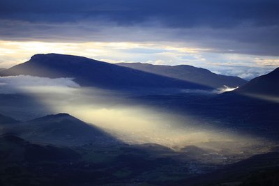
Gap depuis faudon - Marc Corail - PNE  Panorama
View over Gap
To the south of Champsaur, the town of Gap is the administrative centre of Hautes-Alpes, with a little over 40,000 inhabitants. It stands at an altitude of 700 m on a major communications route between Provence and the Alps, and enjoys generous rates of sunshine with large natural areas in the vicinity. In 2013, L'Equipe newspaper voted the town of Gap as France's most sports-oriented town of over 20,000 inhabitants.

 History
Canal de Gap
Work began on the canal in 1864 and was completed in 1880. The canal is 28 km long, and takes its water from the River Drac, upstream of Pont du Fossé, before channelling it into the Gap basin. In today's money, it cost some 2 billion euros to build! The man in charge of the project, Maurice Garnier, a local member of parliament and contractor, went bankrupt and died in poverty, but managed to improve the life of local farmers.
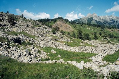
Faudon - les murets et les clapiers d'épierrement - Marc Corail - PNE  Archaeologie
Archaeological site of Faudon
A quick ride takes you past the Croix Saint-Philippe to the remains of the Gallo-Roman village of Faudon, meaning mountain of fayards or beech trees) Settled during the Bronze Age by the Tricorians with a population of up to 400, in the Middle Ages this village became a stronghold for the local nobles before being abandoned in the seventeenth century.
- History
Old Champsaur railway line
1912 saw the start of the Champsaur rail works, an old project for a line between Grenoble and Gap which was intended to pass through Champsaur. In service from 1932 onwards, the Mure to Corps section was an undoubted success. From Corps to Gap, the earthworks and engineering works were almost totally complete. However, the onset of the War, a lack of resources and the development of cars all brought the project to an end in 1941. Today, numerous structures along the route bear witness to this past endeavour.
details.BAMwidget
Source

Report a problem or an error
If you have found an error on this page or if you have noticed any problems during your hike, please report them to us here: