Track No. 2: Tour de la Pousterle
Description
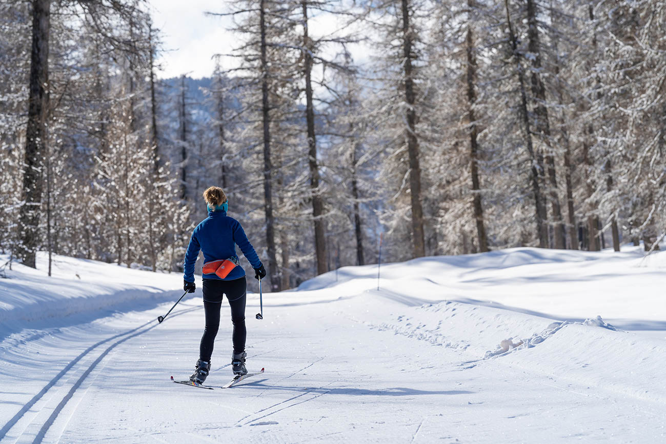
Distance: 6.3 km round trip from the Chalet Nordique - approx. 80 m ascent.
This loop will take you to a superb panorama of the Fournel Valley, in a soothing atmosphere!
The route will take you through the small hamlets of Tournoux and La Pousterle, and will take you from larch forests to sunny spaces, while offering a superb view of the Têtes de La Lauzière and Dormillouse from the Belvédère du Fournel.
Description:
Departing from the Chalet Nordique with your Pass in your pocket, the route heads towards the Belvédère du Pelvoux.
- Once at the Belvédère du Pelvoux, the route branches off to the right towards the Col de la Pousterle (1763m) and the Belvédère du Fournel (1750m).
- The route takes you to a small hamlet and offers superb views of the Tête de Dormillouse and surrounding peaks.
- Take the loop back down to the Belvédère du Pelvoux.
- Take trail no. 1 Tournoux-La Rochaille in the opposite direction, towards the Chalet Nordique.
- Towns crossed : L'Argentière-la-Bessée, Les Vigneaux, and Puy-Saint-Vincent
Sensitive areas
Peregrine falcon
- Impacted practices:
- Aerial, Vertical
- Sensitivity periods:
- FebMarAprMayJun
- Contact:
- Parc National des Écrins
Julien Charron
julien.charron@ecrins-parcnational.fr
Recommandations
→ You use these routes at your own risk. Find out about the weather conditions and avalanche risks published by Météo France. Also, don't hesitate to ask at tourist information offices or the Nordic chalet before you set off.
→ For avalanche-prone trails, we strongly advise you to take your avalanche transceiver, shovel and probe with you.
→ Night-time activities on Nordic areas are prohibited. It must be supervised by a professional and must be authorized by the ski slopes service.
→ Several itineraries are shared with cross-country skiers and ski tourers: give them priority, always walk along the edge of the piste and be vigilant when crossing these shared paths.
→ Many routes cross downhill ski slopes; be vigilant and give skiers the right of way.
→ Don't walk in the cross-country ski tracks, straddle them.
→ Respect the signposting: dangers, prohibitions, trail directions, among other things.
→ Don't overestimate your abilities!
→ Dogs are tolerated, on a leash, off the cross-country ski trails (dogs prohibited on the Lauzet itinerary of the Puy-Saint-Vincent ski area, reserved for approved sled dog teams).
→ Take your garbage with you!
Please note: This information is given for guidance only. It is your responsibility to check the weather forecast before setting off and not to overestimate your possibilities. The Tourist Office and the PNE cannot be held responsible in the event of an accident. In case of doubt, contact professionals: instructors or equipment hire companies.
Emergency contact details: Secours Montagne: 04 92 22 22 22 or 112
9 points of interest
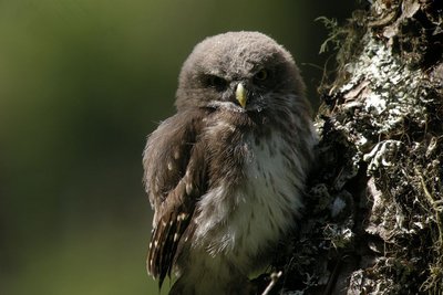
Jeune chouette chevêchette - Damien Combrisson - Parc national des Écrins  Fauna
FaunaThe Eurasian pygmy owl
The call of this small, nocturnal bird of prey can be heard in the spring, and also in the autumn when it can utter some peculiar sounds. Active during daytime hours and at dusk, the pygmy owl is a predator of passerine birds and small forest rodents. But when they spot it, passerines will come together in large numbers to mob it, so as to prevent any attempted surprise attack. It is restricted to mountain forests where it seeks out trees with woodpecker cavities in which it builds its nest.
Col de la Pousterle - Bertrand Bodin - Parc national des Écrins  Pass
PassThe Col de la Pousterle
A pousterle (in the local high-alpine Occitan language) is a small gate, a postern. It comes from the Latin posterula which means back door. This place name is sometimes given to a pass, which could be described as a gateway between two valleys! The glaciers carved out this gateway through which an arm stretched between the glacier occupying the Fournel valley and the glacier flowing down the Vallouise valley.
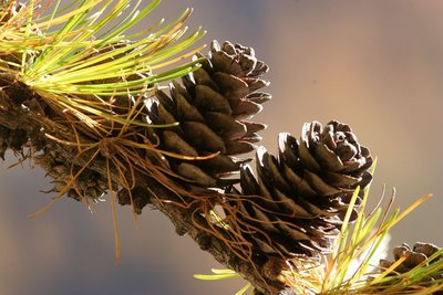
Mélèze avec cônes - Robert Chevalier - Parc national des Écrins  Flora
FloraThe larch
The symbol of the Southern Alps, this softwood tree loses its leaves in winter, and is swathed with gold and lights up the mountains in autumn. The larch forests are maintained by the grazing of flocks. Without them, other trees like the fir or other pine trees could grow, creating a different kind of forest. A pioneer species, the larch establishes freely in light conditions. Its solid rot-proof wood has always been used in the construction of houses.
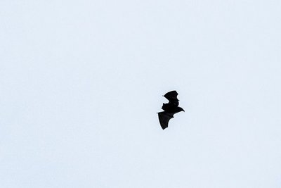
Chauve-souris en vol en contre jour - Mireille Coulon - Parc national des Écrins FaunaForest-dwelling bats
Bats don't just live in caves! In summer, some forest-dwelling species shelter in old hollow trees or woodpecker holes during the day. Sometimes, the females also form little colonies here, where their young will be born (one bat pup per female). In this forest, which is still young with very few old trees, artificial roosts have been installed to help the bats and to facilitate their study.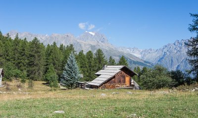
Chalet - Jan Novak  Panorama
Tournoux
The Tournoux plateau is a small paradise with its cool meadows, its occasional renovated chalets made from stone and larch wood and its view over the Tête d'Aval, an imposing limestone peak forming part of the Montbrison massif. Whether on a mountain bike, on foot or on cross-country skis in the winter, this spot is always an invitation to stop for a break!
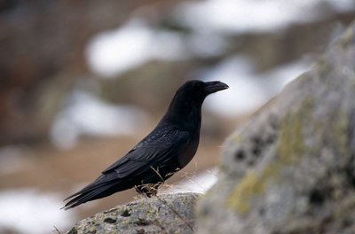
Le grand corbeau - Chevalier Robert - Parc national des Écrins FaunaThe common raven
A hollow "caw" makes you lift up your head (careful not to trip!). A pair of common ravens is nesting near here (they pair for life), on a cliff face. Although bigger than its cousins the carrion crow and the rook, it can be identified by its rather lozenge-shaped tail. It almost became extinct due to persecution Yet it's an omnivore and, more particularly, a scavenger which plays an important role by cleaning up disease-prone carcasses.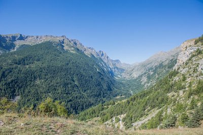
Vallon du Fournel vu du Col de la Pousterle - Jan Novak PanoramaThe Fournel valley
This is the southern side of the Col de la Pousterle and its view over the very long Fournel valley, known for its mines, ice waterfalls, blue thistles, its canyon and other treasures. Lower down is L'Argentière-la-Bessée. At the highest point, right in the distance, is the Champsaur!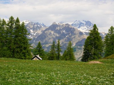
Le Laus - Marie-Geneviève Nicolas - Parc national des Écrins  Vernacular heritage
Le Laus
A number of old alpine pasture chalets or hamlets, often renovated, are dotted across the Puy-Saint-Vincent resort. These are the Chalets du Laus. Le Laus is a place name designating a lake. In fact, just after the chalets, although not a lake, there is a flat, marshy area which is no doubt a small filled-in lake. So no point in bringing your pedalo!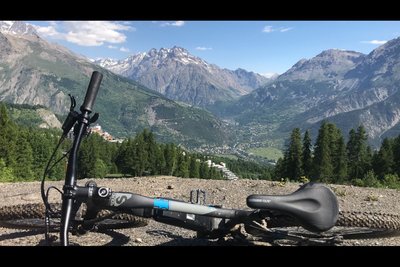
Lecture de paysage - Office de tourisme du Pays des Écrins PanoramaReading the landscape
The Vallouise valley is a tributary valley on the right-hand bank of the Durance. It is made up of three municipalities: Vallouise-Pelvoux, Les Vigneaux and, looking down from the heights, Puy-Saint-Vincent. This 25 km-long valley is dominated by numerous peaks, ranging in altitude from 980 metres, at the confluence of the Durance, to the peak of the Barre des Écrins at 4,102 metres (the highest point in the Les Écrins massif) and covers 18,541 hectares. Lying at the centre of the crystalline massif, the Vallouise valley is the gateway to the Parc National des Écrins and boasts exceptional and varied landscapes and a diverse wealth of fauna and flora.