Durance P5 : from l’Argentière-La-Bessée to Saint Crépin
Description
Ideal for less experimented navigators or people who want to discover white waters kayaking, for a peaceful ride on the Durance river while enjoying the views over the Écrins and the Queyras mountain ranges.
Without any particular difficulty, a few jamlogs can nonetheless make their way on the water between La Roche-de-Rame and Saint-Crépin, when passing through wooded areas.
Follow the eau-vive (white water) signs to disembark.
Return : From the Chanteloube bridge, merge on the N94 and take a right towards l’Argentière.
- Towns crossed : Champcella, Freissinières, L'Argentière-la-Bessée, La Roche-de-Rame, and Saint-Crépin
Gear
Helmet and life jacket are mandatory
Inflatable kayaks are not suitable and strongly advised against
Sensitive areas
Short-toed snake eagle
- Impacted practices:
- Aerial,
- Sensitivity periods:
- MarAprMayJunJulAugSep
- Contact:
- Parc National des Écrins
Julien Charron
julien.charron@ecrins-parcnational.fr
Short-toed snake eagle
- Impacted practices:
- Aerial,
- Sensitivity periods:
- MarAprMayJunJulAugSep
- Contact:
- Parc National des Écrins
Julien Charron
julien.charron@ecrins-parcnational.fr
Recommandations
Careful with floods after a storm
Careful with logjams, especially at the beginning of the season
Please take your trash with you
Attention : Experience is required in order to navigate these rivers without professional supervision. This information is provided for general guidance. Checking weather reports, water levels, flow rates and conditions before embarking is under your responsability. The tourism office and the national park will not be held responsable in case of an accident.
If you have doubts, please ask a professional. Kayak schools, instructors and renting shops of the valley are here to help you.
Mountain Rescue : dial 112
Weather report
Water levels at l’Argentière : https://www.rdbrmc.com/hydroreel2/station.php?codestation=1125
11 points of interest
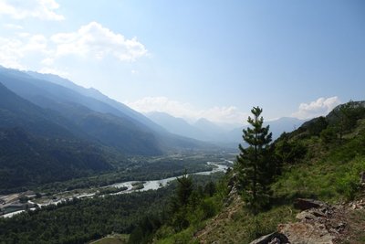
La vallée de la Durance - Office de tourisme Pays des Écrins  Geology and geography
The high Durance valley
Protected from Atlantic influences by the Massif du Pelvoux, the high Durance valley has a very dry climate with wide seasonal temperature fluctuations. It has grasslands very similar to the steppes of Central Europe which are rare in France. It is part of the Natura 2000 “Steppique durancien et queyrassien” (Durance and Queras valley steppes) site.
Le sentier du Gouffre - Thibault Blais Photographie  History
The Sentier du Gouffre - the ravine path
The Sentier du Gouffre has sometimes been described as a Roman road, but we do not know the exact route the Roman road followed. One thing is certain, it used to be used by the villagers to reach their fields and vineyards, and for any other journeys they had to make.
Plaine de Rame et la Chapelle pris de la cime des Rampes - Jean-Philippe Telmon - Parc national des Écrins HistoryThe lost village
In ancient times, the Durance valley was a key communication corridor. Rama was a kind of staging post on the Roman road. In the Middle Ages, Rama was a small town with a noble's château. But the village was devastated by the capriciousness of the Durance and the Biaysse rivers on numerous occasions and the inhabitants gradually deserted the site, moving to neighbouring villages. The attachment of the parish of Rame to that of La Roche in 1446 is indicative of this decline.
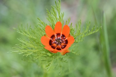
L'adonis d'été - Coulon Mireille - Parc national des Écrins  Flora
FloraThe summer pheasant's-eye
The history of plants is fascinating. A large number of messicole plants (those associated with crops), like the poppy and the cornflower, arrived from the Mediterranean basin or the Middle East as seeds, mixed with cereal seeds, as far back as the very first trading activity in prehistory. Unfortunately, herbicides have led to their virtual disappearance and mountain farming has become their last refuge. And so the summer pheasant's-eye, with its splendid but discreet flowers, still grows here.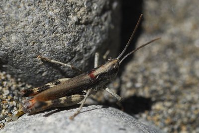
Le criquet des iscles - Coulon Mireille - Parc national des Écrins  Fauna
FaunaThe gravel grasshopper
This species of grasshopper favours islands of gravel, sand banks, and the edges of meandering mountain streams. These habitats are increasingly rare because rivers have been reworked, dammed up or dredged for gravel extraction. So this grasshopper, along with several others, has become critically endangered. The Durance population is one of the few remaining populations in Europe.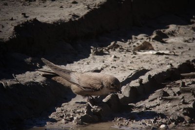
L'hirondelle de rochers - Combrisson Damien - Parc national des Écrins FaunaThe crag martin
They first appear in the Pays des Écrins from late February, so it's true to say that they don't bring the spring! Brown with a beige underside, as their name suggests they nest on crags and cliffs. It is the most common species of swallow in the mountains and is present up to an altitude of 2,500 metres. They are partially migratory, overwintering in the south of France where they join resident colonies.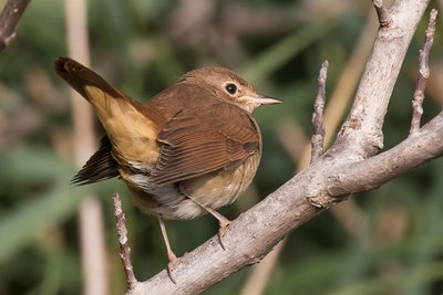
Le rossignol philomèle - Saulay Pascal - Parc national des Écrins FaunaThe nightingale
Superbly camouflaged in a bush, the male nightingale sings his loud and very varied song. What a chatterbox! He even sings at night! This bird is rarely found above an altitude of 1,200 metres, but here he is in Rame. He favours warm places, often by water, and nests in the bushes. A migratory bird, he spends the winter in Africa.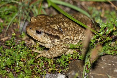
Le crapaud commun - Corail Marc - Parc national des Écrins FaunaThe common toad
This large toad only lives in the ponds during the spawning season, leaving its long strings of toad spawn in the water. So here in the artificial Lac de Rama it has found a habitat to ensure its survival. After the spawning season, it returns to the cool, wooded areas where it hunts small invertebrates at night and spends the day hiding underneath wood or stones or in underground crevices. In hibernates in cavities, protected from freezing temperatures.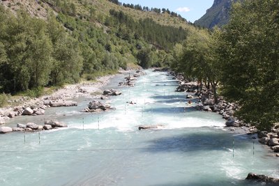
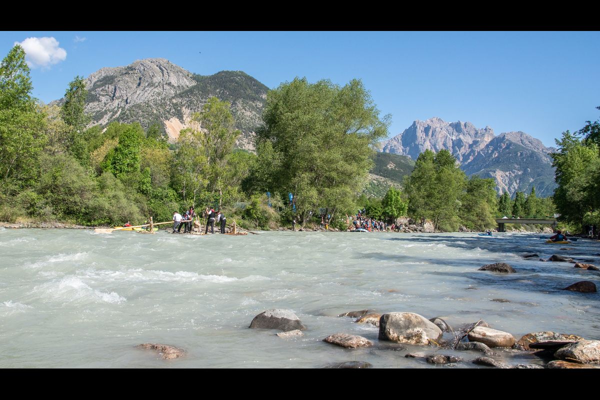
Stade d'eau vive - Office de tourisme du Pays des Écrins  Water
WaterThe white water stadium
As part of its restructuring after the closure of the industrial site, the town of L'Argentière-la-Bessée opted for sports tourism, exploiting the natural elements present on the site, that is to say, water. Standing at the beginning of the longest navigable section of the Durance river, in 1993 the municipality decided to establish itself as a major white water centre by creating this stadium which covers a 400-metre stretch. So thanks to its reputation and its ideal situation, every year this stadium hosts several elite competitions at national and international level.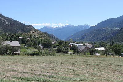
La Roche-de-Rame - Office de tourisme du Pays des Écrins  Vernacular heritage
La Roche-de-Rame
The municipality of La Roche-de-Rame lies entirely on the left-hand bank of the Durance. Like L'Argentière-la-Bessée, its recent history has been profoundly marked by industry which saw rapid expansion in the early twentieth century. Well known for its natural stretch of water, a glacial lake, the hamlets of the municipality are dotted across the slopes.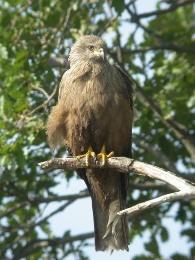
Milan noir - Combrisson Damien - Parc national des Écrins FaunaThe black kite
A bird of prey circles slowly above the valley. It is dark coloured with a slightly forked tail. A black kite, which returned from Africa in spring. It feeds on carrion or scraps as well as fish. It is easy to confuse with the red kite which is brown, red and white and its tail has a much more pronounced fork. The red kite does not nest here in the massif. It is only seen during the migration period, in the Durance valley.