The Béal Neuf canal: canals and men, an iconic history
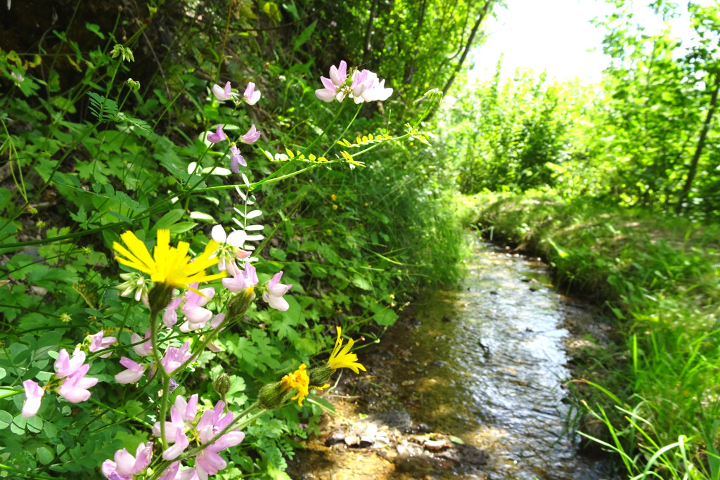
A waterside route taking you along the path followed by the Béal Neuf canal, the embodiment of men's enormous efforts to irrigate their fields! An exploration that also offers enjoyment of the surrounding landscapes and unrivalled views over the Vallouise valley and the Pelvoux.
Description
From the car park, take the path running above the road (signs for the Béal Neuf). It runs level at first and then drops sharply along the side of a stream before levelling out again just above-the road. The path comes to a track; turn right onto this and carry on downhill for 50 metres.
- Turn left to cross the mountain stream La Juliane (no footbridge). You then continue downhill again, passing a cross, and a little further down turn left onto the path following a new section of the Béal.
- When you reach the Rif Paulin stream, retrace your steps back to your starting point.
- Departure : Route de Chambran
- Arrival : Route de Chambran
- Towns crossed : Vallouise-Pelvoux
Altimetric profile
details.BAMwidget
Recommandations
Access to the canal is prohibited for herds or flocks of animals and all vehicles (motorised or otherwise).
There is an alternative section following the Béal Neuf canal: “Du torrent au canal” (from the mountain stream to the canal). It starts 1 kilometre above the starting point of this last path, near a picnic table-nique.
Check weather conditions before setting off.
Rescue services contact details: Secours Montagne (Mountain Rescue): +33 (0)4 92 22 22 22 or 112
Show consideration for the work of farmers, livestock keepers and owners
Close all gates behind you
Take your litter home
Do not take shortcuts across pastureland
Information desks
Place de l'Eglise, 05340 Vallouise

Vallouise Park house
, 05290 Vallouise
Information, documentation, models, exhibitions, screenings, product sales and works of the Park. Guided tours for school, reservation required. The new Park House opened in Vallouise since June 1, and offers visitors an interactive permanent exhibition inviting to explore the area and its heritage. A temporary exhibition space will allow a renewed offer. Finally, the device is completed by an audiovisual room to organize screenings and conferences Free admission. All animations of the Park are free unless otherwise stated.
Transport
Public transport >> www.pacamobilite.fr
Consider car-sharing >> www.blablacar.fr
For more information, ask at the Tourist Information Office nearest to the trail starting point.
Access and parking
13.5 km from L'Argentière-La Bessée, take the D994E and then the D421T.
Parking :
6 points of interest
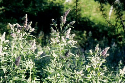
La menthe à longues feuilles - Bernard Nicollet - Parc national des Écrins  Flora
FloraThe wild mint
Mints (there are several species) often live on the water's edge. The wild mint found here is very common. If you rub its leaves gentlythey give off a pleasant and recognisable scent. The small purple flowers gathered into a dense spike are very attractive to insects.
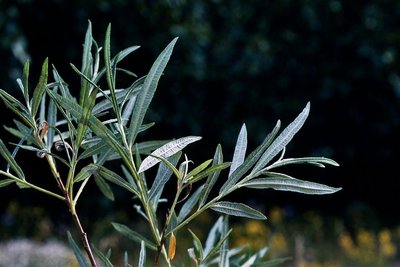
Saule drapé - Marie-Geneviève Nicolas - Parc national des Écrins FloraWillows
Willows grow in places with cool soil. There are many species of willow. Many of them aren't trees at all, but bushes and even, at high altitudes, tiny sub-shrubs hugging the ground. Here, in the bed of the mountain stream and in its immediate vicinity, two easily identifiable willows grow: the hoary willow, a shrub with long narrow leaves curled at the edge and with white undersides; and the purple willow, also with long narrow leaves, but they are bluish-green and it has purple shoots.
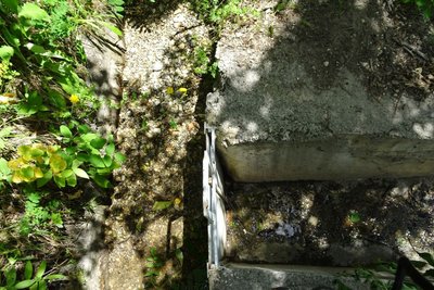
Canal du Béal Neuf - Office de tourisme Pays des Écrins  Water
WaterThe role of the canals
Irrigation of meadows and private gardens; preservation of traditions; the promotion of social contact through collective canal maintenance operations carried out by local people; development of canals to create trails for tourists and locals... The canals have fulfilled a variety of roles, hence the benefit of conserving and maintaining them.
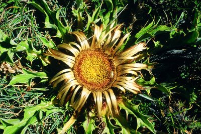
La carline à feuilles d'acanthe - Bernard Nicollet - Parc national des Écrins FloraThe acanthus-leaved thistle
This is a hot, west-exposed slope with rocky ground. The plant life reflects this situation: the narrow-leaved lavender and acanthus-leaved thistle grow here. The latter looks like a large sun with its very big flower head which quickly turns golden and its leaves radiating out around it. It often used to be hung on house doors... but much better to leave it lighting up the stony meadows!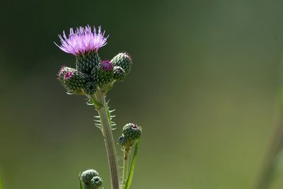
le cirse de Montpellier - Mireille Coulon - Parc national des Écrins FloraThe Montpellier thistle
A large plant grows along the canal side; a sort of thistle although it is not spiky: the Montpellier thistle. Its oval, pointed leaves are edged with large, stiff but non-spiky cilia. Its flowers are pink. In France, it is only found in the Alps and the Pyrenees and a few departments in the south. Associated with wet areas, this species has become rare in many regions because of damage to its habitat.
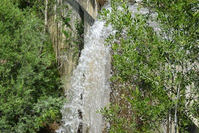
Torrent de Paulin - Office de tourisme Pays des Écrins WaterMountain land rehabilitation projects
Stream correction dams have been built by RTM (Mountain Land Rehabilitation), a branch of the National Forestry Agency. The purpose of these structures is to limit erosion and mountain stream flooding. The RTM has been in existence for a long time, set up in the late nineteenth century. At that time, the slopes where much more sparsely wooded than they are today, and erosion was a very significant problem.
More information
Source

Report a problem or an error
If you have found an error on this page or if you have noticed any problems during your hike, please report them to us here: