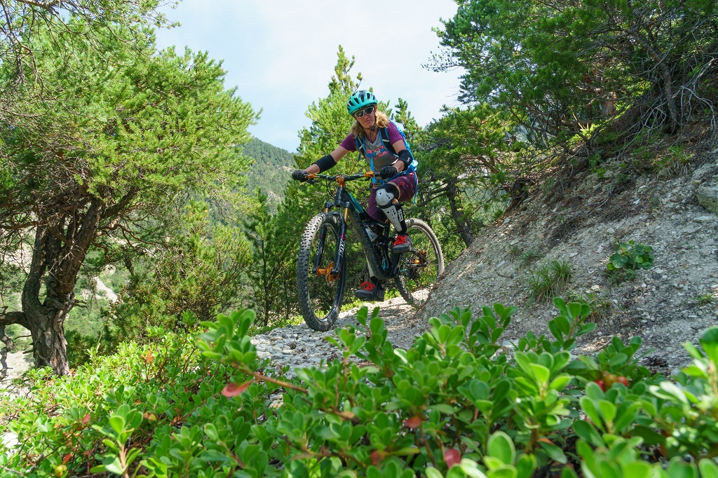
Le Grand Parcher circuit (no. 6)
Description
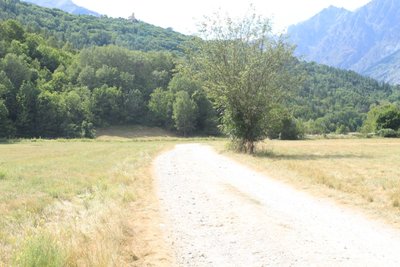
The circuit starts near the car park on the right-hand bank of the Gyronde, on a narrow track that follows the river upstream, below the road leading to a campsite, the Camping des Vaudois
- After going through the campsite, take the track on the left leading towards Le Chambon. This virtually straight path passes through a number of meadows
- Cross a bridge (the Pont Haut) and join the local road. After 200 metres, at the next intersection turn right towards Le Petit Parcher
- At the crossroads, turn right towards Le Grand Parcher
- In Le Grand Parcher, take the road rising uphill to the left. A few metres beyond the Chapelle Saint-André, take a narrow path on the right leading towards the Rocher Blanc
- As you ascend, head right on a single track until you come to the Rif Cros mountain stream
- Cross the mountain stream and carry on to the centre of Les Vigneaux. When you come to the local road and the Pont du Rif you have reached your starting point
- Departure : Pont du Rif (right-hand bank of the Gyronde), Les Vigneaux
- Arrival : Pont du Rif (right-hand bank of the Gyronde), Les Vigneaux
- Towns crossed : Les Vigneaux and Vallouise-Pelvoux
Altimetric profile
details.BAMwidget
Recommandations
Rescue services contact details: Secours Montagne(Mountain Rescue): +33 (0)4 92 22 22 22 or 112
Take your litter home
Do not take shortcuts across pastureland In mountain pastures, protection dogs are there to protect the herds from predators (wolves, etc.).
When mountain biking, I adapt my behavior by going around the herd, pausing and getting off the bike so the dog can identify me.
Find out more about the actions to adopt with the article "Protection dogs: a context and actions to adopt".
Tell us about your meeting by answering this survey.
Information desks
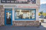
23 Avenue de la République, 05120 L'Argentière-La Bessée
Place de l'Eglise, 05340 Vallouise

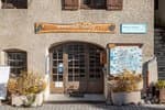
Vallouise Park house
, 05290 Vallouise
Information, documentation, models, exhibitions, screenings, product sales and works of the Park. Guided tours for school, reservation required. The new Park House opened in Vallouise since June 1, and offers visitors an interactive permanent exhibition inviting to explore the area and its heritage. A temporary exhibition space will allow a renewed offer. Finally, the device is completed by an audiovisual room to organize screenings and conferences Free admission. All animations of the Park are free unless otherwise stated.
Transport
Public transport >> www.pacamobilite.fr
Consider car-sharing >> www.blablacar.fr
Access and parking
Parking :
Sensitive areas
Short-toed snake eagle
- Impacted practices:
- Aerial,
- Sensitivity periods:
- MarAprMayJunJulAugSep
- Contact:
- Parc National des Écrins
Julien Charron
julien.charron@ecrins-parcnational.fr
Short-toed snake eagle
- Impacted practices:
- Aerial,
- Sensitivity periods:
- MarAprMayJunJulAugSep
- Contact:
- Parc National des Écrins
Julien Charron
julien.charron@ecrins-parcnational.fr
8 points of interest
L'ubac - Office de tourisme du Pays des Écrins  Geology and geography
The "ubac"
The track rises gently up the right-hand bank of the Gyronde, on the "ubac" side. The "ubac" is the slope that is exposed to the north, so it is in shadow in winter when the sun is low in the sky.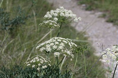
Le laser siler - Cédric Dentan - Parc national des Écrins  Flora
FloraThe laserwort
After the bridge, a large plant with flowers arranged in umbels (in other words, an umbellifer) clings to a small rock bar to the right of the track, the laserwort. This plant belongs to the family Apiaceae, which used to be called umbellifers, and grows in dry areas. It has a distinctive feature: in autumn, the basal part of the stem breaks of its own accord and the entire plant, now dry, sets off rolling down the hillside like a large ball, or is blown by the wind.
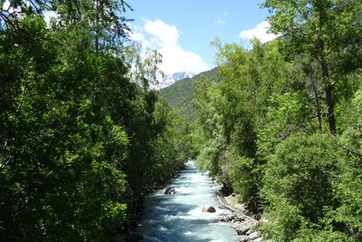
La Gyronde - Office de tourisme Pays des Écrins  Water
WaterThne Gyronde
No, we're not in south-west France where the Gironde flows! The Gyronde (spelt with a «y»!) is the river that flows between Vallouise and L'Argentière-La Bessée, where it flows into the Durance. It originates from the Gyr and Onde mountain streams which merge in Vallouise.
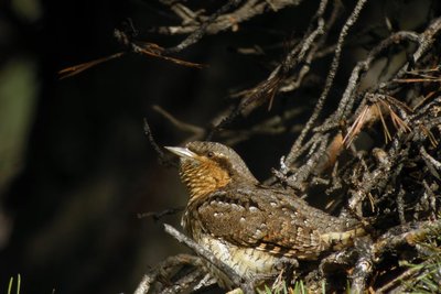
Le torcol - Damien Combrisson - Parc national des Écrins  Fauna
FaunaThe northern wryneck
In the spring, an odd song can be heard among the old trees in the orchard, a loud song similar to that of the green woodpecker, only slower. It is that of the northern wryneck. This bird owes its name to the extreme way it extends and twists its neck when it feels threatened. Its French name torcol fourmilier is a reference to the fact that it feeds on ants (fourmils in French). Difficult to spot because its plumage merges into the colour of the tree trunks, it gives its presence away by its song when it returns from its migration.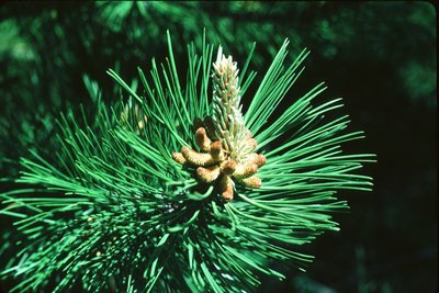
Aiguilles de pin sylvestre - Parc national des Écrins FloraOn the south-facing slope, pine forest
The track passes through a forest of Scots pines, mixed with some downy oak trees. It is a forest typical of those found in the lower south-facing slopes (those exposed to the sun) in the intra-alpine valleys.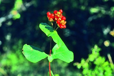
Le chévrefeuille d'Étrurie - Bernard Nicollet - Parc national des Écrins FloraEtruscan honeysuckle
Etruria was the territory of the Etruscans, in the area of present-day Tuscany. Although this honeysuckle does not grow only in Tuscany, it is Mediterranean, however, and only grows naturally in the wild in the southern half of France. Being a plant that needs warmth, it does not grow at altitude, except here where the south-facing slopes are particularly dry and warm. Its large pink and yellow flowers are highly perfumed.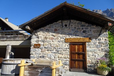
Le four banal des Vigneaux - Office de tourisme Pays des Écrins  Vernacular heritage
The communal oven
Legend has it that the Lord caused a communal oven to be built and kept it maintained. The local people could use this oven in exchange for the payment of a levy. Families would prepare and knead their own dough at home and then bring it to the oven for baking. Names were drawn by lot to establish their turns.
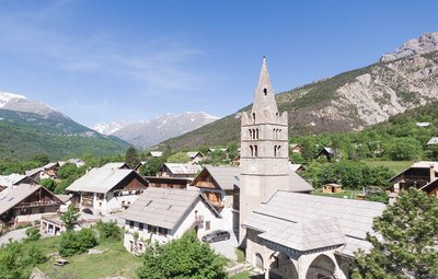
Eglise des Vigneaux - Blandine Reynaud - PDE  History
The village of Les Vigneaux
In spite of the altitude, the region's dry climate and the local growing conditions of limestone and sediments facing due south made the planting of grapevines possible as far back as the tenth century. The municipality owes its name to the presence of these vineyard operations, which were very significant in the late nineteenth century. The almost simultaneous appearance of the phylloxera aphid and the Briançon train, bringing wine from Provence, spelled the end of this activity here.
More information
Source

Report a problem or an error
If you have found an error on this page or if you have noticed any problems during your hike, please report them to us here: