Les Eyssarts
Description
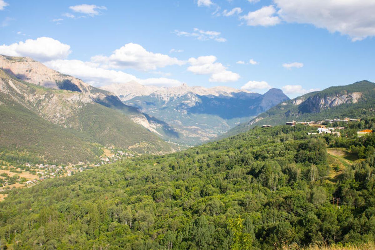
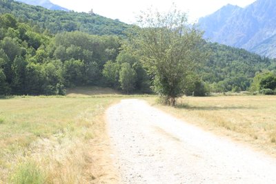
The route starts at Le Pont du Rif, from the car park on the right-hand bank of the Gyronde. Take the paved road heading towards the campsite «Le Courounba»
- Before you reach the campsite, go left onto a path which runs just above it
- At the intersection, continue straight ahead towards Les Eyssarts (Snowshoe track ("Piste de raquettes") no. 10)
- At the end of the path, turn left and after 150 metres head right onto the heritage path ("Sentier du patrimoine") towards the chapel of Saint-Romain
- Turn right and after another 150 metres turn left which takes you up a short incline. At the end of the path, where you reach the D4, head right and after 15 metres turn right again onto a track leading to the chapel of Saint-Romain
- At the chapel of Saint-Romain, retrace your steps until you are back on the road, then turn left again and start the descent, following signs for Vallouise, via the "Sentier du facteur" (postman's path)
- At the end of the track, head left to continue downhill on a new track which brings you to the D4 again. Carry on downhill and at the intersection turn right towards the Park Centre ("Maison du Parc")
- Leave the road going right to follow the Gyronde towards Champ Clément, Les Parchers and La Chambon. After 350 metres, turn left and continue in the same direction
- Turn right again, following the first part of the trail in reverse, to skirt around the campsite and back to your starting point
- Departure : Pont du Rif (right-hand bank of the Gyronde), Les Vigneaux
- Arrival : Pont du Rif (right-hand bank of the Gyronde), Les Vigneaux
- Towns crossed : Les Vigneaux, Vallouise-Pelvoux, and Puy-Saint-Vincent
Altimetric profile
Recommandations
Check weather conditions before setting off.
Rescue services contact details: Secours Montagne (Mountain Rescue): +33 (0)4 92 22 22 22 or 112
Show consideration for the work of farmers, livestock keepers and owners
Close all gates behind you
Take your litter home
Do not take shortcuts across pasturelandInformation desks
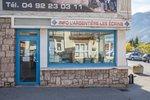
23 Avenue de la République, 05120 L'Argentière-La Bessée
110 route des Alberts - Station 1400, 05290 Puy Saint Vincent 1400 m
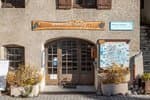
Place de l'Eglise, 05340 Vallouise

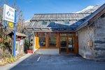
Vallouise Park house
, 05290 Vallouise
Information, documentation, models, exhibitions, screenings, product sales and works of the Park. Guided tours for school, reservation required. The new Park House opened in Vallouise since June 1, and offers visitors an interactive permanent exhibition inviting to explore the area and its heritage. A temporary exhibition space will allow a renewed offer. Finally, the device is completed by an audiovisual room to organize screenings and conferences Free admission. All animations of the Park are free unless otherwise stated.
Transport
Public transports >> www.pacamobilite.fr
Consider car-sharing >> www.blablacar.fr
Access and parking
Parking :
Sensitive areas
Short-toed snake eagle
- Impacted practices:
- Aerial,
- Sensitivity periods:
- MarAprMayJunJulAugSep
- Contact:
- Parc National des Écrins
Julien Charron
julien.charron@ecrins-parcnational.fr
Short-toed snake eagle
- Impacted practices:
- Aerial,
- Sensitivity periods:
- MarAprMayJunJulAugSep
- Contact:
- Parc National des Écrins
Julien Charron
julien.charron@ecrins-parcnational.fr
10 points of interest
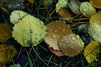
Des feuilles de tremble - Bernard Nicollet - Parc national des Écrins  Flora
FloraRiparian forest
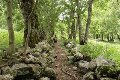
The track runs through a wood of alder, beech, aspen and oak, the remnant of the natural forest growing at the water's edge, called riparian forest. This type of forest is in decline everywhere, destroyed by urbanisation and by containment of the mountain streams. Yet it is an essential zone for the fixation of river banks and for purifying the water. Since it offers specific natural habitats, it also plays a major role in maintaining biodiversity.
L'ubac - Office de tourisme du Pays des Écrins  Geology and geography
The "ubac"
The track rises gently up the right-hand bank of the Gyronde, on the "ubac" side. The "ubac" is the slope that is exposed to the north, so it is in shadow in winter when the sun is low in the sky.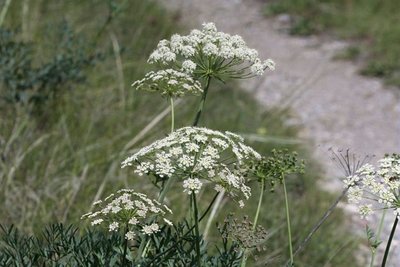
Le laser siler - Cédric Dentan - Parc national des Écrins FloraThe laserwort
After the bridge, a large plant with flowers arranged in umbels (in other words, an umbellifer) clings to a small rock bar to the right of the track, the laserwort. This plant belongs to the family Apiaceae, which used to be called umbellifers, and grows in dry areas. It has a distinctive feature: in autumn, the basal part of the stem breaks of its own accord and the entire plant, now dry, sets off rolling down the hillside like a large ball, or is blown by the wind.
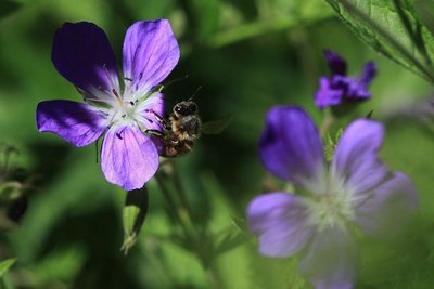
Géranium des bois - Marc Corail - Parc national des Écrins FloraWood cranesbill
The path is edged with large clumps of a plant with purple flowers, the wood cranesbill. The leaves are palmate and divided into 5 to 7 incised and indented lobes, This common plant grows in meadows and cool woods. The «geraniums» we see on balconies are in fact pelargoniums, distant cousins originally from South Africa and cultivated for ornamental purposes.
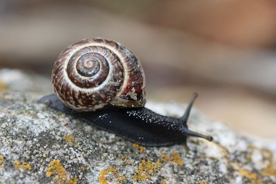
Hélice des Alpes - Damien Combrisson - Parc national des Écrins  Fauna
FaunaThe Alpine copse snail
On the damp banks of the stream, hidden in the grass, is a snail with a beautiful golden brown shell speckled with brown, decorated with a dark spiral stripe. It has a black body. The alpine copse snail is relatively rare and, as its name suggests, it is found in the Alps. It is a sub-species of the ordinary copse snail, which is present across Europe.
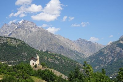
La chapelle Saint-Romain - Office de tourisme Pays des Écrins  History
The chapel of Saint-Romain
Included on the Supplementary Inventory of Historical Monuments in 1931, the chapel of Saint-Romain has been converted into an eco museum. It was the first chapel to be built in Puy-Saint-Vincent and is thought to date from the twelfth century. Up to the mid-fifteenth century, the village bore the name of its patron saint: Puy-Saint-Romain. Then, in honour of the arrival of the Dominican monk Vincent Ferrier, the village took the name Puy-Saint-Vincent. It stands on a rocky promontory outside the village, and offers a panoramic view over the Les Écrins massif and the Gyronde Valley, over Vallouise in particular.
Des feuilles de tremble - Bernard Nicollet - Parc national des Écrins FloraThe aspen
A sizeable aspen grows on the roadside, on the edge of a small wood of fellow-aspens. This tree has a smooth, greenish trunk and rounded, crenelated leaves which take on magnificent colours in autumn. The stem, or petiole, of aspen leaves is flat and twisted, so it can be caught by the slightest breeze making the foliage «quake» hence its common name, the quaking aspen. It grows in places where the soil is quite damp.
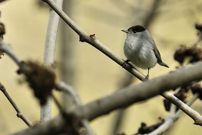
Fauvette à tête noire - Mireille Coulon - Parc national des Écrins FaunaThe Eurasian blackcap
Hidden in the tree foliage, the Eurasian blackcap announces its presence with its loud and piping song. Its head is adorned with a cap which is black in the male and russet in the female. The rest of its plumage is greyish, its underside lighter than its back. It is a migratory bird which travels to the Maghreb to overwinter. However, increasing numbers of birds make only a partial migration, flying to the south of France to spend the winter.
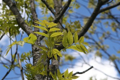
Un frêne élevé - Marie-Geneviève Nicolas - Parc national des Écrins FloraThe ash tree
This is one of the most common trees, provided the ground is relatively cool. It is characterised by its pinnate leaves, that is to say, made up of several segments, and in winter is can be recognised by its large black leaf buds. The ash was extremely important in times past: its foliage was used to feed cattle and its hard, flexible wood was used to make a variety of objects such as tool handles.
Les Eyssarts - Dominique Vincent - Parc national des Écrins HistoryLes Eyssarts
The track runs through a place called Les Eyssarts, which gave this circuit its name. This name comes from the word essart which refers to «a place that has been cleared, most often to create agricultural land». A few meadows, but above all former canals and low walls hidden under the advancing forest, bear witness to this past use of the land.
More information
details.BAMwidget
Source

Report a problem or an error
If you have found an error on this page or if you have noticed any problems during your hike, please report them to us here: