1. From L'Argentière - La Bessée to Bouchier
Description
1. Bridge over the Gyronde; from here, you leave the right-hand bank of the river behind, to climb up towards Bouchier. Cross the bridge and turn right onto the D994E. Cross the bridge over the Torrent de Rif Gros and join a path on the left between the D4 and the mountain stream.
2. When you reach Les Vigneaux, go straight through the village past the church. Cross the D4 and continue past the cemetery. Continue straight ahead, on a balcony path. 20 metres before the hamlet of Les Sagnes, take a narrow path on the left which leads to the D4 again. Cross the D4 and join a path opposite, which is not very clearly marked (trail no. 10). Continue straight on, rising approximately 100 metres to join the Bouchier path (cairns). Turn right onto the path and follow it until you reach the hamlet.
- Departure : Train station of l'Argentière-La Bessée
- Towns crossed : L'Argentière-la-Bessée, Les Vigneaux, and Saint-Martin-de-Queyrières
Altimetric profile
Recommandations
Information desks
23 Avenue de la République, 05120 L'Argentière-La Bessée
7 points of interest
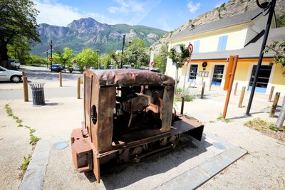
Le locotracteur - Jan Novak Photography  History
The light rail tractor
A locomotive? No, its little cousin, the light rail tractor. This replaced manually pushed carts and horse-drawn vehicles. Less powerful than a locomotive, it travelled along narrow-gauge tracks which could be laid on different types of terrain. An information panel also described the role of this vehicle during the Great War.
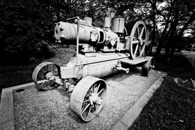
Le compresseur mobile - Jan Novak Photography HistoryThe mobile compressor
In the mines, compressed air is used to remove dust and to create power for the drills. The mobile compressor holds compressed air in a resistant tank. This is brought to a high pressure via a pump (the compressor). The compressed air is then distributed to the mine machinery through a conduit system.
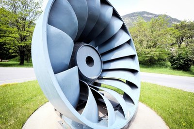
La turbine Francis - Jan Novak Photography HistoryThe Francis turbine
The American James Francis developed the Francis turbine between 1849 and 1855. It is a “àreaction” turbine suitable for medium-sized waterfalls (with a water head of between 15 and 500 metres). The water enters the turbine and then circulates between the turbine blades, which are fixed, while the inner wheel is mobile. The pressure at the wheel intake is greater than the pressure at the outlet.
Eglise des Vigneaux - Blandine Reynaud - PDE HistoryThe village of Les Vigneaux
In spite of the altitude, the region's dry climate and the local growing conditions of limestone and sediments facing due south made the planting of grapevines possible as far back as the tenth century. The municipality owes its name to the presence of these vineyard operations, which were very significant in the late nineteenth century. The almost simultaneous appearance of the phylloxera aphid and the Briançon train, bringing wine from Provence, spelled the end of this activity here.
Damien Combrisson - Parc national des Écrins  Fauna
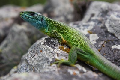
FaunaThe western green lizard
Very shy, this large lizard quickly takes refuge beneath a bush or stone, or among the tangled branches of a hedge when it senses danger. It is on average 30 cm in length and it is bright green slightly speckled with black. During the mating season, the male presents a bright blue colouring on his throat and on the sides of his head. It lives on sunny south-facing slopes, in uncultivated areas and forest edges, where it feeds primarily on insects.
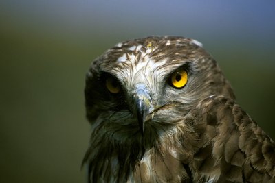
Le circaète Jean-le-Blanc - Marc Corail - Parc national des Écrins FaunaThe short-toed snake eagle
In March, this large brown bird of prey, brown on its upperside, white speckled with black on its underside and a dark head, returns from Sub-Saharan Africa where it has spent the winter. It feeds primarily on reptiles which its hunts in steppe or barren areas, derelict sites or stony terrain. It builds its nest in a pine tree where it will rear a single chick. It can often be seen hovering in the air, thirty or so metres above the ground, and then swooping down on its prey.
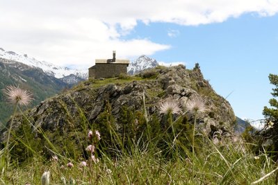
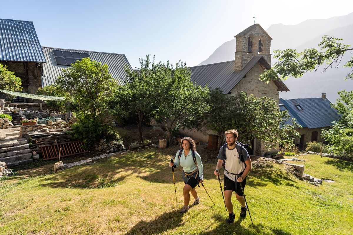
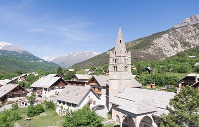
La chapelle Saint-Hippolyte de Bouchier - Office de tourisme Pays des Écrins HistoryThe hamlet of Bouchier
Bouchier is a small hamlet in the municipality of Saint-Martin-de-Queyrières, which has a few permanent inhabitants in spite of its relatively inaccessible location. Standing a little apart from the hamlet, on a promontory overlooking the Durance valley, the chapel of Saint-Hippolyte dates from the early sixteenth century. It was built against what used to be a hermit's cell, and contains frescoes some of which relate the miraculous cures performed by the saint. It drew ailing people who flocked here to seek his intercession.
details.BAMwidget
Source

Report a problem or an error
If you have found an error on this page or if you have noticed any problems during your hike, please report them to us here: