3. From Vallouise to Ailefroide
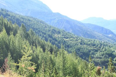
From pastoral surroundings to high mountain landscapes, from greenery to rock, this trail gradually takes you into an extraordinary environment dominated by water, granite and glaciers.
Description
1. From here, the path follows the contour of the mountain side, always heading towards Ailefroid (North). The track turns into a path. Go straight on at the intersection. The path winds along the foot of a small cliff, following an irrigation ditch. Ford the Rif Paulin stream and then head towards Le Sarret. There is a short ascent, then bear left. Do not go towards Le Poet; instead, take the path on the right which runs along the irrigation ditch. At the next intersection, "Bellevue 1,330 m", head towards Le Sarret. Follow the left-hand bank of the mountain stream La Juliane upwards and then ford it. On the hairpin bend, take the track on the right (Chambran). On the next hairpin bend, continue straight on. At subsequent intersections, head for Chambran. The track turns into a path. Continue straight on (leave the path to the Cabane Chouvet on the right).
2. At Les Choulières, turn left onto the paved road to Eychauda. 10 minutes after the next hairpin bend, take the track on the right (Ailefroide). Cross the mountain stream L'Eychauda and carry on towards Ailefroide. The track turns into a steeper path.
3. You cross the penstock pipe. The way becomes trickier: sandy ground, sharply sloping gradient, rather steep descent.
4. When fording across the Rif du Fraysse stream, exercise caution in stormy weather and in the spring when winter snow lingers. Reaching the ford crossing can also be tricky. The path descends through the larch forest and leads past a climbing school. Continue straight on until you reach Ailefroide.
- Departure : Vallouise downtown
- Towns crossed : Vallouise-Pelvoux
Altimetric profile
Recommandations
The last ford crossing, 2 km outside Ailefroide, can still be filled with snow in the event of late-season snowfall.
After the penstock pipe, the path (between Les Choulières and Ailefroide) is narrow, sharply sloping and sandy with a short stretch of steep descent.
Enquire about the presence of lying snow on some sections early in the season.
Sensitive areas
Golden eagle
- Impacted practices:
- Aerial, , Vertical
- Sensitivity periods:
- JanFebMarAprMayJunJulAug
- Contact:
- Parc National des Écrins
Julien Charron
julien.charron@ecrins-parcnational.fr
Golden eagle
- Impacted practices:
- Aerial, , Vertical
- Sensitivity periods:
- JanFebMarAprMayJunJulAug
- Contact:
- Parc National des Écrins
Julien Charron
julien.charron@ecrins-parcnational.fr
7 points of interest
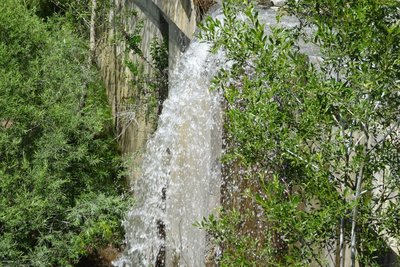
Torrent de Paulin - Office de tourisme Pays des Écrins  Water
WaterMountain land rehabilitation projects
Stream correction dams have been built by RTM (Mountain Land Rehabilitation), a branch of the National Forestry Agency. The purpose of these structures is to limit erosion and mountain stream flooding. The RTM has been in existence for a long time, set up in the late nineteenth century. At that time, the slopes where much more sparsely wooded than they are today, and erosion was a very significant problem.
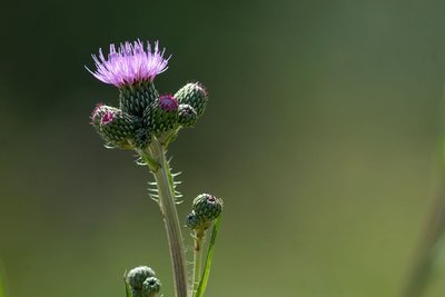
le cirse de Montpellier - Mireille Coulon - Parc national des Écrins  Flora
FloraThe Montpellier thistle
A large plant grows along the canal side; a sort of thistle although it is not spiky: the Montpellier thistle. Its oval, pointed leaves are edged with large, stiff but non-spiky cilia. Its flowers are pink. In France, it is only found in the Alps and the Pyrenees and a few departments in the south. Associated with wet areas, this species has become rare in many regions because of damage to its habitat.
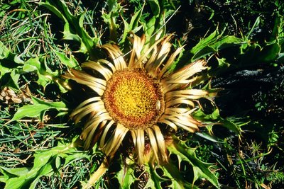
La carline à feuilles d'acanthe - Bernard Nicollet - Parc national des Écrins FloraThe acanthus-leaved thistle
This is a hot, west-exposed slope with rocky ground. The plant life reflects this situation: the narrow-leaved lavender and acanthus-leaved thistle grow here. The latter looks like a large sun with its very big flower head which quickly turns golden and its leaves radiating out around it. It often used to be hung on house doors... but much better to leave it lighting up the stony meadows!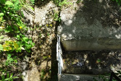
Canal du Béal Neuf - Office de tourisme Pays des Écrins WaterThe role of the canals
Irrigation of meadows and private gardens; preservation of traditions; the promotion of social contact through collective canal maintenance operations carried out by local people; development of canals to create trails for tourists and locals... The canals have fulfilled a variety of roles, hence the benefit of conserving and maintaining them.
L'Adret - Office de tourisme du Pays des Écrins  Geology and geography
L'Adret
This place is called L'Adret. In some regions, the term adret refers to the slope that is exposed to the sun, facing south or west. This is as opposed to the ubac, the north-facing slope. On the adret side, crops start to grow earlier and ripen faster and the houses warm up quicker too! These warmer slopes have therefore largely been cleared of vegetation, and the forest was maintained as a source of wood for fuel or building material.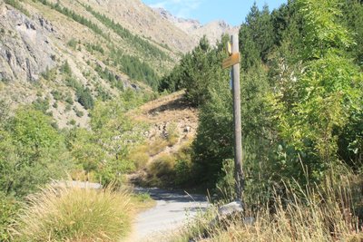
Les Choulières - Office de tourisme du Pays des Écrins  History
Les Choulières
The French children's song Savez-vous planter les choux? (Do you know how to plant cabbage?) is very appropriate here! In any event, the name Choulières is believed to be a reference to a place planted with cabbages and, by extension, a place where vegetables are grown. The phasing out of crop cultivation in the mountains has altered the landscape: the hay meadows and fields are now used as grazing meadows for increasingly large flocks of sheep.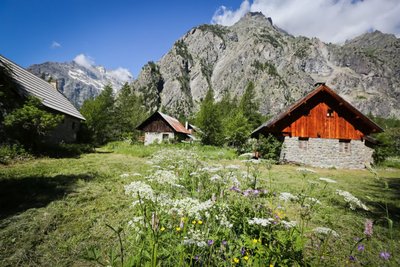
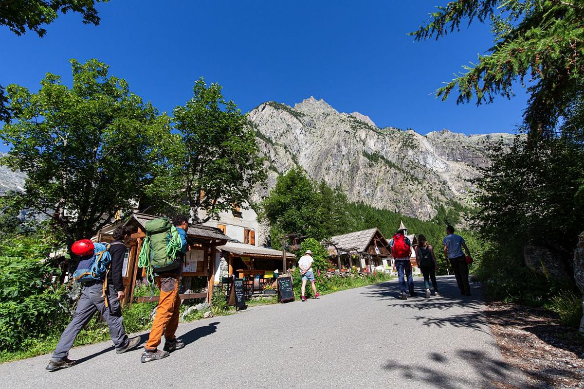
Ailefroide - Jan Novak Photography  Top
TopAilefroide
Formerly an alpine pasture hamlet, Ailefroide lies at the foot of Mont Pelvoux, surrounded by larch woods and granite cliffs. It is the last hamlet in the valley, at the confluence of the valleys of Saint-Pierre and Celse Nière. The name Ailefroide is thought to originate from the term Alpe froide or “cold Alp”, a reference to the lack of sun here in the winter. It is the starting point of numerous trails and is a paradise for climbers. Ailefroide is a legendary destination for mountaineers: a stele commemorates the conquest of Mont Pelvoux in 1828.
details.BAMwidget
Source

Report a problem or an error
If you have found an error on this page or if you have noticed any problems during your hike, please report them to us here: