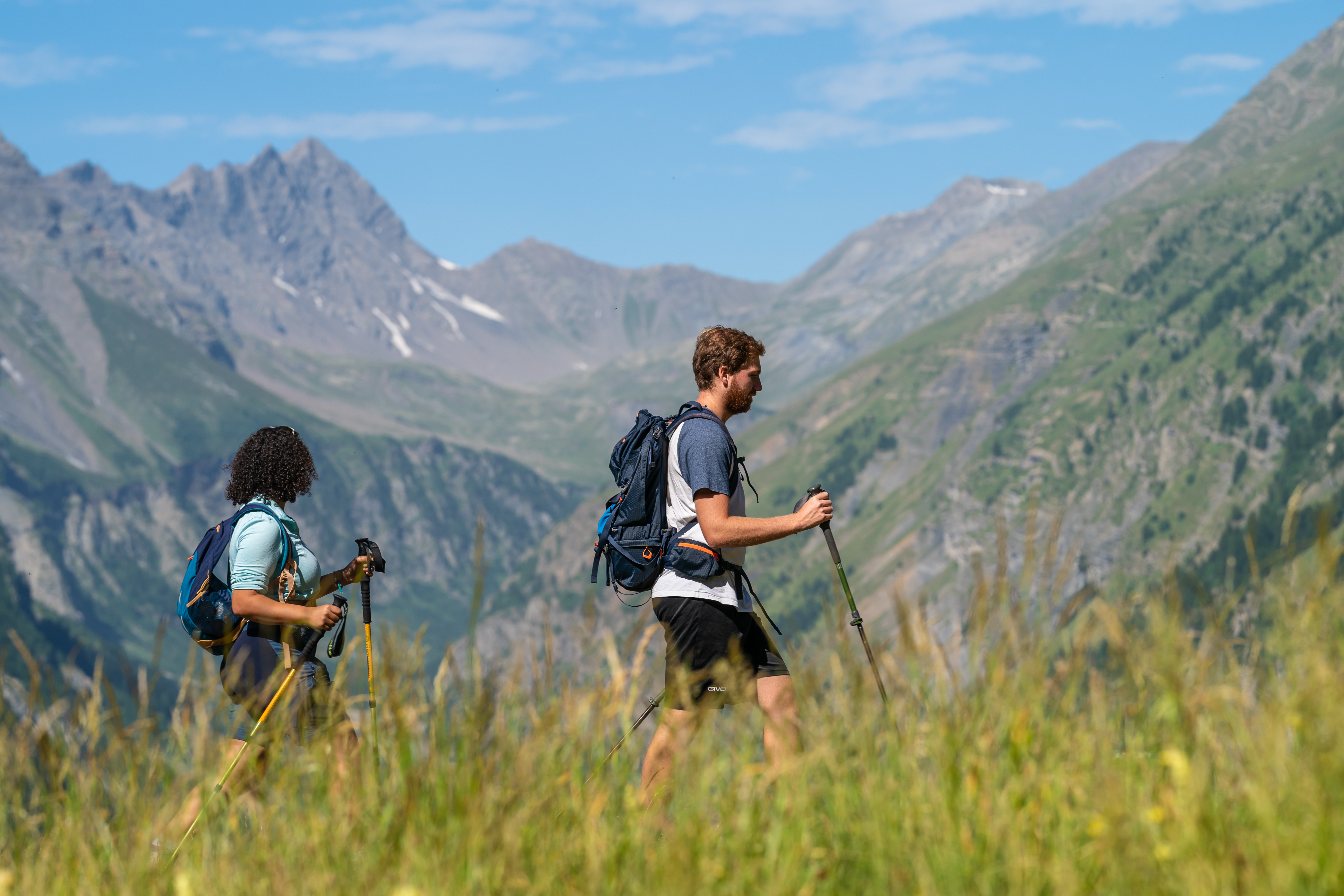
5. From Puy-Saint-Vincent 1400 to Freissinières
From a developed mountain across the Col de la Pousterle to the wild Fournel valley ... From a forested shady northern slope to sunlit alpine pastures and populated hamlets via the Col de la Lauze... The magic of mountain pass crossings which, in just a few steps, take you into completely different environments and landscapes.
Description
At the chapel of St Roch, take the paved road that leads up to the resort buildings (leave the GR). Go across the car park - private property, gate/fence. At the far end of the car park, take a narrow forest path that follows the stream Les Alberts (trail no. 15). You reach a paved road. Turn left onto it, pass under the cable cars and when you come to another paved road turn right (trail no. 15). Follow this for approximately 600 metres. From here, follow the GR waysigns until you reach the Col de la Pousterle - the route alternates between paved road and track
- When you reach the Pousterle plateau, you come to the large sign "Forêt des Vigneaux", "Plateau de la Pousterle 1,760 m". Follow the track heading towards Vallon du Fournel (GR). At subsequent intersections, stay on the track (Vallon du Fournel). After the drinking troughs, leave the track to follow a path on the right leading into the alpine pastures (GR). After thirty or so metres, the path drops down to the Vallon du Fournel, crossingthe GR track at a number of points. Superb view over the valley. At subsequent intersections, follow signs for Col des Lauzes (GR). You come to a dwelling, and the path becomes a track until it reaches "Pont Haut 1,405 m".
- Cross the bridge over the mountain stream Le Fournel then take the path on the left, on the right-hand bank of the stream. When you come to a track on a hairpin bend, take the path leading uphill on the right (GR). At the intersection "Le Sapey 1,370 m", follow the track (Col des Lauzes). Approximately 200 metres after crossing the Crouzet mountain stream, leave the track to take a narrow path on the right (GR). The path winds swiftly uphill, steeply in places, up to the "Couieman" intersection (GR, trail no. 15); here, continue heading towards Col des Lauzes. You go past the Couieman high pasture chalet, the end of the steep uphill section. The path runs on a level gradient to the Les Lauzes alpine pasture.
- Les Lauzes alpine pasture. Cross the track and follow an indistinctly marked path opposite (GR). After a short ascent and a long level stretch, the path joins a track which you follow right until you reach the Col des Lauzes.
- Col des Lauzes. Take the downhill path (Les Aujards – Freissinières – GR). After approximately 30 metres, take the narrow path on the right. Continue on the GR until you come to Freissinières, after passing through the hamlets of Les Aujards and Les Roberts. A beautiful path, sometimes lined with walls, which regularly intersects the track and then the paved road (GR, trail no. 15 then no. 7).
- Departure : Puy-Saint-Vincent 1400
- Arrival : Freissinières
- Towns crossed : Puy-Saint-Vincent, Les Vigneaux, L'Argentière-la-Bessée, and Freissinières
Altimetric profile
Recommandations
Alpine pastures: follow instructions relating to livestock and the presence of guard dogs.
Les Lauzes alpine pasture: (presence of livestock).
At the Col des Lauzes, before the narrow path on the right, you have the option of staying on the track for approximately 30 metres to take in a magnificent panoramic view over the Freissinières valley (bench), and then retracing your steps back to the turnoff point.
Sensitive areas
Peregrine falcon
- Impacted practices:
- Aerial, Vertical
- Sensitivity periods:
- FebMarAprMayJun
- Contact:
- Parc National des Écrins
Julien Charron
julien.charron@ecrins-parcnational.fr
3 points of interest
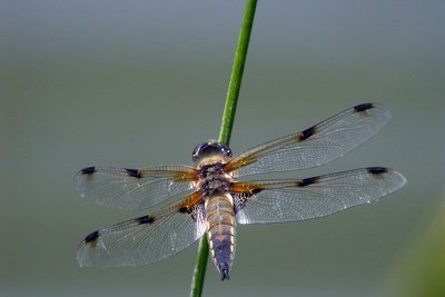
La libellule à quatre taches - Damien Combrisson - Parc national des Écrins  Fauna
FaunaThe four-spotted chaser
Dragonflies can be seen gliding around the lake One of them is relatively easy to identify: the four-spotted chaser. It is called this because there is a spot on each of its four wings. The female lays her eggs on floating vegetation and the larvae are aquatic. The dragonfly feeds primarily on mosquitoes and midges which it catches in mid-air. The male and female also mate while in flight... A real acrobat!
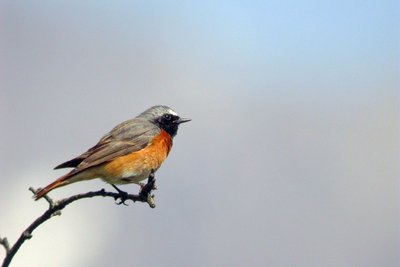
Le rougequeue à front blanc - Damien Combrisson - Parc national des Écrins FaunaThe common redstart
The common redstart can be told apart from its cousin, the black redstart by its white eyebrow (hence its French name which is translated as "white-browed redstart") and its orange breast. At least for the male, since the female of both birds is duller and brownish, but the female common redstart also has an orangey tail. It returns from Africa in early April and searches the areas to find a hollow in a tree or in an old wall where it builds its nest.
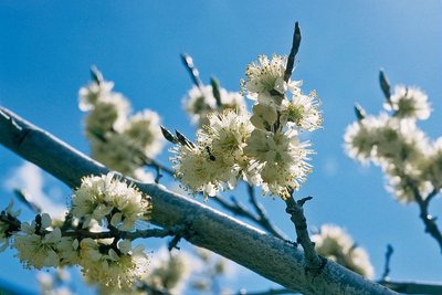
Prunier de Briançon - Bernard Nicollet - Parc national des Écrins  Flora
FloraHuile de marmotte - marmot oil
In times past, the inhabitants of Freissinières used oil for cooking and lighting. Walnut or almond oil was difficult to produce at this high altitude. The Briançon plum tree or marmottier, however, can withstand the mountain conditions, and the yellow fruits of this tree contain kernels. These kernels were pressed in mills to produce an oil with medicinal virtues: marmot oil. .
details.BAMwidget
Source

Report a problem or an error
If you have found an error on this page or if you have noticed any problems during your hike, please report them to us here: