6. De Freissinières to L'Argentière-La Bessée
Description
- Via ferrata car park. Take the level path (Clot du Puy, GR). At the state forest sign (“Forêt domaniale”), turn left (via ferrata). The path rises steadily to the cliffs; always follow signs for Clot du Puy. When you arrive at the foot of the rock face, turn right (Clot du Puy) (under the cliffs, vertiginous stretches).
- When you come to Clot du Puy, turn right (Col de l’Aiguille). The path runs level through forest, following the ridgeline. The ridge tapers off and the path runs left (trail no. 14). (There-and-back walk of a few metres to reach a viewing point). (/!\ Steep rocky steps, technical descent). The path runs between two large boulders and continues downhill (/!\ Steep rocky stretches, technical descent). You come to an intersection, "Crête des Falaises 1,390 m". Take the uphill path (Col de l’Aiguille).
- At the Col de l'Aiguille, the path drops sharply in tight twists and turns until it reaches the junction with the GR leading from Pallon. Head towards L'Argentière. At the next intersection, head towards Plan Léothaud. The path turns into a track. At the next intersection, stop following the GR waysigns. DO NOT head in the direction of Plan Léothaud, but instead take the track leading uphill on the left. After approximately 800 metres, at the intersection take the path leading downhill to the right (Plan Léothaud). After two hairpins, you come to Plan Léothaud (1,009 m).
- Follow the paved road that runs downhill. When you reach a junction, turn right onto the Rue Saint Antoine which joins the RD 138a. Cross this road and take an indistinctly marked track opposite (trail no. 23) which leads to a railway underpass. Go through this underpass and turn left onto the track running alongside the railway line. At the intersection with a narrow road (level crossing) continue straight ahead on the paved road (trail no. 23). At the next junction, turn right (lake) and continue on to a car park. Cross the two footbridges that take you across to the right-hand bank of the Durance, at the white water stadium.
- Head back up to L'Argentière following the walking path. When you come to the industrial zone, continue straight on between the buildings until you reach the L'Argentière train station.
- Departure : Freissnières
- Arrival : L'Argentière-La Bessée
- Towns crossed : Freissinières and L'Argentière-la-Bessée
Altimetric profile
Recommandations
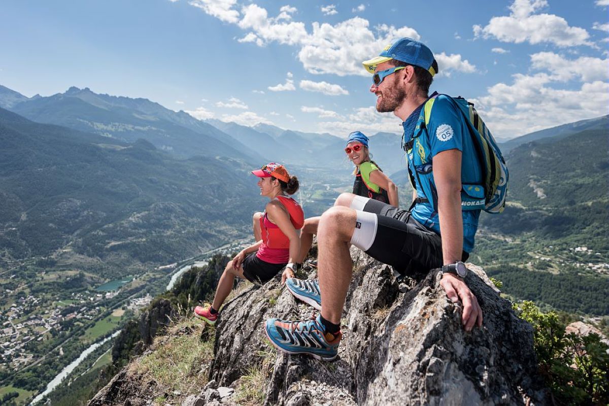
This stage is not recommended for people who suffer from vertigo or who are not at ease on steep paths.
At the foot of the cliffs: (on the cliff section, there are several vertiginous stretches and some short rocky stretches where there is a risk of rock falls; do not linger here).
Information desks
23 Avenue de la République, 05120 L'Argentière-La Bessée
Sensitive areas
Peregrine falcon
- Impacted practices:
- Aerial, Vertical
- Sensitivity periods:
- FebMarAprMayJun
- Contact:
- Parc National des Écrins
Julien Charron
julien.charron@ecrins-parcnational.fr
Short-toed snake eagle
- Impacted practices:
- Aerial,
- Sensitivity periods:
- MarAprMayJunJulAugSep
- Contact:
- Parc National des Écrins
Julien Charron
julien.charron@ecrins-parcnational.fr
Short-toed snake eagle
- Impacted practices:
- Aerial,
- Sensitivity periods:
- MarAprMayJunJulAugSep
- Contact:
- Parc National des Écrins
Julien Charron
julien.charron@ecrins-parcnational.fr
Short-toed snake eagle
- Impacted practices:
- Aerial,
- Sensitivity periods:
- MarAprMayJunJulAugSep
- Contact:
- Parc National des Écrins
Julien Charron
julien.charron@ecrins-parcnational.fr
8 points of interest
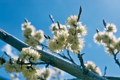
Prunier de Briançon - Bernard Nicollet - Parc national des Écrins  Flora
FloraHuile de marmotte - marmot oil
In times past, the inhabitants of Freissinières used oil for cooking and lighting. Walnut or almond oil was difficult to produce at this high altitude. The Briançon plum tree or marmottier, however, can withstand the mountain conditions, and the yellow fruits of this tree contain kernels. These kernels were pressed in mills to produce an oil with medicinal virtues: marmot oil. .
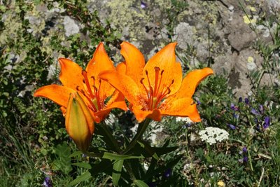
Le lys orangé - Marie-Geneviève Nicolas - Parc national des Écrins FloraThe fire lily
In June and early July, the rocks are brightened up here and there by large orange flowers: the fire lily is a splendid plant which grows in the mountains of Europe. It grows in rocky or bush-covered terrain and even - why not? - right on the cliff faces, in dry areas. It is a protected species.
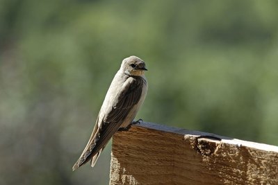
Hirondelle de rocher - Mireille Coulon - Parc national des Écrins  Fauna
FaunaThe crag martin
The birds that are constantly swooping around the cliff are crag martins. They are brown with a beige underside. They have built their nests under small overhangs. This species is very common in the Alps. Partially migratory, crag martins return to the Mediterranean coast in winter, where they join resident populations. So it is the first bird to reappear in the valleys of the Pays des Écrins in late February and the last to leave in October!
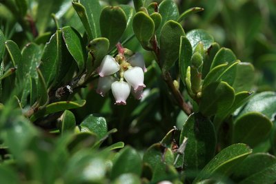
Raisin d'ours, Ericacées - Cédric Dentan - Parc national des Écrins FloraThe bearberry
The floor of the pine forest is carpeted by a creeping sub-shrub with glossy oval evergreen leaves. In spring, the bearberry produces small bell-shaped flowers which are white and edged with pink. They will turn into red berries, edible but floury. Bears love them, hence their name. It is a drought-tolerant plant.
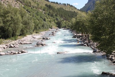
Stade d'eau vive - Office de tourisme du Pays des Écrins  Water
WaterThe white water stadium
As part of its restructuring after the closure of the industrial site, the town of L'Argentière-la-Bessée opted for sports tourism, exploiting the natural elements present on the site, that is to say, water. Standing at the beginning of the longest navigable section of the Durance river, in 1993 the municipality decided to establish itself as a major white water centre by creating this stadium which covers a 400-metre stretch. So thanks to its reputation and its ideal situation, every year this stadium hosts several elite competitions at national and international level.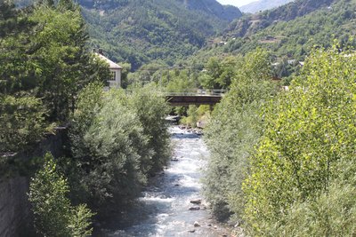
Le Fournel - Office de tourisme du Pays des Écrins WaterThe Fournel
The source of the Fournel rises in the Fournel valley, in the heart of the Parc National des Écrins, and flows into the Durance near the white water stadium. It is known as a high alpine canyon offering lots of sport and leisure possibilities, and is the most popular in the Haut Val Durance. It is ideal for an introduction to vertical activities, in particular thanks to the presence of several jumps, toboggan runs and rappel sites. Access is authorised from April to October and is regulated because it is located upstream from an EDF water intake, which presents a real hazard.
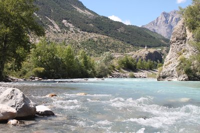
La Durance - Office de tourisme du Pays des Écrins WaterThe Durance
The Durance is the biggest river in Provence. Its source rises in the municipality of Montgenèvre at an altitude of 2,390 metres, and it flows down to meet the Rhône to the south of Avignon. This is a "pluvio-nival" river, that is to say, its flow depends on the natural addition of water due to snowmelt and rainfall. It thus constitutes a real playground for kayakers from across Europe.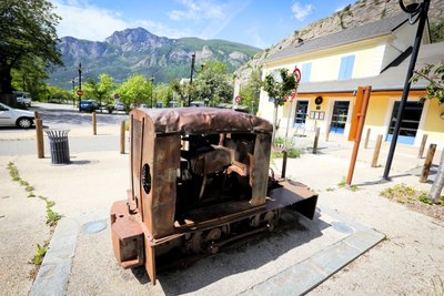
Le locotracteur - Jan Novak Photography  History
The light rail tractor
A locomotive? No, its little cousin, the light rail tractor. This replaced manually pushed carts and horse-drawn vehicles. Less powerful than a locomotive, it travelled along narrow-gauge tracks which could be laid on different types of terrain. An information panel also described the role of this vehicle during the Great War.
details.BAMwidget
Source

Report a problem or an error
If you have found an error on this page or if you have noticed any problems during your hike, please report them to us here: