
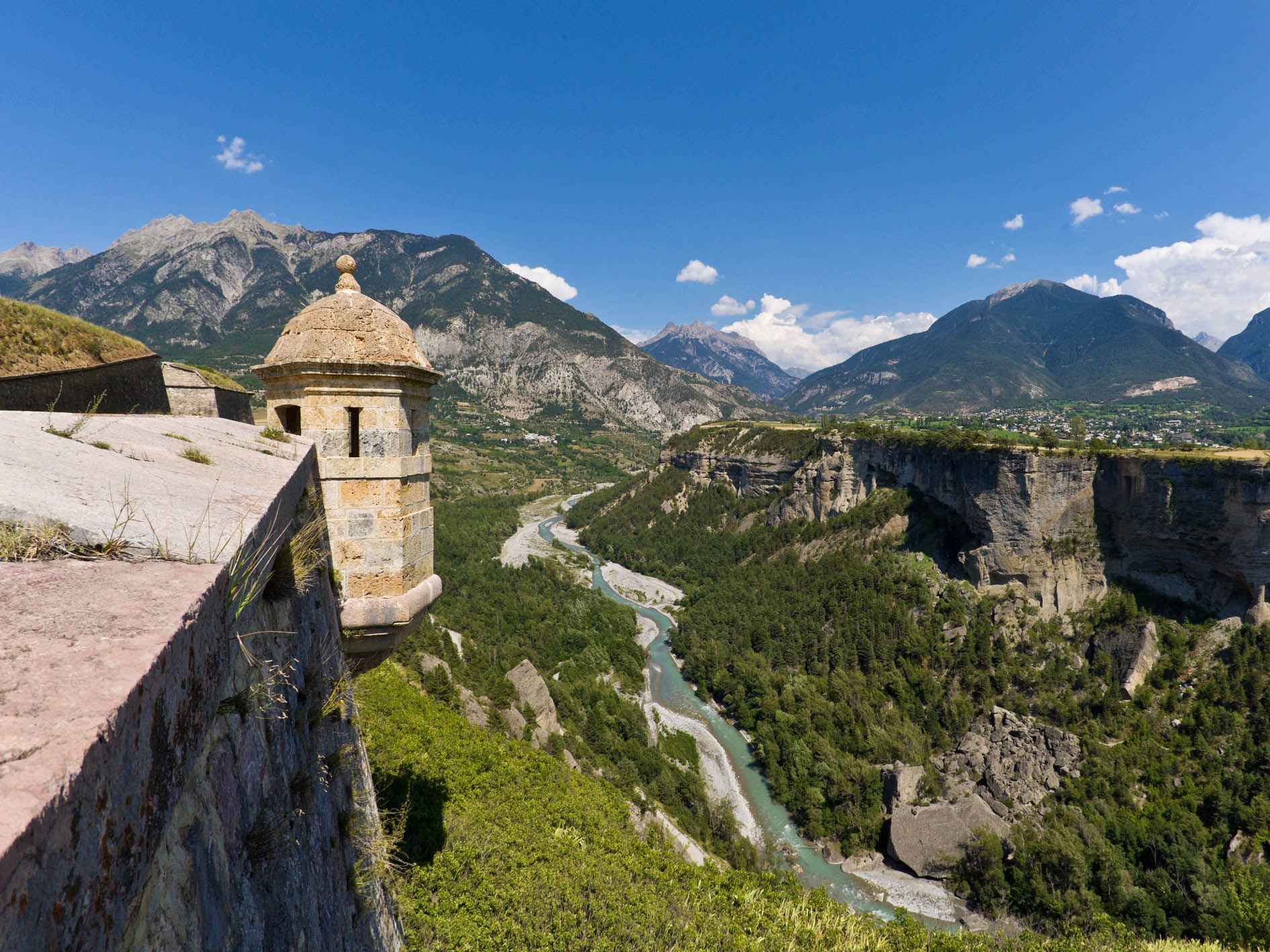
2. Durance by bike Stage 2 : L'Argentière-la-Bessée - Embrun
 Medium
Difficulty
The northern section of the route (from Briançon) follows mountain roads with steep gradients (>6%). We recommend this northern portion to experienced cyclists. It is possible to skip the more challenging stages by train. The southern section (from Gap) is easier, as it largely follows the Durance Canal. We recommend this more accessible portion to less experienced cyclists.
In Guillestre as in Embrun, we feel the urge to touch the ancient stone and dive into history through the local heritage. The Guil joins the Durance; the high waters of winter and the low waters of summer mark the rhythm of the mountain torrents. Alluvial deposits drift along, sometimes settling, then moving on again at the whim of the climate and the floods.
Description
- Leaving L'Argentière, the route once again moves away from the Durance to tackle a climb that is short but steep! The ascent to Freissinières is the first opportunity to find your rhythm, discovering with each pedal stroke the valley taking shape below — wide and open. A viewing table waits patiently at the top, a welcome reward.
- Leaving Champcella and Pallon behind, we plunge into a descent that will be swallowed up all too quickly under the condescending gaze of Mont-Dauphin, perched on its pedestal of materials carried there from the Guil valley by glacier and river alike. Behind it, the Queyras hints at its presence, and the summits towering above Vars come into view; the Durance is about to change course and take the final straight that will lead it to Serre-Ponçon.
- Still on the right bank, Eygliers and its lake offer welcome relief if the heat is fierce; or, following a tradition unchanged since Gallo-Roman times, you can sample at Réotier the warm mineral waters that rise from deep reserves through the great fault lines that have shaped the course of the Durance. A detour through Guillestre for a drink on a terrace, an overnight stay, a stroll among the pink marble rich in ammonites. The Cyclopathes — an association offering self-service bike repairs — may well be on hand for a quick mechanical check, a few adjustments, or a repair on the go.
- Guillestre has drawn us to the right bank of the Durance, and now we find ourselves below Saint-André d'Embrun, winding along the road above a turbulent Durance rushing noisily below.
- After Saint-André, we rejoin the Durance at the Pont Neuf which, with a clatter of its wooden planks, carries us to the right bank to stay in the company of the river all the way to Embrun. These are its final kilometres as a torrent: soon, it will become a lake. Then a gentler river, spreading out into a wide alluvial plain, shifting in landscape, agriculture, vegetation and dams.
A short climb up to the city perched on its moraine and the Archbishop's Gardens? A wander around the market and a glance at the Pic de Morgon? A water and sailing activity on the lake? Or a spot of fishing in the Durance? Either way, rest up before tackling the Route des Puys — an incredible balcony overlooking the lake: even more breathtaking than demanding, though your thighs will certainly feel the burn.
- Departure : L'Argentière-la-Bessée
- Arrival : Embrun
- Towns crossed : L'Argentière-la-Bessée, Freissinières, Champcella, Saint-Crépin, Réotier, Saint-Clément-sur-Durance, Saint-André-d'Embrun, Saint-Sauveur, and Embrun
Altimetric profile
Recommandations
Best period: April to October — be mindful of intense summer heat.
Waymarking: The route is continuously waymarked from Briançon to Sisteron with standard cycling route signage featuring the "Durance à Vélo" logo.
Surface / Safety: The Durance by Bike is a cycling route that follows a network of paved secondary roads. You will be sharing the road with motor vehicles. This is not a dedicated cycle path itinerary.
Difficulty: The northern section of the route (from Briançon) follows mountain roads with steep gradients (>6%). We recommend this northern portion to experienced cyclists. It is possible to skip the more challenging stages by train. The southern section (from Gap) is easier, as it largely follows the Durance Canal. We recommend this more accessible portion to less experienced cyclists.
To ride comfortably on the road, appropriate equipment is essential. Whether it comes to tyres, mechanical components or clothing, choose according to your level and the ride ahead. From non-superfluous accessories such as saddle bags and components to improve your pedalling, to outfits suited to road cycling, neither the cyclist's gear nor the bike's equipment should be left to chance. Specific road cycling equipment is designed and built for this discipline. Cycling shorts, jerseys, gloves, glasses and helmets specifically designed for road cycling are strongly recommended.
Transport
Train: The TER network in the Hautes-Alpes offers the following stations (from North to South):
Briançon
L'Argentière-La-Bessée
Montdauphin-Guillestre
Embrun
Chorges
Gap
Sisteron
Access and parking
The Durance by Bike follows the roads below (from North to South):
D1091 (between Le Monêtier-les-Bains and Briançon)
N94 (between Briançon and Gap)
N85 (between Gap and Sisteron)
Sensitive areas
Peregrine falcon
- Impacted practices:
- Aerial, Vertical
- Sensitivity periods:
- FebMarAprMayJun
- Contact:
- Parc National des Écrins
Julien Charron
julien.charron@ecrins-parcnational.fr
Short-toed snake eagle
- Impacted practices:
- Aerial,
- Sensitivity periods:
- MarAprMayJunJulAugSep
- Contact:
- Parc National des Écrins
Julien Charron
julien.charron@ecrins-parcnational.fr
Short-toed snake eagle
- Impacted practices:
- Aerial,
- Sensitivity periods:
- MarAprMayJunJulAugSep
- Contact:
- Parc National des Écrins
Julien Charron
julien.charron@ecrins-parcnational.fr
Short-toed snake eagle
- Impacted practices:
- Aerial,
- Sensitivity periods:
- MarAprMayJunJulAugSep
- Contact:
- Parc National des Écrins
Julien Charron
julien.charron@ecrins-parcnational.fr
Short-toed snake eagle
- Impacted practices:
- Aerial,
- Sensitivity periods:
- MarAprMayJunJulAugSep
- Contact:
- Parc National des Écrins
Julien Charron
julien.charron@ecrins-parcnational.fr
10 points of interest
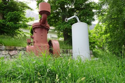
Le compresseur vertical - Office de tourisme Pays des Écrins  History
The vertical compressor
In 1910, a 22-year-old engineer, Gilbert Planche arrived in L'Argentière-La Bessée to take advantage of the water here and open a large aluminium factory.
The vertical compressor is the forerunner of the pneumatic drill. The mine operators needed a large quantity of coal and compressed air helped to accelerate coal output. In 1852, Swiss physicist Jean-Daniel Colladon invented the pneumatic drill. The vertical compressor enabled the production of compressed air which powered a drill and simplified coal excavation. The compressor is placed vertically on its support, hence its name.
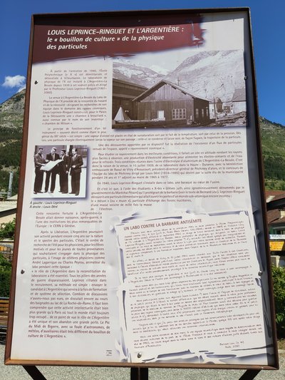
Louis Leprince-Ringuet et L'Argentière - Office de tourisme du Pays des Écrins HistoryLouis Leprince-Ringuet and L'Argentière
Louis Leprince-Ringuet was the director of the Physics Laboratory of X ("X" being a polytechnic school in Villeurbanne) established in L'Argentière. During the summer of 1942, he took in several Jewish students, thus saving them from the Nazis and deportation to Auschwitz. A panel presents the discoveries made by Louis Leprince-Ringuet in this laboratory. A text by Bernard Lévi is also displayed. As a young Jewish student, he took part in research at the laboratory during the summer of 1942. In it he thanks the scientific team for helping him to escape the anti-Semitic barbarism.
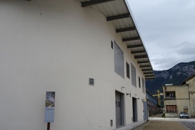
Anciennement l'usine Péchiney - Office de tourisme Pays des Écrins HistoryThe Péchiney factory
This French electro metal company established itself in L'Argentière in 1907. The construction of the aluminium factory started in 1909 and it opened its doors in 1910, powered by the electricity plant built by Gilbert Planche. With it, L'Argentière became an industrial town. The economic crisis of the 1970s and the rise of foreign sources of supply led to the factory's closure in 1985. It was partially demolished in 1988. The workers left the town and in order to prevent the abandonment of L'Argentière, a restructuring project was launched.
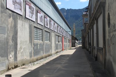
Anciennes industries de L'Argentière-la-Bessée - Office de tourisme du Pays des Écrins HistoryFormer industrial area of L’Argentière-la-Bessée
On the two walls of these now-disused industrial structures, you can read the history of L’Argentière-la-Bessée. The town is marked by its industrial past, in particular by the presence of a hydroelectric power station built between 1907 and 1909 to harness the power of the mountain waterfalls. At the time, it was the most powerful power station in Europe. Other industries were also established here, like the Société du Quartz Fondu fused quartz works and the aluminium factory which provided livelihoods for a large number of workers.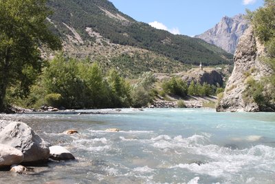
La Durance - Office de tourisme du Pays des Écrins  Water
WaterThe Durance
The Durance is the biggest river in Provence. Its source rises in the municipality of Montgenèvre at an altitude of 2,390 metres, and it flows down to meet the Rhône to the south of Avignon. This is a "pluvio-nival" river, that is to say, its flow depends on the natural addition of water due to snowmelt and rainfall. It thus constitutes a real playground for kayakers from across Europe.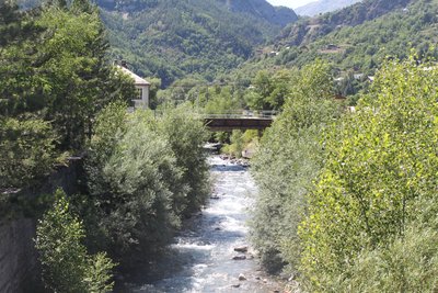
Le Fournel - Office de tourisme du Pays des Écrins WaterThe Fournel
The source of the Fournel rises in the Fournel valley, in the heart of the Parc National des Écrins, and flows into the Durance near the white water stadium. It is known as a high alpine canyon offering lots of sport and leisure possibilities, and is the most popular in the Haut Val Durance. It is ideal for an introduction to vertical activities, in particular thanks to the presence of several jumps, toboggan runs and rappel sites. Access is authorised from April to October and is regulated because it is located upstream from an EDF water intake, which presents a real hazard.
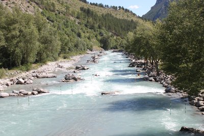
Stade d'eau vive - Office de tourisme du Pays des Écrins WaterThe white water stadium
As part of its restructuring after the closure of the industrial site, the town of L'Argentière-la-Bessée opted for sports tourism, exploiting the natural elements present on the site, that is to say, water. Standing at the beginning of the longest navigable section of the Durance river, in 1993 the municipality decided to establish itself as a major white water centre by creating this stadium which covers a 400-metre stretch. So thanks to its reputation and its ideal situation, every year this stadium hosts several elite competitions at national and international level.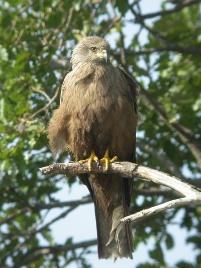
Milan noir - Combrisson Damien - Parc national des Écrins  Fauna
FaunaThe black kite
A bird of prey circles slowly above the valley. It is dark coloured with a slightly forked tail. A black kite, which returned from Africa in spring. It feeds on carrion or scraps as well as fish. It is easy to confuse with the red kite which is brown, red and white and its tail has a much more pronounced fork. The red kite does not nest here in the massif. It is only seen during the migration period, in the Durance valley.
Hameau de Pallon - Office de tourisme Pays des Écrins  Geology and geography
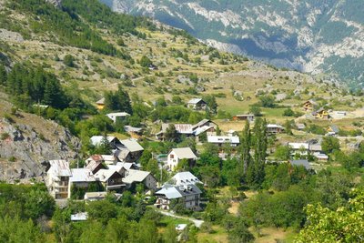
A Medieval tsunami?
Pallon marks the entrance to the ancient glacial valley of Freissinières, enclosed behind a bar of hard rock. As they melted, the glaciers left behind a lake, trapped by this bar. It is said that this natural dam has been breached on numerous occasions. In the Middle Ages, suddenly released into the Gourfouran gorge, the water is said to have laid ruin to the village of Rame, standing on the plain.
La Durance à sa confluence avec le Lac de Serre-Ponçon, plan d'eau d'Embrun sur la droite - Agence Kros_Rémi Fabrègue WaterThe Durance
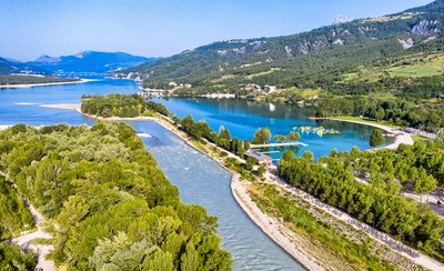
The Durance is the most important river in Provence and the third largest tributary of the Rhône, behind the Saône and the Isère. It rises in the Hautes-Alpes in the municipality of Montgenèvre and is soon joined by the Clarée and Guisane rivers, which flow past it despite being longer and having a greater flow at the confluence point. The Durance valley has been a major communication route for centuries, and its capricious nature has been controlled by the artificial lake at Serre-Ponçon and a canal running downstream. The old proverb from the Ancien Régime, which once claimed that "the three scourges of Provence are the Mistral, the Durance and Parliament", has now been forgotten, and the Durance now brings nothing but life to the land it irrigates.
.
More information

details.BAMwidget
Source

Report a problem or an error
If you have found an error on this page or if you have noticed any problems during your hike, please report them to us here: