Tour of Oisans and Ecrins
The Tour of Oisans and Ecrins footpath is one of the three great hiking trails in the French Alps (with Mont Blanc and the Vanoise),
but it is without doubt the most unspoilt of all, and the hardest too: 184 kilometres, 14 mountain passes and over 12 800 metres of inclines.
Leaving from L'Oisans, the GR 54 footpath takes you on a journey through mountain villages, deep valleys and high Alpine passes, watched by emblematic wildlife, discreet but present.
13 steps
Description
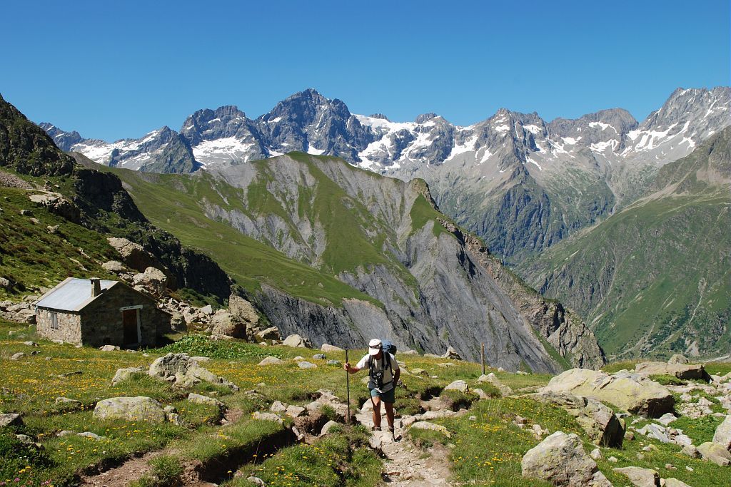
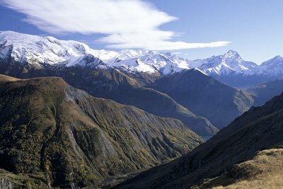
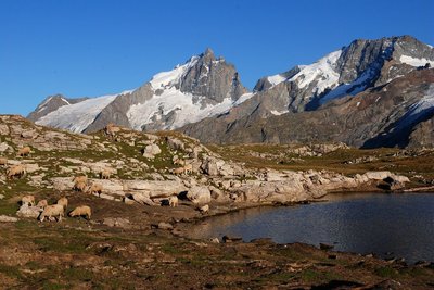
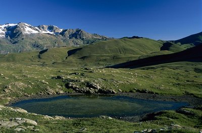
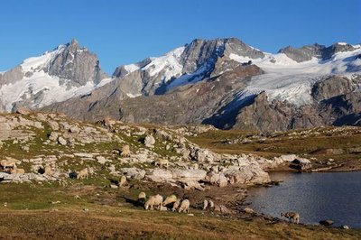
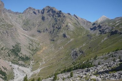
From Le Bourg d'Oisans, the Tour of Oisans and Ecrins footpath begins its grand tour with the help of handrails to reach the small villages perched on the mountainside. It descends towards the Sarenne mountain stream and then goes up to the mountain pass, with a panorama over the Monts de Lans. We then go down towards Clavans and the Ferrand valley, before a fine climb as far as Besse-en-Oisans, at the edge of the vast Emparis plateau. Above, Col de Souchet offers a five-star view over the Meije. A descent of almost 1000 metres leads to La Grave. You then walk along the River Romanche as far as its source on the mountain pastures of Villar d'Arène. When you arrive at Col d'Arsine, the spectacle is astonishing. The mountainous setting is an invitation to visit the Arsine glacier lake before beginning our long descent along the Petit Tabuc mountain stream as far as the Guisane valley and Monêtier-les-Bains. Our destination is Vallouise via Col de l'Eychauda and the peaceful chalets of Chambran. 8 km of road along the Onde mountain stream bring us to the Jas Lacroix alpine pastures. Crossing Col de l'Aup Martin, the highest point in all the tour, is always rich in adventure, and the descent towards the Pré de la Chaumette is equally exciting. To reach Lake Vallonpierre and Valgaudemar, you have to take care crossing no less than three mountain passes carved out in the schist. Along the Séveraisse, the footpath joins La Chapelle-en-Valgaudemar and then rises through Villar Loubière as far as the Souffles refuge and the impressive Col de la Vaurze. Equally impressive is the descent towards the unspoilt Valjouffrey. The rich green Col de Côte Belle contrasts with the schist landscapes we have seen until now. Valsenestre, in the Béranger valley, comes as a well-earned break before we set off for the last few twists and turns. We arrive at the vertical Col de la Muzelle, leading to the Vénéon. One last mountain pass takes us to the biggest lake in L’Oisans, the Lauvitel, and we are back in Le Bourg d'Oisans. We have come full circle!
You can follow the GR® 54 footpath either from Le Bourg d'Oisans, L'Argentière, La Grave or from any other village along the way.
- Departure : Le Bourg d’Oisans
- Towns crossed : Le Bourg-d'Oisans, La Garde, Huez, Le Freney-d'Oisans, Clavans-en-Haut-Oisans, Besse, Mizoën, La Grave, Villar-d'Arêne, Le Monêtier-les-Bains, Vallouise-Pelvoux, L'Argentière-la-Bessée, Champoléon, La Chapelle-en-Valgaudemar, Villar-Loubière, Valjouffrey, and Les Deux Alpes
Altimetric profile
Recommandations
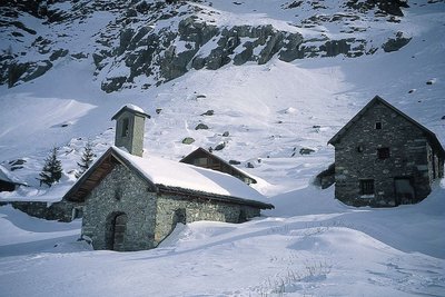
The best time to do the tour is between late June and mid-September. Find out about weather conditions and snow levels on the mountain passes in early summer.
Some passages, near high mountain areas, cross difficult terrain. It is possible to sleep in the open air all along the GR (see regulations in the National Park / the Emparis plateau and prohibition in certain municipalities) and in campsites, hotels, gîtes or refuges.
On some stages you will need to take your own food with you.

 In mountain pastures, protection dogs are there to protect the herds from predators (wolves, etc.).
When I hike I adapt my behavior by going around the herd and pausing for the dog to identify me.
Find out more about the actions to adopt with the article "Protection dogs: a context and actions to adopt".
Tell us about your meeting by answering this survey.
Information desks

Oisans Park house
45 avenue de la République, 38520 Le Bourg d'Oisans
Video presentation of the natural resources of the Oisans mountain and its crafts. Information, documentation about the Park, projections, reading space for children. Accessible to people with reduced mobility. Free admission. All animations of the Park are free unless otherwise stated.
Transport
Grenoble SNCF station : https://www.sncf-connect.com/
Airports : Grenoble Isère : www.grenoble-airport.com
ou Lyon Saint-Exupéry : www.lyon.aeroport.fr
ou Geneva : www.gva.ch
Daily bus services between Grenoble-Le Bourg d’Oisans :
https://carsisere.auvergnerhonealpes.fr/
https://www.itinisere.fr/
Access and parking
The Bourg d'Oisans is 50 km from Grenoble by the motorway A48 (exit 8 "Station de l'Oisans), the N85 and the D 1091 from Vizille.
Parking :
Sensitive areas
- Impacted practices:
- Aerial, Aquatic, Land, Vertical
- Sensitivity periods:
- JanFebMarAprMayJunJulAugSepOctNovDec
- Contact:
- Parc national des Écrins.
Alpine ibex
- Impacted practices:
- Aerial, , Land, Vertical
- Sensitivity periods:
- JunJulAugSep
- Contact:
- Parc National des Écrins
Julien Charron
julien.charron@ecrins-parcnational.fr
Golden eagle
- Impacted practices:
- Aerial, , Vertical
- Sensitivity periods:
- JanFebMarAprMayJunJulAug
- Contact:
- Parc National des Écrins
Julien Charron
julien.charron@ecrins-parcnational.fr
Golden eagle
- Impacted practices:
- Aerial, , Vertical
- Sensitivity periods:
- JanFebMarAprMayJunJulAug
- Contact:
- Parc National des Écrins
Julien Charron
julien.charron@ecrins-parcnational.fr
Bearded vulture
- Impacted practices:
- Aerial, , Vertical
- Sensitivity periods:
- JanFebMarAprMayJunJulAugNovDec
- Contact:
- Parc National des Ecrins - Yoann Bunz- 06 99 77 37 65 yoann.bunz@ecrins-parcnational.fr
Alpine ibex
- Impacted practices:
- Aerial, , Land, Vertical
- Sensitivity periods:
- JunJulAugSep
- Contact:
- Parc National des Écrins
Julien Charron
julien.charron@ecrins-parcnational.fr
Golden eagle
- Impacted practices:
- Aerial, , Vertical
- Sensitivity periods:
- JanFebMarAprMayJunJulAug
- Contact:
- Parc National des Écrins
Julien Charron
julien.charron@ecrins-parcnational.fr
Golden eagle
- Impacted practices:
- Aerial, , Vertical
- Sensitivity periods:
- JanFebMarAprMayJunJulAug
- Contact:
- Parc National des Écrins
Julien Charron
julien.charron@ecrins-parcnational.fr
Golden eagle
- Impacted practices:
- Aerial, , Vertical
- Sensitivity periods:
- JanFebMarAprMayJunJulAug
- Contact:
- Parc National des Écrins
Julien Charron
julien.charron@ecrins-parcnational.fr
Golden eagle
- Impacted practices:
- Aerial, , Vertical
- Sensitivity periods:
- JanFebMarAprMayJunJulAug
- Contact:
- Parc National des Écrins
Julien Charron
julien.charron@ecrins-parcnational.fr
Golden eagle
- Impacted practices:
- Aerial, , Vertical
- Sensitivity periods:
- JanFebMarAprMayJunJulAug
- Contact:
- Parc National des Écrins
Julien Charron
julien.charron@ecrins-parcnational.fr
Golden eagle
- Impacted practices:
- Aerial, , Vertical
- Sensitivity periods:
- JanFebMarAprMayJunJulAug
- Contact:
- Parc National des Écrins
Julien Charron
julien.charron@ecrins-parcnational.fr
Golden eagle
- Impacted practices:
- Aerial, , Vertical
- Sensitivity periods:
- JanFebMarAprMayJunJulAug
- Contact:
- Parc National des Écrins
Julien Charron
julien.charron@ecrins-parcnational.fr
Golden eagle
- Impacted practices:
- Aerial, , Vertical
- Sensitivity periods:
- JanFebMarAprMayJunJulAug
- Contact:
- Parc National des Écrins
Julien Charron
julien.charron@ecrins-parcnational.fr
Golden eagle
- Impacted practices:
- Aerial, , Vertical
- Sensitivity periods:
- JanFebMarAprMayJunJulAug
- Contact:
- Parc National des Écrins
Julien Charron
julien.charron@ecrins-parcnational.fr
Golden eagle
- Impacted practices:
- Aerial, , Vertical
- Sensitivity periods:
- JanFebMarAprMayJunJulAug
- Contact:
- Parc National des Écrins
Julien Charron
julien.charron@ecrins-parcnational.fr
Peregrine falcon
- Impacted practices:
- Aerial, Vertical
- Sensitivity periods:
- FebMarAprMayJun
- Contact:
- Parc National des Écrins
Julien Charron
julien.charron@ecrins-parcnational.fr
Short-toed snake eagle
- Impacted practices:
- Aerial,
- Sensitivity periods:
- MarAprMayJunJulAugSep
- Contact:
- Parc National des Écrins
Julien Charron
julien.charron@ecrins-parcnational.fr
Black grouse - winter
- Impacted practices:
- , Land
- Sensitivity periods:
- JanFebMarAprDec
- Contact:
- PN Ecrins BERGEON Jean-Pierre jean-pierre.bergeon@ecrins-parcnational.fr QUELLIER Hélène helene.quellier@ecrins-parcnational.fr Membre de l OGM ogm.vds@gmail.com ogm.amblard@gmail.com
50 points of interest
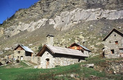
Le clocher de Besse-en-Oisans - François Labande - PNE  History
Besse-en-Oisans
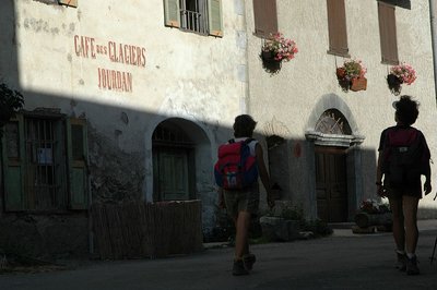
The arrival in Besse-en-Oisans leaves no hiker indifferent. Besse, with its listed historic buildings, is the kind of village you will never forget. With its stone houses built closely together, as if for protection from the rough winters, and its narrow streets inviting visitors to take a stroll, Besse deserves more than a passing glance.
Why not take a break at the terrace of the Café des Touristes, next door to the village’s only grocery shop, or a little further up, in front of the bakery where they serve the traditional Tourte de Besse?
A welcome break before the steep climb up to the peaceful Alpine pastures of Emparis. Almost 3000 hectares of playground facing the grandiose panorama of the Aiguilles d'Arves and the Meije.
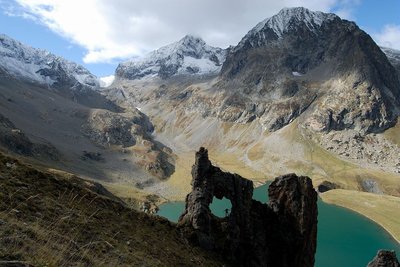
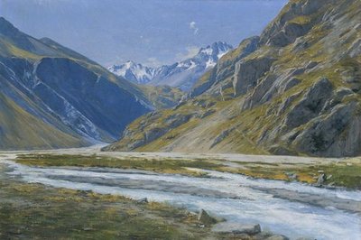
La cascade de Sarenne au départ du GR 54 - © Florence Chalandon  Water
WaterSarenne waterfall
Less than 100 metres after the start of the GR54 footpath, you arrive at an impressive waterfall. This is a daughter of the Sarennes mountain stream, which takes its source in the glacier of the same name in the Alpe d'Huez ski resort. It then rushes down a steep-sided valley before reaching the village of Huez, and then plunges into a gorge linking it to the River Romanche. A refreshing break before taking on the first climb of this grand tour.
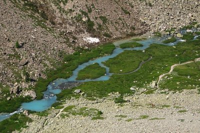
Zones humides du Rif Tort - © Parc national des Écrins - Jean-Pierre Nicollet  Flora
FloraThe wetlands of the Rif Tort
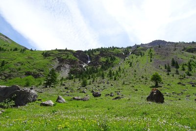
Temperatures on the Emparis plateau are characteristic of a cool steppe climate. It is a very windy plateau with an average annual temperature only just above zero degrees. Winter lasts for eight months, during which it freezes almost every day. The particularly severe temperature constraints in the Rif Tort catchment area have favoured the maintenance of a relic flora adapted to these extreme conditions since the last ice age. «Arctic-Alpine»plant formations are found here. This is a relic flora inherited from advancing glaciers in the Quaternary period, comparable to the flow found on the coasts of the Far North. These formations are particularly rare in Europe and are of very high heritage value. You might see numerous protected species here: bicoloured sedge, sweet grass (a boreal relic species, sole colony in Isère) and the sago pondweed. Livestock grazing in the marsh is necessary because it limits the development of herbaceous plants which could squeeze out the Arctic-Alpine species. A delicate balance needs to be found between the trampling likely to destroy the plant species growing in the low marshes and the passage of the flocks to encourage rejuvenation of the area, and thus maintain this habitat.
Troupeau d'ovins sur le plateau d'Emparis - Denis Fiat - PNE  Panorama
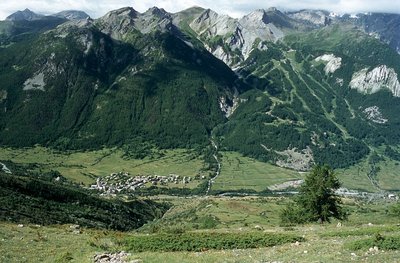
The Emparis Plateau
The mule path follows the edge of the Southern border of the plateau which is completely dedicated to pastoralism and tourism. It offers an exceptional view of the Meije whose marked relief contrasts with this gentle landscape. It welcomes 7 refuges and pastoral cabins as well as remarkable fauna, like the Mountain Hare and the Mountain Apollo butterfly. The challenge for this site is to preserve its pastoral character.
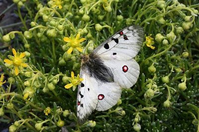
Petit apollon sur sa plante hôte (saxifrage faux aizoon) - Bernard Nicollet - PNE  Fauna
FaunaSmall Apollo
The Small Apollo is a rare and protected butterfly. It has finely striped black and white antennae, and a tiny red ocellus (eye) on each of its forewings. With a wingspan of 60 to 80 mm, it is the lord and master of the orangey-yellow beds of mountain saxifrages where it takes care of its eggs and feeds its caterpillars.
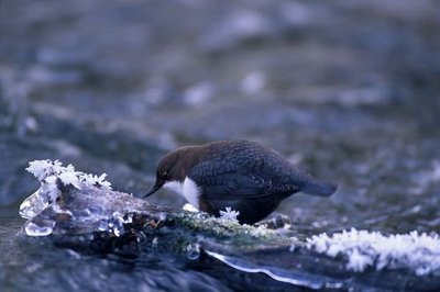
Cincle plongeur - Robert Chevalier - PNE FaunaWhite-throated dipper
Perched on a large, partly immersed pebble, the dipper sways to and fro with its tail aloft, and then dives down head first into the swirling water. This surprising passerine is unusual in moving underwater against the current in search of food. Thanks to a thin membrane protecting its eyes from the water, it can spot its prey (worms, small shellfish, water insect larva), before lifting its head out of the water and letting the current carry it gently along. It then takes up a new surveillance position and starts the process all over again.
 Panorama
Chazelet perch
To test your head for heights, there is nothing like this new, life-size game played facing the Meije a steel walkway suspended over empty space. The first few steps are daunting, but reaching the end of the walkway – or rather, empty space – calls for even more courage! Beneath your feet, all the way down below is the village of Les Fréaux, nestling against the Romanche, and above you, the giants of ice. If you add in the element of air, with gusts of wind blowing all around you, then strong sensations are guaranteed!
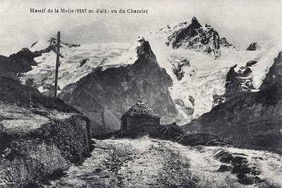
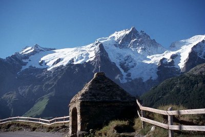
Massif de la Meije vu du Chazelet - PNE  Architecture
Sainte-Anne du Chazelet oratory
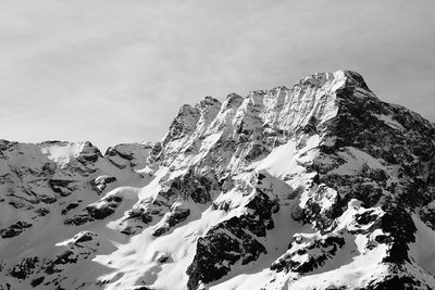
Although it stands beside an ordinary road, the Chazelet oratory is famous for one of the most beautiful panoramas of the Alps and the Meije mountains. Built in dry stone, the edifice is at 1 834 m and overlooks the valley and the Ecrins and Meije mountains. It has been sketched, photographed and painted many times, including in the famous Meije by the Japanese painter Foujita.
Recently a new orientation table was placed a few metres above the oratory. In two parts, it shows the northern slope of the Meije and the southern slope in the direction of Chazelet and Savoie.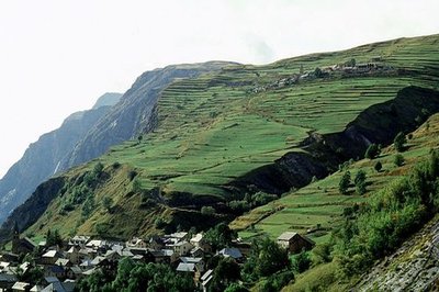
Terrasses, au hameau des Terrasses - Jean-Pierre Nicollet - PNE  Vernacular heritage
La Grave terraces
On the south-facing slope of La Grave, terraced farmland and villages are inseparable. This is a European-wide landscape uniting many architectural, archaeological and natural elements. This mountain farming system was shaped mainly by past and present agricultural activity. The steep terrain at the time required terracing for it to be farmed. These former planted terraces are today natural meadowland, which is mowed or used for grazing. It is highly sensitive to this new pastoral usage, and is little by little showing signs of soil erosion.
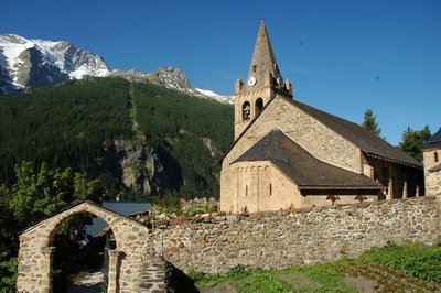
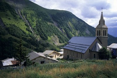
Eglise ND de l'Assomption à la Grave - Jenny Selberg - OT Hautes Vallées ArchitectureNotre-Dame de l’Assomption Church
Listed as an historic monument, Notre Dame de l'Assomption church towers over La Grave. In First Romanesque style, this remarkable building is thought to date from the 11th century, making it the oldest building in the town. All around the church is a cemetery with graves marked by wooden crosses and decorated with brass hearts, facing the giants of ice.
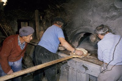
A Villar d'Arène: le four chauffé 15 h est à point, on enfourne - Jean-Pierre Nicolet - PNE  Know-how
Villar d’Arène communal oven
Pies, raviolis and crozet pasta are some of the main culinary specialities in Villar d'Arène, but above all it is the famous Pô Buli (“boiled bread”) that has made the village’s reputation. Once a year, in November, the village inhabitants make this bread using an ancestral recipe. For over 500 years, it has been kneaded with rye flour and boiling water, and then baked in the communal oven in the centre of the village, near the Penitents’ chapel.
Vallée de la Romanche, Charles Bertier - © Musée de Grenoble HistoryRomanche valley, Charles Bertier
The Romanche was a source of inspiration for many mountain artists and it have been painted repeatedly. Charles Bertier (1860-1924) was inspired to paint Vallée de la Romanche au Pied-du-Col and Les Fréaux près de la Grave, two oil paintings that were painted in 1894. The artist from Grenoble learnt to paint landscapes with Jean Achard, and mountains with the abbot Guétal and did not hesitate to set up his easel on the high summits of the Dauphiné Alps. More to the point, his mission was to make his contemporaries 'understand the mountains'!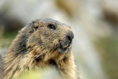
Marmotte au printemps - PNE - Papet Rodolphe FaunaThe marmots’ "bosse"
The alpine marmot is naturally present on grass at altitude. Here, it occupies a singular place which we call the marmots’ "bosse». This hibernating rodent is only visible between April and October. The marmot lives in a family and respects a hierarchy. Games, grooming, fighting and biting ensure the dominance of a couple as well as the cohesion of the group. Each animal participates in the delimitation of the territory by rubbing its cheeks on rocks and also by urinating and defecating there. When there is danger, the marmot emits a high and powerful whistle in order to warn the others.
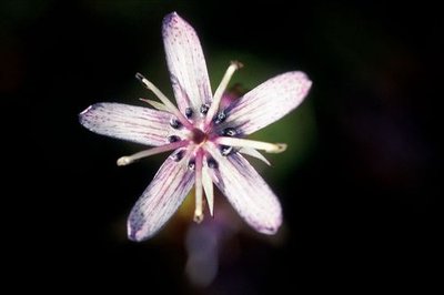
Swertie vivace - Bernard Nicollet - PNE FloraFelwort
In early August, the felwort’s violet stars open in the sunshine. At the base of each of its five petals, two shiny pits full of nectar attract insects. A member of the gentian family, this beautiful flower is a perennial that survives the cold season with its persistent winter bud close to the ground, surrounded by a rosette of protecting leaves.
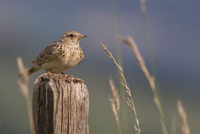
L’alouette des champs - PNE - Saulay Pascal FaunaSkylark
This bird is like a tightrope walker suspended in the sky, sounding out a long chorus of notes. Then, triangular wings back, and in a perfect spiral, the bird lands in the middle of the prairie. On the ground, it is difficult to see: its varying shades of brown means it is very well camouflaged. In its search for food, its movements, which are a succession of small sprints and sudden halts, enable it to spot possible predators.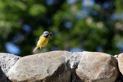
La bergeronnette des ruisseaux - PNE - Saulay Pascal FaunaGrey wagtail
The grey wagtail elegantly hops along the rocks at the riverside. They are found in mountain streams, but also near all waterways in the mountains, in the countryside or in towns, and even small high-altitude lakes. Like other wagtails, they continually wag their long black tails edged with white. They have yellow breasts like the western yellow wagtail, but their backs are ash grey. In the mating season, males proudly show off their black throats, making it easier to tell them apart from females, whose throats and breasts are partly white. Their pinkish claws are specific to the breed, since other wagtails’ claws are black.
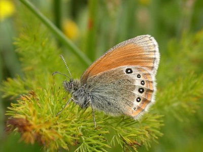
Satyrion (papillon de jour) - PNE - Delenatte Blandine FaunaButterflies and moths
Butterflies can be distinguished from moths by the shape of their antennae. You will also notice that when resting, the butterflies wings are vertically folded over the body for necessary discretion while the moth's cover them. The moorland clouded yellow butterfly has another unusual habit: as soon as it becomes too cold to fly, it settles and bends its side to the sun to absorb energy. It can even lean slightly, whereas others tend to fully, and dangerously spread themselves out.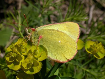
Solitaire mâle sur une euphorbe - PNE - Delenatte Blandine FaunaMoorland clouded yellow
The heath surrounded by heather and willows is the home of a population of unusual and protected butterflies: the moorland cloud yellow. Elsewhere, it lives in different environments, such as blueberry heaths and peatland, where the moorland clouded yellow is rare and hard to spot. It can be recognised by its yellow display delicately sprinkled with grey under the rear wings of the male, while the female of the species has adopted almost purely white wings. They both wear a simple pink border highlighting the edge of their wings, with a tiny white ocellus (eye) encircled with brown and a discrete grey crescent.
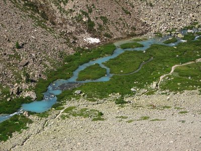
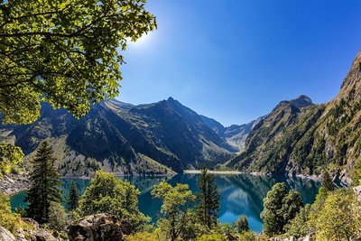
Eaux turquoises du Petit Tabuc - PNE - Coursier Cyril WaterWater colour in the meanders
The turquoise colour of the water that meanders from the Petit Tabuc stream gives a special character to this remarkable site. The valley is popular among photographers and artists for its photographic and pictorial quality.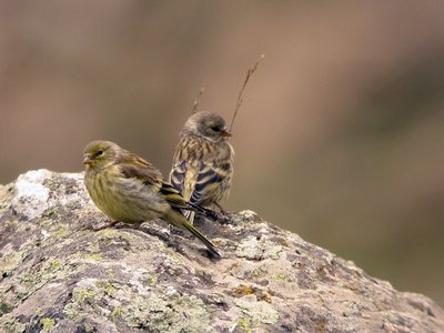
Deux venturons montagnards - PNE - Combrisson Damien FaunaAlpine citril finch
A small green-yellow-grey bird sways on a tall branch. Chet! The Alpine citril finch flies off to land on a scrap of threadbare grass. It looks like a small greenfinch, but the strident cry it makes during its short flight clearly sets it apart. Its head and breast flanks are a pretty blue-grey colour. Its yellow wing stripes can be easily seen. When flying over longer distances, its undulating flight is reminiscent of a goldfinch’s. And just like its cousin, the finch is sociable and moves about in small groups when exploring some sparse group of nettles or grass.
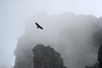
Aigle royal dans la brume - PNE - Telmon Jean-Philippe FaunaA flying predator
The eagle is the archetypal predator. Everything about it suggests strength and daring. Its appearance, of course, with its impressive expression highlighted by the prominent brow ridge, but above all its fearsome weapons: rapid flight, which can be adapted to even the most acrobatic situations, and sharp, powerful talons. Its keen eyesight helps it detect its prey, from the marmot to the young chamois, ptarmigans and hares. In winter, it often takes its food from the dead bodies of animals, helping towards the natural cleansing of nature.
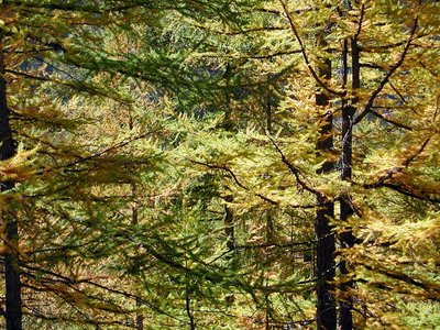
Mélezin - PNE - Quellier Hélène FloraLarch
The larch is the only European resinous tree to lose its needles in winter. Its wood is red-brown. It stands out in the landscape with its leaves ranging from a soft green colour in spring to gold in autumn. Its pink flowers attract naturalists and photographers in the spring. The larch tree is a coloniser of mountain slopes. Although it is at home in the harsh conditions of the mountainside, it cannot bear competition from other trees. The Petit Tabuc site is a fine example of its colonising capacity, even though it is regularly hit by avalanches.
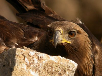
Aigle royal - PNE - Combrisson Damien FaunaGolden eagle, the Ecrins' mascot
The Petit Tabuc site is ideal for the golden eagle to nest. The golden eagle is amongst the protected species that are considered rare in Europe. The size of the populations that have been registered in the Ecrins massif, bestow a strong responsibility on the Park for conservation of the species. Counting takes place regularly since 1985 along with monitoring of reproduction, causes of disturbance and mortality.
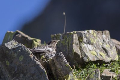
Jeune merle à plastron - PNE - Saulay Pascal FaunaRing ouzel
In the pastures covered with larch or 'bush", a cry of alarm followed the start of a song resounds. A blackbird? Yes, but more specifically a ring ouzel. This shy, swift mountain blackbird lives on the fringe of the larch, scots pine, spruce or Swiss pine forests between 1000 and 2500 m in altitude. The ring ouzel is a migratory bird that spends winter in Spain or North Africa before coming back to the mountains around March.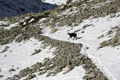
Chamois mâle au moment du rut dans le vallon du petit Tabuc, à proximité du Mônetier-les-bains - Cyril Coursier - PNE FaunaChamois
Rupicapra rupicapra, the mountain goat was not at first solely a creature of the mountains. The species is more attached to rocky escarpments and steep slopes than high altitude. But strong human pressure on chamois made them withdraw ever higher. Coveted as a hunting target, they have found refuge here in the Ecrins National Park.
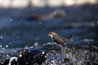
Cincle plongueur avec son repas dans le bec - Damien Combrisson - PNE FaunaWhite-throated dipper
The mountain streams relinquish their secrets to an attentive hiker. The master of this little world is a small brown, red and grey bird with a short tail and a pure white breast, separated from the darker abdomen by a light brown stripe. We can often see it in the air, flying close to the water to snap up insects. The dipper owes its name to its eating habits to find water larva, it dips its head into the water and grips the riverbed to walk against the current.
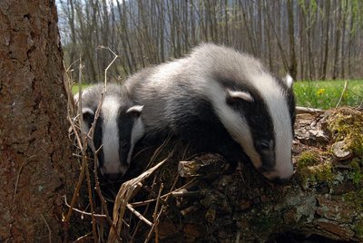
Deux jeunes blaireaux - PNE - Fiat Denis FaunaEuropean badger
You will often see a badger at nighttime on the edge of a path, a road or an embankment. The gentle pace and portly gait of this member of the mustelid family are reminiscent of a small bear you may get a glimpse of his black and the white stripes on his head before he hurries away. Worms, reptiles, frogs, fruit and plants are his staple diet. Families of badgers live in sometimes very extensive and very old burrows, with numerous chambers and galleries. They are tolerant animals, since they will sometimes share their home with rabbits and foxes. Badgers are among the unobtrusive neighbours whose presence goes undetected, except for their footprints made up of five nearly parallel toes and the tracks of their long claws.
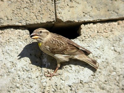
Le moineau soulcie - PNE - Combrisson Damien FaunaLover of old stones
The rock sparrow is a sedentary bird. It generally settles in well-exposed, agricultural areas where there are lots of stones, stone terraces, ruins, piles of stones, old buildings. This southern sparrow can be found up to an altitude of 2000 m provided there is an open landscape and many mineral elements. It nests in the hole of a rock, in a wall and sometimes under the roof of a house. It will then mingle with the house sparrow. A sociable bird, it lives in small, dispersed colonies.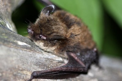
Le murin à moustaches - PNE - Corail Marc FaunaWhiskered bat
The whiskered bat is a dark-faced bat. It is quite common in certain mountain regions and is one of the most frequent species after it cousin the common pipistrelle. It likes trees, be they on the banks of a river or in the high altitude forests, but it is also possible to catch sight of them in gardens and villages such as the hamlet of Casset. This small mammal lives on flying insects and thus helps in controlling their numbers. Like all mammals, the female feeds her sole offspring with her milk.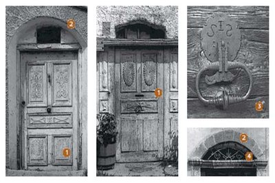
1.Ventaux de porte décorés, 2.Arcs en plein-cintre, 3.Marteau en bronze forgé, 4.Imposte en éventail - PNE ArchitectureDoors and courtyards
As you stroll through the streets of Le Casset, some house doors will attract your notice, as they bring together most of the decorative elements of the facades. Made of larch wood, they have been moulded or sculpted with geometric or floral patterns and have a tympanum above them, often with a grating. Behind the door is the courtyard, the shared entrance for people and animals. The way people lived and organised their homes resulted in this single entrance, an area giving access both to the stable and to the living quarters. Between the world inside and outside, the courtyard provided a passageway, insulation, but also storage space.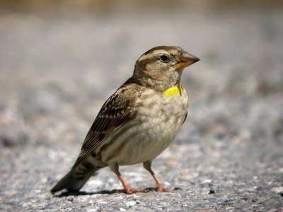
Le moineau soulcie - PNE - Combrisson Damien FaunaRock sparrow
The rock sparrow is here at the north-western limit and highest altitude of its home territory and regularly nests in the area. The species is in decline nationally and is on the endangered ‘red’ list in Rhône-Alpes and is being studied in the PACA region. People sometimes pay little attention to house sparrows since they are so familiar, which is a pity. The rock sparrow is bigger and although its plumage is similar to a female house sparrow’s, its call sets it apart at once: pi-yip or pi-yui or even a chay sound that is similar to a brambling’s!
Dans le hameau du Casset - PNE - Masclaux Pierre HistoryLe Casset
At the entrance to the valley, Le Casset is a stone shell village surrounded by farming landscapes. Its name comes from the verb 'cassare' ('to break, to shatter' in late Latin), describing a place covered with stones. In fact there are many such villages in this mountain valley carved out by a vast glacier. Le Casset, on the left bank of the Guisane, is sheltered from avalanches beneath the watchful eye of the prestigious summits and glaciers that “move” in a different time scale from our own.
Cadran solaire au hameau du Casset - Claire Broquet - PNE ArchitectureSundials
As you walk through the village of Lauzet, you will see recently made sundials made in traditional style. Easy to see from the main village streets, they adorn the beautifully restored facades of the old houses.- Architecture
Saint Claude’s church in Le Casset
With its disproportionately high spire, the Casset church never goes unnoticed. Its four-sided Comtois steeple was modelled on the collegiate church in Briançon. The church is listed as a Historic Monument and is placed under the protection of Saint Claude. In its present condition, it dates from the 18th century. The previous building was constructed prior to the 16th century. Inside, the eye is immediately attracted by the choir ogives, creating an intimate atmosphere, particularly since the unusually large spire does not suggest an interior of such a small size. The choir was rebuilt in 1716-1717, probably after the previous chapel burnt down. Traces from this period can be seen on the keystone. The wrought-iron choir gate has the inscription "HM 1717", a date that can also be seen in the apse, on the wrought iron railing of the impost of the axial window, and on the baptismal font.
La station de Serre Chevalier 1500 au-dessus du hameau des Guibertes - © Parc national des Écrins - Jean-Pierre Nicollet HistoryThe Serre Chevalier resort
At the edge of the Ecrins National Park, the Serre Chevalier ski resort extends over several towns and villages on the right bank of the Guisane, from Monêtier-les-Bains to Briançon. Founded in 1941 with the Chantemerle cable car, it has the biggest ski area in the southern Alps with 61 ski lifts on all levels from an altitude of 1,200 m to 2,830 m to Pic de l'Yret (Le Monêtier-les-Bains). The resort’s logo is an eagle, in reference to Baron Borel du Bez, Briançon’s representative in 1792 at the Legislative Assembly, which ruled France between 1792 and 1795, during the French Revolution. Le Bez is a hamlet in Villeneuve that was united with the Chantemerle ski resort in the 1970s.
Chapelle Saint-Antoine du Charvet - © Florence Chalandon HistoryCharvet Chapel
Near the arrival of the old Charvet button lift, dating from 1948 (still present, but disused since the end of the 2003/2004 season), is the Charvet chapel, which was built in 1755. Easy to access both in summer and winter from Le Monêtier, it provides hikers with a wonderful panorama over the southern Guisane valley.
It is quite unusual for a chapel in the region to be dedicated to Saint Anthony of Padua rather than to Saint Anthony the Great. Was there a shift in patronage over time? The fact the saints had the same name led to the particular qualities of each one being mixed up.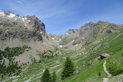
Vallon de l'Eychauda - Office de tourisme Pays des Écrins  Pastoralism
The old hay meadows
Lower down as you cross the area, near the pastoral Cabane de l'Eychauda, you can make out piles of stones, the clapiers formed by the removal of stones from the hay meadows. In order to feed the livestock right through the winter, it was necessary to garner a large amount of hay! With changes in livestock farming practices, there are no longer cut for hay, but used for grazing. Only a tiny area of the valley - the flattest - is still mown for hay, mechanically.
Les deux versants du vallon de Chambran - Marie-Geneviève Nicolas  Geology and geography
The front of the nappes
The two slopes of the Chambran valley are very different: the right bank, minerals are very present. There are granites and gneiss making up the crystalline base of the Ecrins massif. On the left bank, the prairies are sandstone and chalky. These are part of the glacial thrust sheet: they are ancient sediments deposited mostly to the East, in the Alpine ocean, then carried here by compression at the time of the formation of the Alps.
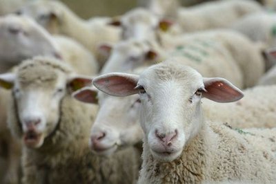
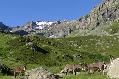
Troupeau de brebis - Mireille Coulon - PNE PastoralismEvolution of pastoralism
In the valley, the ruins of numerous piles of stones resulting from the removal of stones in the hay meadows are witness to another age. Most of these old prairies are now grazed by sheep. Pastoralism has evolved: no more local flocks so less hay, the valley is now occupied by a large flock from the Haute-Provence Alps.
Parc à moutons - Office de tourisme Pays des Écrins PastoralismThe realm of sheep
Together with its entire catchment area, the Chambran valley constitutes an enormous alpine pasture. Sheep belonging to several different owners are gathered here for the summer grazing season. Many of them come from the department of Alpes-de-Haute-Provence. The landscape (sheep paths, old hay meadows), vegetation, built structures (old dairy, pastoral cabins)... everything has been marked by centuries of animal husbandry.
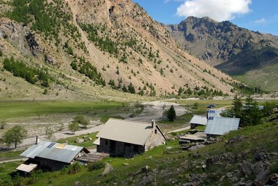
Le hameau de Chambran - Marie-Geneviève Nicolas - PNE HistoryChambran Hamlet
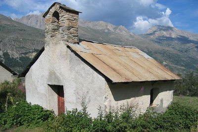
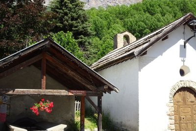
At an altitude of 1700 meters, this hamlet is inhabited in summer, at the beginning of the summer pasture. The old dairy has been spruced up to become a snack bar. It’s pretty little chapel dedicated to Saint Jean is very simple and bare.
Les chalets de Chambran sous la neige - Marie-Genevève Nicolas - PNE Vernacular heritageChambran chalets
Remnants of a way of life that has disappeared, the Chambran chalets were once a high-altitude village where flocks stayed during the summer months. Today this is a welcome stop along the GR54 and the starting point for hikes towards Lake Eychauda.
Le Canal du Béal Neuf - Office de tourisme Pays des Écrins WaterASA of Béal Neuf
The ASA (authorised water user association) of Béal Neuf is the owner of the canal. The association manages, maintains and develops the Béal Neuf canal which carries water to the entire network of irrigation canals.
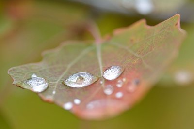
Gouttes d'eau sur une feuille de tremble - Mireille Coulon - Parc national des Écrins FloraThe aspen
The path runs through a small aspen wood. This tree with a smooth, greenish trunk and rounded, crenelated leaves takes on magnificent autumn colours. The stem, or petiole, of aspen leaves is flat and twisted, so it can be caught by the slightest breeze making the foliage «quake» hence its common name, the quaking aspen. It grows in places where the soil is quite damp.
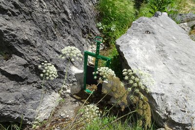
Martelière qui assure la distribution de l'eau - Office de tourisme Pays des Écrins WaterWater in the mountains
Since the Middle Ages, canals have been dug to carry water to the crops. The water is diverted by the canals: through the action of gravity, the water flows down the mountain sides. Use of the water is regulated and for any draw-off, the volume is measured.
La chapelle aau Fangeas - Office de tourisme Pays des Écrins Vernacular heritageThe minor heritage of Pelvoux
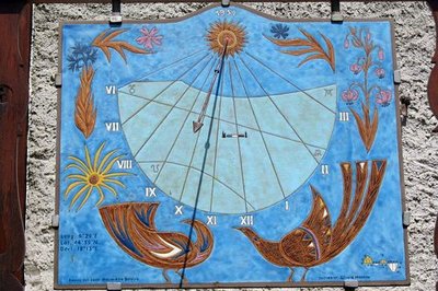
Every hamlet has its own chapel. In the territory of Pelvoux, Les Claux has the chapel of Sainte-Barbe with a restored sun dial dating from 1792. The seventeenth-century chapel of Saint-Pancrace is in Le Poët. In Le Sarret, you can admire the chapel of Saint-Joseph and the chapel of Notre-Dame des Sept Douleurs stands in Le Fangeas. Every hamlet has its own communal oven and water fountains as well. Finally, the church of Saint-Antoine is located in the hamlet of Saint-Antoine. It has a sun dial dating from 1810.
L'aulne blanc - Nicollet Bernard - Parc national des Ecrins FloraThe grey alder
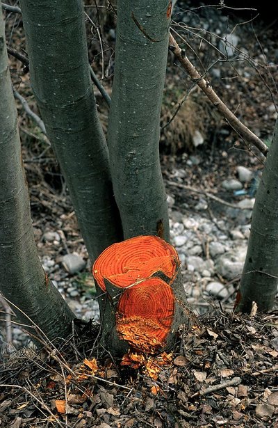
In the valleys of the Alps and the Jura, the grey alder often grows in place of the black alder, present in many parts of France. Like its cousin, it grows on riversides and plays an important role in stabilising the banks. If it is cut down, its wood is bright orange in colour. But why cut it down?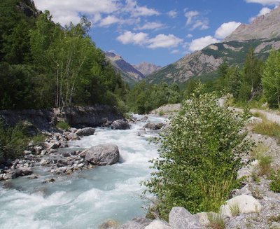
Le Gyr - Office de tourisme du Pays des Écrins WaterThe Gyr
Humans are decidedly bizarre animals: they build, knock down and start again. To protect the new infrastructures of Pelvoux, the Gyr was dammed. But, not able to flow as it did before, it deepened its bed, thus placing the foundations in danger of damage. And so works were carried out to widen its bed, allowing it to flow more naturally. This is also more favourable for biodiversity, as well as protecting the developed urban areas.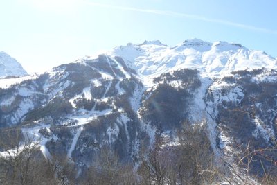
Vue sur la station de Pelvoux-Vallouise - Pelvoux Office de tourisme du Pays des Écrins Vernacular heritageThe ski resort of Pelvoux-Vallouise
The route first leads through the small ski resort of Pelvoux-Vallouise, built in 1982. Very family-focused, in winter it's the ideal place for young children to learn to ski, with small lifts lower down, while their big brothers and sisters can ski higher up.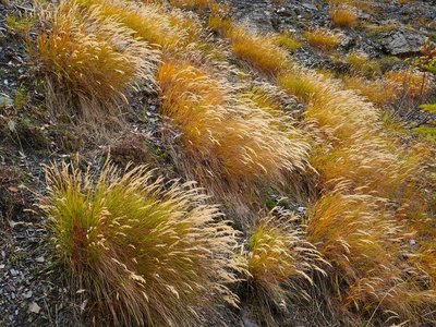
Le calamagrostide argentée - Nicolas Marie-Geneviève - Parc national des Écrins FloraSilver spike grass
A grass grows in large clumps on the embankment: silver spike grass. It is adapted to stony, dry and sunny ground. Its inflorescences reflecting silvery-gold glints create a beautiful effect, but they are particularly noticeable in the late summer, when it forms large shimmering bouquets in the evening sunlight.
More information
Source

Report a problem or an error
If you have found an error on this page or if you have noticed any problems during your hike, please report them to us here: