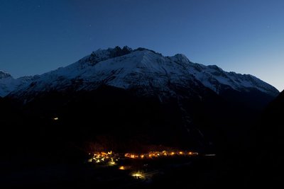
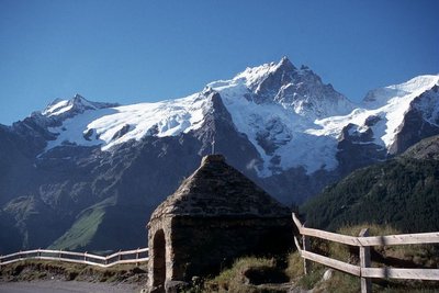
Tour of Oisans and Ecrins from L'Argentière-la-Bessée
The GR 54 footpath is one of the three great hiking trails in the French Alps (with Mont Blanc and the Vanoise).
But it is without doubt the most unspoilt of all, and the hardest too: 184 kilometres, 14 mountain passes and over 12 800 metres of inclines.
A trek through mountain villages, deep valleys and high Alpine passes, watched by emblematic wildlife, discreet but present.
15 steps
Description
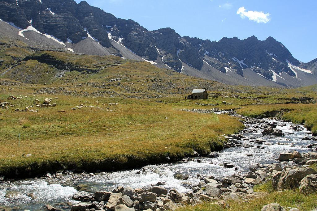
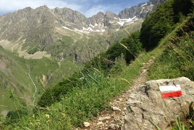
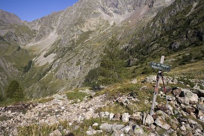
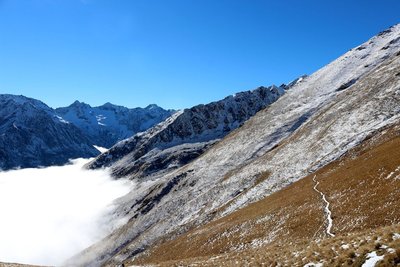
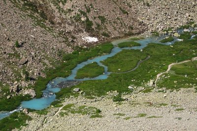
Leaving from L'Argentière-les-Ecrins, the Tour des Ecrins and of L’Oisans begins gently, following the Onde mountain stream as far as Col de La Pousterle, the panoramic route on the following day's stage. To reach the wild Champsaur valley via the Pas de la Cavale, a footpath runs through the Fournel valley. You have to take care crossing no less than three mountain passes carved out in the schist before reaching Lake Vallonpierre and the Valgaudemar valley from Pré de la Chaumette. Along the Séveraisse, the footpath reaches La Chapelle-en-Valgaudemar and then rises in Villar Loubière as far as the Souffles refuge and the impressive Col de la Vaurze. Equally impressive is the descent towards the unspoilt Valjouffrey. The rich green Col de Côte Belle contrasts with the schist landscapes we have seen until now. Valsenestre, in the Béranger valley, comes as a well-earned rest before we set off for the last few twists and turns. We arrive at the vertical Col de la Muzelle, the final point of this grand tour. After Lake Muzelle comes Lake Lauvitel, the biggest lake in L’Oisans, at the end of the mountain pass of the valley. A long, gentle descent along the Vénéon mountain stream leads to Le Bourg d'Oisans. We continue our grand tour along the GR footpath with the help of handrails to reach the small villages perched on the mountainside. The path then goes down to the Sarenne mountain stream before rising again as far as the mountain pass, with a panorama over the Monts de Lans. Then comes a descent towards Clavans and the Ferrand valley, followed by a fine climb as far as Besse at the edge of the vast Emparis plateau. Above, Col de Souchet offers a five-star view over the Meije. After some 1000 metres of descent, La Grave awaits us. We then walk along the River Romanche as far as its source on the mountain pastures of Villar d'Arène. When you arrive at Col d'Arsine, the spectacle is astounding. This mountain setting is an invitation to visit the Arsine glacier lake before beginning the long descent along the Petit Tabuc mountain stream as far as the Guisane valley and Monêtier-les-Bains. Our destination is La Vallouise, via Col de l'Eychauda and the peaceful chalets of Chambran. The final stage is gentle, and we arrive, after Col de La Pousterle, which we left behind us two weeks earlier, in L'Argentière-les-Ecrins. We have come full circle!
- Departure : L'Argentière-les-Ecrins train station
- Towns crossed : L'Argentière-la-Bessée, Les Vigneaux, Puy-Saint-Vincent, Vallouise-Pelvoux, Champoléon, La Chapelle-en-Valgaudemar, Villar-Loubière, Valjouffrey, Les Deux Alpes, Le Bourg-d'Oisans, La Garde, Huez, Le Freney-d'Oisans, Clavans-en-Haut-Oisans, Besse, Mizoën, La Grave, Villar-d'Arêne, and Le Monêtier-les-Bains
Altimetric profile
Recommandations
The best time to do the tour is between late June and mid-September.
Find out about weather conditions and snow levels on the mountain passes in early summer.
Some passages, near high mountain areas, cross difficult terrain.
It is possible to sleep in the open air all along the GR trail (see National Park regulations) and in campsites, hotels, gîtes or refuges.
On some stages you will need to take your own food with you.

 In mountain pastures, protection dogs are there to protect the herds from predators (wolves, etc.).
When I hike I adapt my behavior by going around the herd and pausing for the dog to identify me.
Find out more about the actions to adopt with the article "Protection dogs: a context and actions to adopt".
Tell us about your meeting by answering this survey.
Information desks

Vallouise Park house
, 05290 Vallouise
Information, documentation, models, exhibitions, screenings, product sales and works of the Park. Guided tours for school, reservation required. The new Park House opened in Vallouise since June 1, and offers visitors an interactive permanent exhibition inviting to explore the area and its heritage. A temporary exhibition space will allow a renewed offer. Finally, the device is completed by an audiovisual room to organize screenings and conferences Free admission. All animations of the Park are free unless otherwise stated.
Transport
By train, the Argentière-les-Écrins station at l'Argentière-la-Bessée is the start point for this version of the GR®54 : www.voyages-sncf.com
By bus : https://zou.maregionsud.fr/
Access and parking
L’Argentière-les-Ecrins is on the N94 between Briançon and Embrun. It can be reached with the motoway A51 from Marseille and the South. From the North and Briançon, the motorway A48 and the Frejus tunnel must be taken.
Sensitive areas
- Impacted practices:
- Aerial, Aquatic, Land, Vertical
- Sensitivity periods:
- JanFebMarAprMayJunJulAugSepOctNovDec
- Contact:
- Parc national des Écrins.
Alpine ibex
- Impacted practices:
- Aerial, , Land, Vertical
- Sensitivity periods:
- JunJulAugSep
- Contact:
- Parc National des Écrins
Julien Charron
julien.charron@ecrins-parcnational.fr
Golden eagle
- Impacted practices:
- Aerial, , Vertical
- Sensitivity periods:
- JanFebMarAprMayJunJulAug
- Contact:
- Parc National des Écrins
Julien Charron
julien.charron@ecrins-parcnational.fr
Golden eagle
- Impacted practices:
- Aerial, , Vertical
- Sensitivity periods:
- JanFebMarAprMayJunJulAug
- Contact:
- Parc National des Écrins
Julien Charron
julien.charron@ecrins-parcnational.fr
Bearded vulture
- Impacted practices:
- Aerial, , Vertical
- Sensitivity periods:
- JanFebMarAprMayJunJulAugNovDec
- Contact:
- Parc National des Ecrins - Yoann Bunz- 06 99 77 37 65 yoann.bunz@ecrins-parcnational.fr
Alpine ibex
- Impacted practices:
- Aerial, , Land, Vertical
- Sensitivity periods:
- JunJulAugSep
- Contact:
- Parc National des Écrins
Julien Charron
julien.charron@ecrins-parcnational.fr
Golden eagle
- Impacted practices:
- Aerial, , Vertical
- Sensitivity periods:
- JanFebMarAprMayJunJulAug
- Contact:
- Parc National des Écrins
Julien Charron
julien.charron@ecrins-parcnational.fr
Golden eagle
- Impacted practices:
- Aerial, , Vertical
- Sensitivity periods:
- JanFebMarAprMayJunJulAug
- Contact:
- Parc National des Écrins
Julien Charron
julien.charron@ecrins-parcnational.fr
Golden eagle
- Impacted practices:
- Aerial, , Vertical
- Sensitivity periods:
- JanFebMarAprMayJunJulAug
- Contact:
- Parc National des Écrins
Julien Charron
julien.charron@ecrins-parcnational.fr
Golden eagle
- Impacted practices:
- Aerial, , Vertical
- Sensitivity periods:
- JanFebMarAprMayJunJulAug
- Contact:
- Parc National des Écrins
Julien Charron
julien.charron@ecrins-parcnational.fr
Golden eagle
- Impacted practices:
- Aerial, , Vertical
- Sensitivity periods:
- JanFebMarAprMayJunJulAug
- Contact:
- Parc National des Écrins
Julien Charron
julien.charron@ecrins-parcnational.fr
Golden eagle
- Impacted practices:
- Aerial, , Vertical
- Sensitivity periods:
- JanFebMarAprMayJunJulAug
- Contact:
- Parc National des Écrins
Julien Charron
julien.charron@ecrins-parcnational.fr
Golden eagle
- Impacted practices:
- Aerial, , Vertical
- Sensitivity periods:
- JanFebMarAprMayJunJulAug
- Contact:
- Parc National des Écrins
Julien Charron
julien.charron@ecrins-parcnational.fr
Golden eagle
- Impacted practices:
- Aerial, , Vertical
- Sensitivity periods:
- JanFebMarAprMayJunJulAug
- Contact:
- Parc National des Écrins
Julien Charron
julien.charron@ecrins-parcnational.fr
Golden eagle
- Impacted practices:
- Aerial, , Vertical
- Sensitivity periods:
- JanFebMarAprMayJunJulAug
- Contact:
- Parc National des Écrins
Julien Charron
julien.charron@ecrins-parcnational.fr
Golden eagle
- Impacted practices:
- Aerial, , Vertical
- Sensitivity periods:
- JanFebMarAprMayJunJulAug
- Contact:
- Parc National des Écrins
Julien Charron
julien.charron@ecrins-parcnational.fr
Peregrine falcon
- Impacted practices:
- Aerial, Vertical
- Sensitivity periods:
- FebMarAprMayJun
- Contact:
- Parc National des Écrins
Julien Charron
julien.charron@ecrins-parcnational.fr
Peregrine falcon
- Impacted practices:
- Aerial, Vertical
- Sensitivity periods:
- FebMarAprMayJun
- Contact:
- Parc National des Écrins
Julien Charron
julien.charron@ecrins-parcnational.fr
Short-toed snake eagle
- Impacted practices:
- Aerial,
- Sensitivity periods:
- MarAprMayJunJulAugSep
- Contact:
- Parc National des Écrins
Julien Charron
julien.charron@ecrins-parcnational.fr
Short-toed snake eagle
- Impacted practices:
- Aerial,
- Sensitivity periods:
- MarAprMayJunJulAugSep
- Contact:
- Parc National des Écrins
Julien Charron
julien.charron@ecrins-parcnational.fr
Short-toed snake eagle
- Impacted practices:
- Aerial,
- Sensitivity periods:
- MarAprMayJunJulAugSep
- Contact:
- Parc National des Écrins
Julien Charron
julien.charron@ecrins-parcnational.fr
Black grouse - winter
- Impacted practices:
- , Land
- Sensitivity periods:
- JanFebMarAprDec
- Contact:
- PN Ecrins BERGEON Jean-Pierre jean-pierre.bergeon@ecrins-parcnational.fr QUELLIER Hélène helene.quellier@ecrins-parcnational.fr Membre de l OGM ogm.vds@gmail.com ogm.amblard@gmail.com
50 points of interest
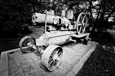
Le compresseur mobile - Jan Novak Photography  History
The mobile compressor
In the mines, compressed air is used to remove dust and to create power for the drills. The mobile compressor holds compressed air in a resistant tank. This is brought to a high pressure via a pump (the compressor). The compressed air is then distributed to the mine machinery through a conduit system.
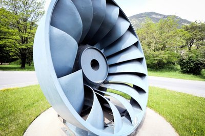
La turbine Francis - Jan Novak Photography HistoryThe Francis turbine
The American James Francis developed the Francis turbine between 1849 and 1855. It is a “àreaction” turbine suitable for medium-sized waterfalls (with a water head of between 15 and 500 metres). The water enters the turbine and then circulates between the turbine blades, which are fixed, while the inner wheel is mobile. The pressure at the wheel intake is greater than the pressure at the outlet.
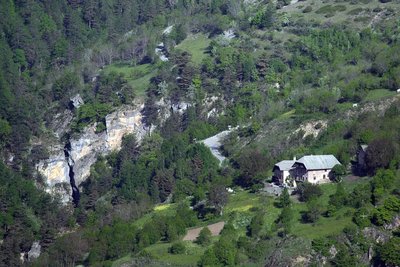
Les hameaux de l'Argentière - Jean-Philippe Telmon - Parc national des Écrins  Vernacular heritage
The hamlets of L'Argentière
Before it was attached to the municipality of La-Bessée during the revolutionary period, L'Argentière covered this well-exposed slope, with all its hamlets from the church to Eychaillon. It was only in the second half of the nineteenth century, when the Durance was dammed and industries sprang up here, that the modern town of L'Argentière developed in the plain between the two old localities. The path takes you on a discovery of the old hamlets and their very attractive houses.
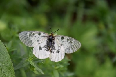
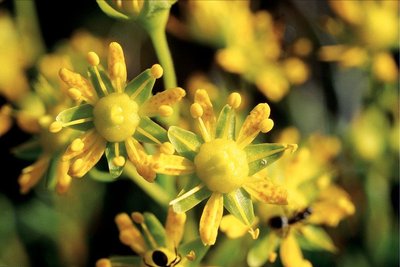
Le semi-apollon - Mireille Coulon - Parc national des Écrins  Flora
FloraThe Apollo
This large white butterfly decorated with black marks and red dots, is common in warm areas where stonecrops and houseleeks grow, as these are host plants for its caterpillars. It remains common in the Alps, but is much rarer elsewhere. In fact, it is a protected species. Its movement to higher altitudes has been observed, in line with climate warming, because its eggs, which it lays on plants in summer, need a certain number of days of freezing temperatures in winter in order to hatch.
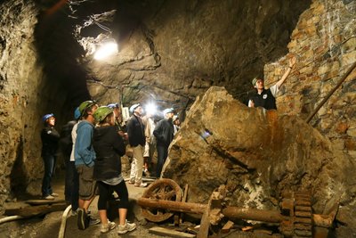
Les mines d'argent - Thibault Blais Photographie Vernacular heritageThe silver mines
The path passes close to the silver mines which gave L'Argentière its name (argent meaning "silver"). They were first worked in the early Medieval period and later abandoned before exploitation resumed again in the nineteenth century. They were finally closed in 1908. Since 1992, the site has been the subject of archaeological excavations, with major work to clear materials carried by the Fournel when in flood. They can be visited with a guide (by appointment), leaving the visitor in awe: how much ingenuity has been involved in extracting the silver-bearing galena!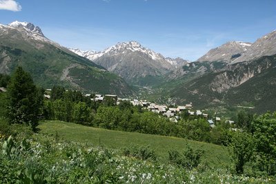
Hameau des Prés - Marie-Geneviève Nicolas - Parc national des Écrins HistoryLes Prés, hamlet of Puy-Saint-Vincent
Le Prés is one of the main hamlets of Puy-Saint-Vincent. Like Le Puy and Les Alberts, it stands on a flat plateau which is a glacial escarpment left by the now-retreated Gyronde glacier. Like Prey d'Aval, Prey du Milieu and Prey d'Amant, its name is a reminder that prior to the development of the ski resort, the land here used to be shared by meadows and crops.
Vue sur Puy Saint Vincent - Christophe Albert - Parc national des Écrins HistoryThe Sentier du Facteur - the postman's path
In former times, the postman would take this path every day: He would set out from Vallouise, deliver letters in Puy-Saint-Vincent and drop back down to Vallouise, stopping at the hamlets of Parcher on the way. In the winter, when the snow was too deep, the Traversouires (the inhabitants of Puy-Saint-Vincent) donned their snowshoes and wielded their shovels to clear the postman's path down to Vallouise.

Le semi-apollon - Mireille Coulon - Parc national des Écrins  Fauna
FaunaThe clouded Apollo
This butterfly with hyaline (glass-like) translucent white wings, marked with two black spots, flutters around the clearing or the edges of the forest, where the host plants of its caterpillars grow: the corydalis. Although abundant locally, it is nevertheless a species in sharp decline and is protected.
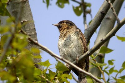
Torcol fourmilier - Damien Combrisson - Parc national des Écrins FaunaThe northern wryneck
The old trees in the orchard are home to the northern wryneck. It has a loud song, rather like that of the green woodpecker, only slower. This bird owes its name to the extreme way it extends and twists its neck when it feels threatened. Its French name torcol fourmilier is a reference to the fact that it feeds on ants (fourmils in French). Difficult to spot because its plumage merges into the colour of the tree trunks, it gives its presence away by its song when it returns from its migration.
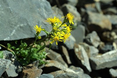
Petite verge d'or - Cédric Dentan - Parc national des Écrins FloraThe great goldenrod
In damp spots on the edge of the track, swathes of tall plants grow. It forms great plumes of tiny yellow plants. The great goldenrod, still known as the tête d'or or "head of gold" is a plant native to North America and introduced into Europe in the eighteenth century as an ornamental. Since then, it has colonised a large are of Europe and in some places it even competes with the local flora.
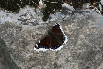
Le morio - Bernard Nicollet - Parc national des Écrins FaunaThe morio
With wings edged with creamy white and sporting a string of little blue dots, a large butterfly takes flight from the path as the walker approaches. This is the morio. Its common French name is manteau royal, or royal cloak (although her cloak is not edged with ermine!) It lives near willow and beech trees because it loves the sap that flows from wounds in these trees. It is one of the few butterflies to hibernate as an adult.
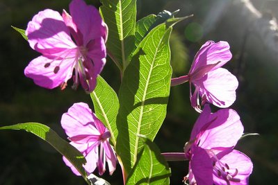
Epilobe en épis - Thierry Maillet - Parc national des Écrins FloraThe rosebay willowherb
The rosebay willowherb is a tall, upright plant with elongated leaves. Its numerous purple-pink flowers are arranged in loose spikes at the top of the stem. It forms large clumps, which produce a beautiful display when in bloom. It is a pioneer plant and favours road embankments and disturbed ground. In late summer, its very numerous seeds, each with a little plume, float away en masse glowing in the advancing twilight…
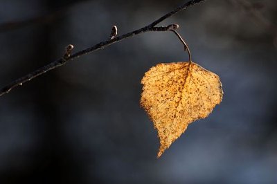
Feuille de bouleau - Mireille Coulon - PNE FloraSilver birch
On the edge of the Onde, once you have crossed the footbridge, the stone footpath weaves its way between the birch trees. This tree is easy to recognize amongst all the others due to it thin white bark. Due to the tar that it contains, birch bark stays intact even after the wood has rotted inside. It was used as parchment and as tannin in boreal regions. In this area, the birch's young twigs were mostly used to make brooms.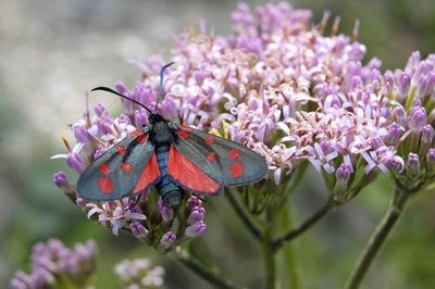
Zygène transalpine - Mireille Coulon - PNE FaunaSoutherly burnet
These small moths that come out during the day, are part of thirty species of burnet in France. Their long wings are black or sometimes bluish and have red spots. Such bright colours are a warning of toxicity to their predators. Burnets are capable of extracting chemical components similar to cyanide from plants. They then secrete this poison through their mouth and joints when faced with danger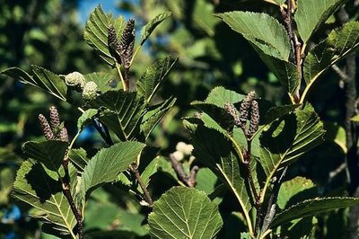
Aulne vert - Bernard Nicollet - PNE FloraGreen alder
This bushy shrub grows in entangled thickets, which are a refuge to birds and chamois that are in search of coolness and quiet. It is a pioneer and not afraid of settling in poor, steep terrains. Its strong roots mean it can latch on where everything else slides. Its flexibility means avalanches slide over it as it bends under the weight of the snow. The male catkins dangle when they are mature showing the pale yellow of their flowers. The female flowers will bear characteristic fruit like small pinecones that are first green, and then brown that persist all year round.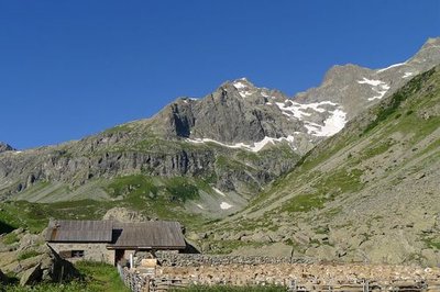
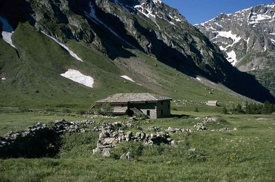
Brebis parquées près de la cabane de Jas Lacroix - Thierry Maillet - PNE  Pastoralism
The pastoral hut and the walkers' shelter
The Jas Lacroix pastoral hut is where the shepherd lives during the mountain pasture period. This where she herds the flock to count or nurse the animals. To the right of the hut there is a shelter for walkers on the GR54 route. It is maintained by a volunteer from the valley. Please leave it in the state of cleanliness you would like to find it.
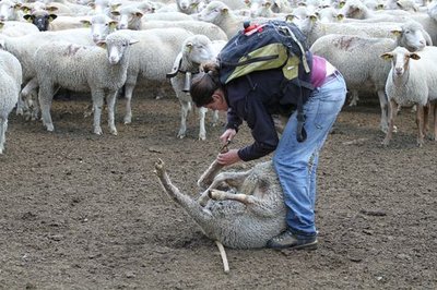
Soin aux brebis - Jean-Philippe Telmon - PNE PastoralismPastoral activity in the Selle valley, dale
Between l’Aup Martin pass and Entre les Aygues, the Selle valley is the communal pasture for Vallouise. During the summer, the pasture is grazed by a flock of sheep, a herd of cows, a few horses and the donkeys that accompany the shepherds. The shepherd's role is to not only keep and guide the sheep on the pasture with the help of dogs. She also nurses them, in particular to avoid foot-rot, a bacterial infection of the hooves that could spread to wild animals.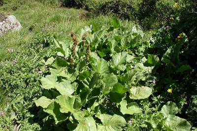
Rhubarbe des moines - Christophe Albert - PNE FloraMonk's Rhubarb
Around the pastoral hut, monk's rhubarb forms an ocean of bright green. This species along with Good King Henry and stinging nettles have a love for ample manure. They therefore create vast fluffy carpets on the animals' resting places and around the pastoral huts where they stifle out most of the other vegetation due to its vigorous germination and the damp shade of its large leaves. On its stem, the flower heads that look like candles are made up of uncountable greenish flowers that, when mature, will become winged, three-sided brown fruit. The leaf petioles of this wild rhubarb, which are fleshy, juicy and tangy, can be used in cooking.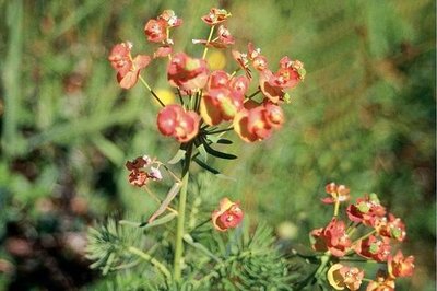
Euphorbe faux cyprès - Catherine Boutteau FloraCypress spurge
This is also referred to as "milk herb" in relation to the sticky white liquid that flows when it is cut. This is a toxic, irritating latex. It is identifiable due to its thin soft leaves and its original flowers that change colour and group together in inflorescence. By looking closer, in the middle of a 'cup' made from two bracts, it is possible to distinguish a female flower which is reduced to a ball (ovary) on a long stem, and males flowers with a sole stamen and four crescent-shaped nectar glands.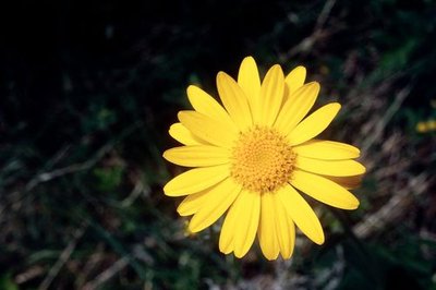
Séneçon doronic - Bernard Nicollet - PNE FloraChamois ragwort
In June it impossible not to see these large yellow sun-like flowers on the edge of the path. Their greyish, fleshy leaves look like they have grown through a spider's web. At the end of July they are unrecognisable: the leaves turn green and no longer have the grey fluff. Once the flowers have wilted, they give way to a fluffy white seed head that is easily scattered by the wind. Our elders used to compare them to an old man's hair (senex in Latin) which lead to the French name "séneçon".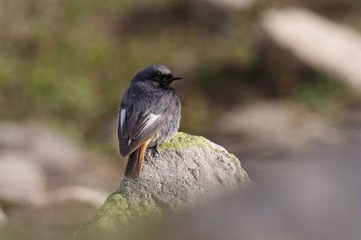
Rougequeue noir mâle - Jean-Philippe Telmon - PNE FaunaBlack redstart
The black redstart has a grey crown, a white patch on its wings and a tan tail and rump. A lively and active common bird, it likes the rocky environments and constantly hunts insects in flight or on the ground. Perched on a rock or a stone wall, it gives out brief cries of warning whilst folding it feet. Its chatty song interrupted by "paper rustling" is characteristic. This partly migratory bird can be seen at high altitude during the summer but heads to the lower valleys for the winter.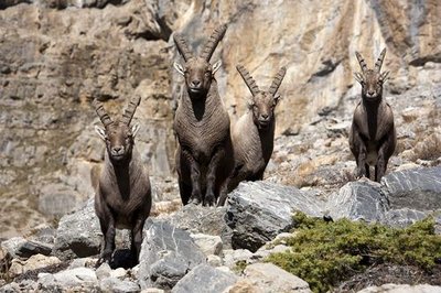
Quatre bouquetins dans le massif des Cerces - Cyril Coursier - PNE FaunaThe ibex, a survivor
In the face of danger, the ibex does not run away but takes refuge on a rock face where it thinks it will be safe. This strategy has enabled it to escape from land predators for thousands of years. However, it has proved to be inefficient against man since the invention of the crossbow or the rifle. As a result, the ibex was almost wiped out in the 19th century. The species owes it survival to Italy's protection in the creation of a royal reserve, that later became the Gran Paradiso National Park.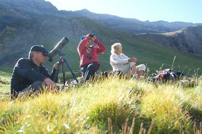
Jean-Philippe Telmon anime une sorties observation des bouquetins - Pierre Masclaux FaunaThe alpine ibex
In 1995 several ibex were introduced into the Champsaur. Since then, their population has steadily progressed to the valleys of the massif. A small group of ibex spend the summer season on the cliffs of the Chanteloube valley that overlooks the Jas Lacroix hut, on the left bank. They are more often than not perched on the rock faces and are difficult to see but from the hilltop above the hut, you might be lucky enough to see one on the rocks with the help of a telescope.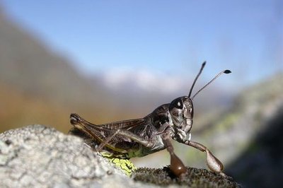
Gomphocère des alpages - Blandine Delenatte - PNE Fauna"Popeye" grasshopper
In the pastures, in August, tens of grasshoppers jump and then disappear into the grass with each of our footsteps. Amongst them, the most original is perhaps the gomphocerus sibiricus nicknamed Siberian grasshopper, due to its resistance to the cold. The male is also known as the "Popeye grasshopper" because of its 'muscled' front legs. Its green-brown colour might mean it would go unnoticed were it not for this anatomical detail and it long, consistent "cre-cre-cre-cre" ending with a couple of separate "cre" that it repeats in order to attract a female.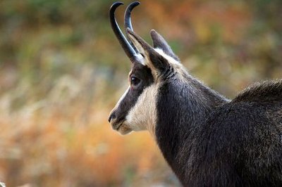
Chamois mâle dans le vallon de Celse Nière - Christophe Albert - PNE FaunaChamois
In the summer, it is at the coolest times of the day that you are likely to see a chamois busy grazing. When the sun heats the valley, they prefer to lie in the shade of the green alders, or otherwise stay on the névés. Their hearing and their sense of smell are highly developped and makes it difficult to approach them. You will need binoculars to see them. If the end of their horns are curved, it's a male, a buck. Open horns, it's a female, a doe. If the horns are shorter than the ears, it's an 'éterlou', a young male chamois in its second year. Barely visible horns, it's a kid.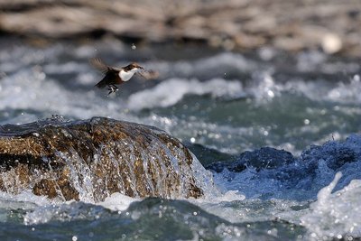
Cincle plongeur - Mireille Coulon - PNE FaunaWhite throated dipper
Stocky, short-tailed with a slender beak, it has a white patch from chin to chest and the rest of its plumage is ginger to slate grey. This is the portrait of this fantastic stream-loving bird. Standing on a large, half-immersed stone, it rocks with its tail out. Then suddenly it dives head first into the turbulent water. One of its features is walking upstream in the water in search of food such as small invertebrates that it uncovers by moving pebbles with its beak.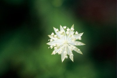
Petite astrance - Bernard Nicolet - PNE FloraAstrantia minor
At the top of a thin and fragile, divided stem, four or five small, delicate white stars move in the slightest breeze. The astrantia minor's umbels brighten up the shady areas that it likes under the shrubs on the moors. Its fanned, finely serrated leaves at the end of a long petiole, do their best to emerge from the vegetation.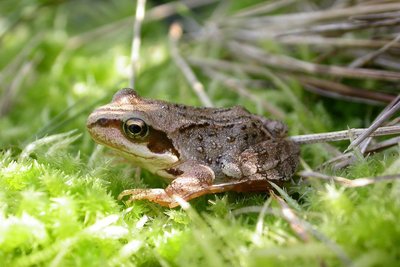
Grenouille rousse sur un lit de mousse - Jean-Philippe Telmon - PNE FaunaCommon frog
After the glacial cross-cliff above the Jas Lacroix mountain hut, not far from the footpath leading to the pass, there is a small lake that is home to the common frog. This is the most common frog in the Alps. It can live up to 2800 m in altitude, a record! It has a chocolate coloured mask around its golden eyes.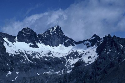
Pointe de Verdonne, face Sud, vue du Rouite - François Labande - PNE  Top
TopVerdonne Point
Above the Jas Lacroix hut, the Chanteloube valley opens up to the right in the form of a cirque. The highest peak in the cirque is the Verdonne point, which rises to 3328m. Sometimes a glittering object can be seen at its summit. This a Grand Réseau Radio des Alpes (GRA) radio relay station, serving the mountain rescue network. It is used to make radio contact with police and emergency services in Briançon.
Saxifrage des ruisseaux - Bernard Nicollet - PNE FloraYellow (mountain) saxifrage
At the edge of the clear waters of the brook, a flowerbed of yellow stars catches the eye. When young, the flowers are male and only have 10 stamen and a large shiny disc full of nectar. Later, when the stamen have fallen off, they become female and two small nipples appear on the nectar disc, ready to welcome pollen from a younger neighbour. The small rare and protected apollo butterfly has chosen this plant to protect its eggs and feed its caterpillars.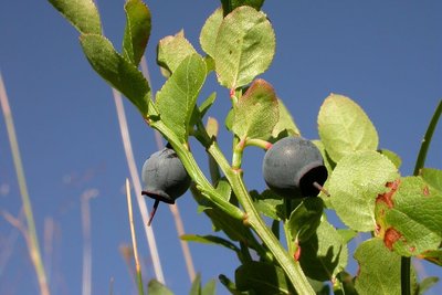
Myrtilles mûres - Christophe Albert - PNE FloraBlueberry
This shrub does not venture much higher than the last trees where it constitutes the moors that cover the ground along with other shrubs. Its finely serrated, light green leaves, ever green branches and juicy, sweet, black fruit that turn your tongue purple, make it possible to distinguish it from its cousins. The berries are a true treasure of the mountains and are used for many culinary and medicinal purposes.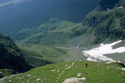
Le vallon de la Selle - Robert Chevalier - PNE PastoralismCattle
The Selle valley is the Vallouise communal pasture where breeders take their animals in the summer. The pasture is divided into sectors where sheep, cattle and horses graze. Each group moves according to the growth of the grass and they rarely mingle, if at all.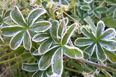
Feuilles d'Alchemille avec givre - Thierry Maillet - PNE FloraAlpine lady's-mantle
Lush foliage, five to seven elegant leaflets, simple inflorescence, this plant is also known as "satin lion's foot", and is common along the footpath. This nickname comes from the underside of the leaves. Its flowers are not very attractive to insects. It does not need them for pollination. Its seeds develop spontaneously, without being fertilised: this is called apogamy. Is this why it is used as an infusion by the women of the high areas in all fields of gynaecology?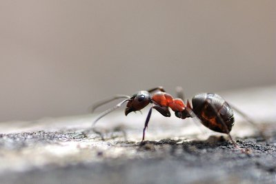
Fourmi rousse des bois - Mireille Coulon - PNE FaunaRed ants
A mound of twigs abounds with life at the edge of the footpath. An anthill in full action. On average it will house 300 000 red ants. This sociable insect is the epitome of perfection. It has strong jaws for digging, cutting and transporting; antennae for communicating and orientating; three pairs of non-slip feet for getting about; compound eyes to see as with a kaleidoscope; a chitin armour and a reserve of formic acid with which to attack. A simple experiment: put your hand close to the anthill, without touching it. Let the ants react then put your tongue to your hand...formic acid!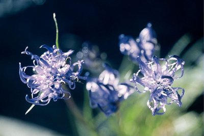
Raiponce hémisphérique - Bernard Nicollet - PNE FloraRampion
Rampion is a pretty, blue flower. On the way up to the Aup Martin pass, it is possible to admire rampion in the prairies and rocky areas at high altitude. A small ball of shiny purple-blue petals and scruffy stamen, it is perched on the top of a short stem surrounded by short narrow leaves. History
Walls
Above the Saume ravine, the footpath’s tight loops are supported by stone walls, the remains of the mule-driver’s path that the army once kept maintained, just in case, between Vallouise and Champoléon...
Champoléon farmers once took their livestock along the path to the Vallouise sheep fair on 4 October.
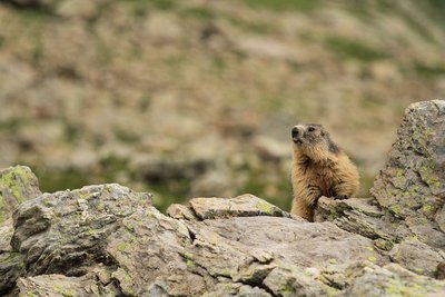
Marmotte des Alpes - Jean-Philippe Telmon - PNE FaunaMarmot
Along the footpath, the marmot makes the rambler jump with its high-pitched whistle. They live in families made up of a couple of dominant adults and subordinates from successive litters. Grooming, games and fights ensure the cohesion of the group and the respect for the hierarchy. All participate in the delimitation of the territory by urinated or defecating at the boundaries or by rubbing their cheeks against the rocks in order to leave their scent.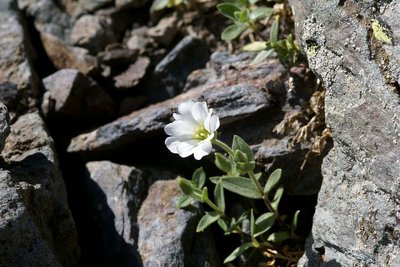
Céraiste à larges feuilles - Cédric Dentant - PNE FloraChickweed
It illuminates the scree that the névé take their time to free. Nestled and sticking in the rock, it amazes walkers who admire its delicate foliage and pure white flowers in such a grey environment. How does it manage to produce such exuberant flowers in such a hostile environment though? Beneath the stones, it develops a network of roots that enable it to get vital nutriments from the waterlogged soil when the snow melts. It also produces pliable shoots that always find a place to latch on in the scree.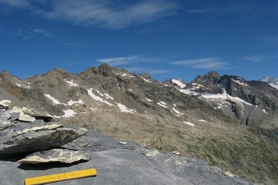
Vue depuis le col de l'Aup Martin - Thierry Maillet - PNE  Geology and geography
Schist sheets
The Col de l'Aup Martin is a surprising desert of dark grey, shiny schist forming fine parallel sheets. The rock was formed under techtonic influence that laid down the minerals making up the rock in parallel layers. Highly friable, the rock makes access to the col slippery or even dangerous, according to the weather conditions, and has given the col its poor reputation: a monstrous col according to Simon. Exactly like the Mordor region described by Tolkien in The Lord of the Rings, says François!
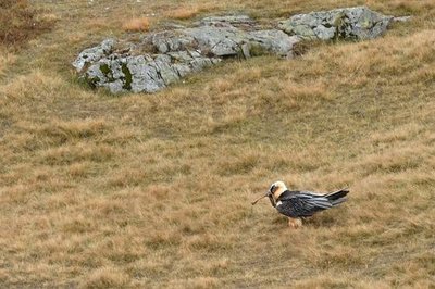
Gypaète barbu posé avec un os - Mireille Coulon - PNE FaunaBearded vulture
During a worldwide count organised in October each year, an observation post is set up in Le Pré de la Chaumette. The bearded vulture has already been spotted, but alas not each time! Falsely accused of carrying off lambs and children, this large bird with a wingspan of 2.80 m has been persecuted by man. Shooting, capture, poison, together with the scarcity of its food sources led to the bird’s extinction in the Alps in 1930. A European programme to reintroduce it was launched in 1986. Since then, the bearded vulture has been regaining ground.
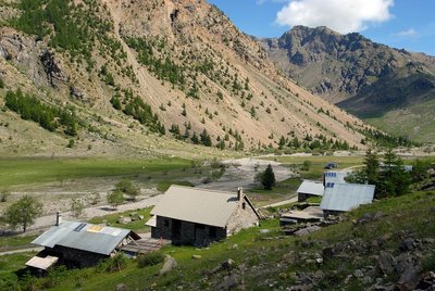
Le refuge du Pré de la Chaumette, Champoléon - Marc Corail - PNE PastoralismChaumette Meadow
The refuge is situated in a vast meadow formed by alpine grasslands that benefit from deep soil, on gentle slopes that are covered with snow on an average of eight months a year.
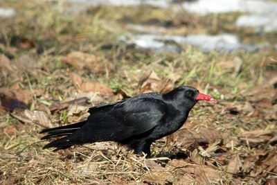
Crave à bec rouge - Damien Combrisson - PNE FaunaRed-billed chough
The red-billed chough is in many ways a surprising bird. It lives near cliffs and plays among the clouds, breaking the silence with a brief, strident, almost metallic cry. Hearing the echo from the cliff walls, its companions reply. With its confident gait and regular step, the red-billed chough patrols the Alpine pastures in small groups, meticulously searching for small worms and meadow grasshoppers. Apart from a few brief seasonal excursions in search of available food, the chough is a sedentary bird.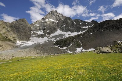
Le Sirac depuis Vallonpierre - Mireille Coulon - PNE TopThe Sirac
To the south of the Ecrins mountains, the Sirac is the last major summit at 3441 m. It stands proudly at the end of the Séveraisse valley. Often during the hike, you will lift your head in wonder and greet this noble lord with its crown. You will walk at its foot and see its hanging glaciers above you. It’s magic!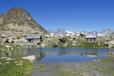
Le refuge de Vallonpierre - Dominique vincent - PNE  Hut
HutThe Vallonpierre refuge
A small lake, pretty meadows and the benevolent Sirac... This magical setting would lead to the construction of a refuge at an altitude of 2270 m in 1942. However, it was a victim of its own success and in 2000 the decision was made to build a second, bigger one. It can accommodate 37 instead of 22. This new building was the first modern mountain refuge to be built using stones on site rather than imported materials. It copies the simplicity and the crow-stepped gable from the "small refuge" which has been kept as lodgings for a warden's helper.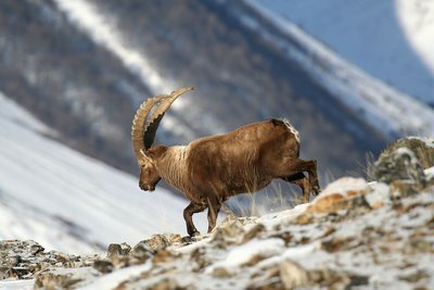
Bouquetin des Alpes - mâle - Jean-Philippe Telmon - PNE FaunaAlpine ibex
The species had almost completely disappeared from the French Alpine regions, and they survived thanks to our Italian neighbours, the kings of Savoy. Until the mid-15th century, they were still to be seen, but they were not wary of mankind and were hunted for their meat. Superstitious medical practice at the period also hastened their decline: their horns were ground into powder and used as a remedy for impotence, while the cross-shaped bone over their hearts was thought to ward off sudden death.
Successfully reintroduced into the Vanoise area in 1960, they were also brought back into the Champoléon valley over 20 years ago.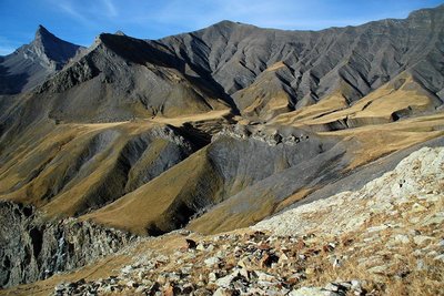
Vallon Plat, Col de Vallonpierre, Aiguille de Morges - Bernard Guidoni - PNE Geology and geographyImpressive geology
From chabournéite, the native mineral of Valgaudemar, to the crystalline rock from the Sirac's gneiss, from the hollow of Vallonpierre made in sedimentary rock to the show that is given by the shale and tuffs on the Chevrettes pass, this circuit will take you back in time. The folds and the colours appear before you like an impressionist’s work of art.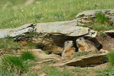
Marmottes à leur terrier - Mireille Coulon - PNE FaunaMarmot
A high-pitched whistle sounds in the mountain pastures it is the cry of the marmot on guard, warning its companions of the arrival of imminent danger from the sky. Any inattentive creature failing to take note should beware a golden eagle will carry them away in its talons to feed its young.
Native to the Alpine grassland, colonies of marmots live with their young until their third year. Gnawing and digging are their favourite pastimes, along with rolling down the slopes. And not forgetting an afternoon nap on a nice, warm rock and their long hibernation between October and March.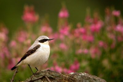
Traquet motteux - Damien Combrisson - PNE FaunaHigh altitude birds
Autumn is migration season. The mountains, which are too harsh in winter, loses their inhabitants. Some opt for a change in altitude and go lower down the valley or to the coast. This is the case for the alpine accentor, the redstart, the redpoll, or the Eurasian linette. Others head off on a long journey to warmer countries. The Sahara offers a milder winter to the common rock thrush, whinchat and wheatear. The lesser whitethroat will head to the east. In the summer, this fine bunch will meet up again in the mountains. It finds a sanctuary where the diversity of plants and invertebrates is preserved. The alpine pastures seem to be favourable for the reproduction of all of these species that are diminishing and need to be protected.
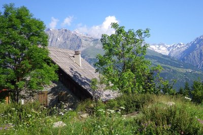
Refuge du Clot Xavier Blanc - Dominique Vincent - PNE HutClot Xavier Blanc mountain refuge
What a strange idea to build this mountain refuge below the road leading to Gioberney, at an altitude of "only" 1397 m. In fact, it was already there more than a century ago, long before the road was built. This simple, sturdy building belonged to the Valgodemar Mining Company that operated in the area extracting copper and lead. When the business closed, the Club Alpin Français bought the building and named it after Xavier Blanc, in recognition of one of the founder members of the CAF, senator of the Hautes Alpes.
Via Clause du Clot - Dominique Vincent - PNE Vernacular heritageWalled paths
On certain stretches of the route, you will walk between two stone walls. Such "via clause" were built to stop the domestic animals, on their way up to the pastures, from walking on or eating the grass in the prairies that was intended for them in the winter. The most remarkable "via clause" is on the way out of the hamlet of Le Clot. It has been restored by the Ecrins National Park.
.
More information
Source

Report a problem or an error
If you have found an error on this page or if you have noticed any problems during your hike, please report them to us here: