11. From Col de Sarenne to Les Mouterres (stage of the GR 54)
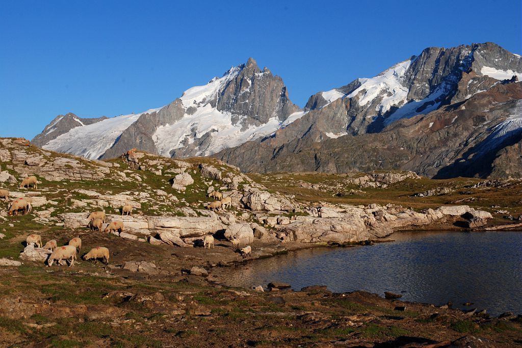
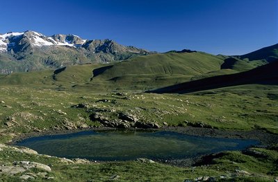
We continue along the GR 54 trail with a steep descent under the north face of the summit of the Sarenne. Then comes a foray into the Ferrand mountain valley, an enclosed valley, as if carved out with a sword in the schist, before we reach the gentle Besse. The Mouterres alpine pastures open the way to the Emparis Plateau, a superb pedestal scattered with lakes, and unveiling the Meije, the Râteau and the Girose glacier.
Description
Pass Col de Sarenne, go down the road, then take the footpath on the right. The path descends steeply, then joins the road, which it cuts across twice before reaching contour line 1 492 m. The path goes past an oratory and arrives at the village of Clavans-le-Haut (1 390 m). When you leave the village, don’t take the D25a road, but the footpath above, which soon arrives at Clavans-le-Bas (1 365 m). To the south you arrive at the Ferrand mountain stream (1 260 m), and you then take the steep footpath leading to Besse (1550 m) by cutting across the bends in the road. Cross the village and take the pastoral route at the exit.
- At the Salce stream, leave the route for the path that climbs to Col Nazié (1 902 m). Walk past the mountain pass and continue the climb as far as the ruins of the Josserand Chalet (2 244 m).
- Take the footpath on the right, pass the ruins of the Favre Chalet and continue across the mountain pastures as far as the chalets and the Rif Tord stream (2 200 m).
- Leave the GR54 footpath to turn right onto the Tour du Haut Dauphiné footpath (GR50), and 15 minutes later you arrive at the Chalets du Fay (2 260 m) and the Mouterres refuge.
- Departure : Col de Sarenne, Clavans-en-Haut-Oisans
- Arrival : Les Mouterres, Mizoën
- Towns crossed : Clavans-en-Haut-Oisans, Besse, Mizoën, and La Grave
Altimetric profile
1 point of interest
Zones humides du Rif Tort - © Parc national des Écrins - Jean-Pierre Nicollet  Flora
FloraThe wetlands of the Rif Tort
Temperatures on the Emparis plateau are characteristic of a cool steppe climate. It is a very windy plateau with an average annual temperature only just above zero degrees. Winter lasts for eight months, during which it freezes almost every day. The particularly severe temperature constraints in the Rif Tort catchment area have favoured the maintenance of a relic flora adapted to these extreme conditions since the last ice age. «Arctic-Alpine»plant formations are found here. This is a relic flora inherited from advancing glaciers in the Quaternary period, comparable to the flow found on the coasts of the Far North. These formations are particularly rare in Europe and are of very high heritage value. You might see numerous protected species here: bicoloured sedge, sweet grass (a boreal relic species, sole colony in Isère) and the sago pondweed. Livestock grazing in the marsh is necessary because it limits the development of herbaceous plants which could squeeze out the Arctic-Alpine species. A delicate balance needs to be found between the trampling likely to destroy the plant species growing in the low marshes and the passage of the flocks to encourage rejuvenation of the area, and thus maintain this habitat.
details.BAMwidget
Source

Report a problem or an error
If you have found an error on this page or if you have noticed any problems during your hike, please report them to us here: