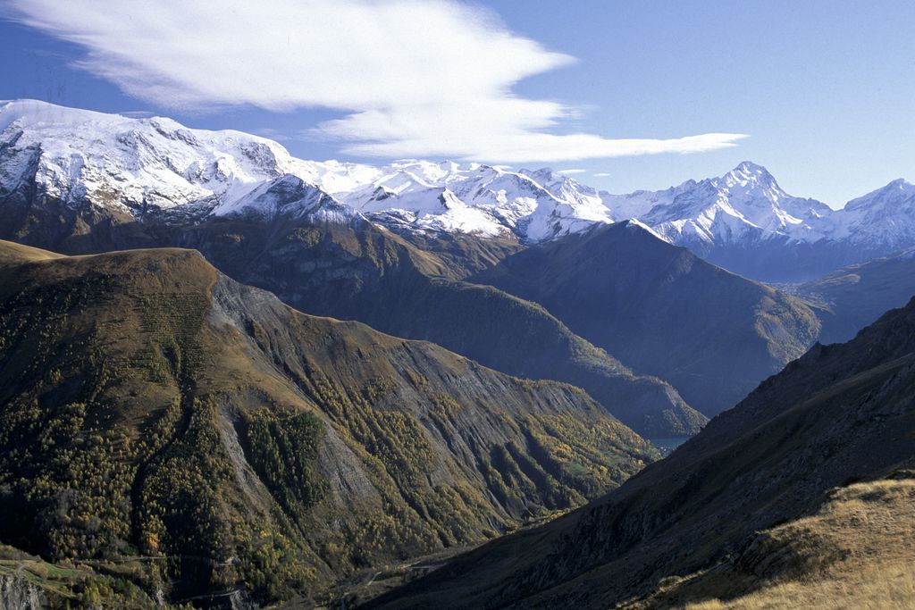
10. From Le Bourg d’Oisans to Col de Sarenne (stage of the GR 54)
It's the big day. A backpack is a hiker's best friend, as long as you haven't forgotten anything! The departure on the Grand Tour of L’Oisans and the Ecrins is discreet. The gates to this great adventure are like a secret passage giving access to another world. At the foot of the Sarenne waterfall, the GR footpath shows what it is made of: it’s going to be steep! The first stage, above Le Bourg d'Oisans, is an invitation to rise above it all with the help of a series of handrails, and passing through a series of villages perched on the mountainside. Welcome to the GR54!
Description
From Le Bourg d'Oisans, cross the River Romanche to reach the D211 towards the Alpe d'Huez. At the sign for the Cascade campsite, take the footpath (marked ""Propriété Privée"" - ""Private Property"") behind the dustbins. It runs along the campsite and leads to the Sarenne waterfall. Climb over the rocks fitted with handrails to reach the village of La Ville (1 031 m).
- Cross the D211a and continue along the footpath through the Maronne forest. The footpath becomes a road and passes through Le Châtelard (1 448 m), La Maronne and Le Rosay. The road comes to an end and the footpath goes down into the Gorges de Sarenne.
- After the bridge (1 424 m), pass the footpath towards Huez on the left and follow the right bank of the mountain stream. After the Combe-Haute inn, the road goes past the bottom of the Alpe d'Huez/Auris-en-Oisans ski lift. Walk across the Gua footbridge and, at the intersection with the GR549 from Alpe d'Huez, cross the ford over the Sarenne (1 700). Go past the Chalet de Stella, cross a bridge (1 790 m) and cut across the bends in the road along the footpath. The road and the footpath soon meet up again, leading to the Col de Sarenne (2 000 m).
- Get on the path on the right side of the road. It goes down fastly, and reaches the main road that is twicely crossed until point 1492m. It passes in front of an oratory and reaches the hamlet of Clavans-le-Haut (1390m)
- At the end of the hamlet, do not follow road D25a but the small path on top, that goes to Clavans-le-Bas (1365m)
- Departure : Le Bourg d’Oisans
- Arrival : Le Col de Sarenne
- Towns crossed : Le Bourg-d'Oisans, La Garde, Huez, Le Freney-d'Oisans, and Clavans-en-Haut-Oisans
Altimetric profile
Recommandations
There are tricky passages with handrails between Le Bourg d'Oisans and the village of La Ville. When it rains, care should be taken walking across the slippery stone slabs.
Sensitive areas
Golden eagle
- Impacted practices:
- Aerial, , Vertical
- Sensitivity periods:
- JanFebMarAprMayJunJulAug
- Contact:
- Parc National des Écrins
Julien Charron
julien.charron@ecrins-parcnational.fr
Golden eagle
- Impacted practices:
- Aerial, , Vertical
- Sensitivity periods:
- JanFebMarAprMayJunJulAug
- Contact:
- Parc National des Écrins
Julien Charron
julien.charron@ecrins-parcnational.fr
2 points of interest
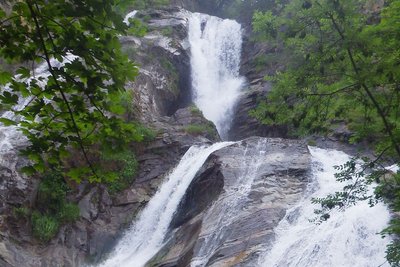
La cascade de Sarenne au départ du GR 54 - © Florence Chalandon  Water
WaterSarenne waterfall
Less than 100 metres after the start of the GR54 footpath, you arrive at an impressive waterfall. This is a daughter of the Sarennes mountain stream, which takes its source in the glacier of the same name in the Alpe d'Huez ski resort. It then rushes down a steep-sided valley before reaching the village of Huez, and then plunges into a gorge linking it to the River Romanche. A refreshing break before taking on the first climb of this grand tour.
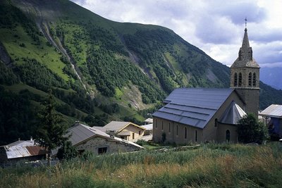
Le clocher de Besse-en-Oisans - François Labande - PNE  History
Besse-en-Oisans
The arrival in Besse-en-Oisans leaves no hiker indifferent. Besse, with its listed historic buildings, is the kind of village you will never forget. With its stone houses built closely together, as if for protection from the rough winters, and its narrow streets inviting visitors to take a stroll, Besse deserves more than a passing glance.
Why not take a break at the terrace of the Café des Touristes, next door to the village’s only grocery shop, or a little further up, in front of the bakery where they serve the traditional Tourte de Besse?
A welcome break before the steep climb up to the peaceful Alpine pastures of Emparis. Almost 3000 hectares of playground facing the grandiose panorama of the Aiguilles d'Arves and the Meije.
details.BAMwidget
Source

Report a problem or an error
If you have found an error on this page or if you have noticed any problems during your hike, please report them to us here: