5. From La Chapelle-en-Valgaudemar to Les Souffles (stage of the GR 54)
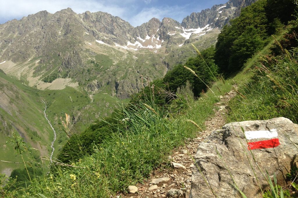
We set off gently from La Chapelle-en-Valgaudemar, along the river, discovering the last few villages of the Séveraisse mountain valley. The atmosphere is similar to the mountain cirques in Reunion Island, but this really is the wild and abrupt Valgaudemar you can see before you. The climb soon brings us above the Villar mountain stream, leading to the alpine pastures under the Pic des Souffles. Then it is time for a rest at the foot of an impressive glacier cirque, the foothills of the Olan, at 2000 metres of altitude.
Description
Walk through La Chapelle, past the municipal campsite and the grocer's, then along the D985 as far as an oratory.
- Cross the River Séveraisse and walk along the right bank as far as Andrieux bridge (1 043 m). Take the right-hand path to follow the Séveraisse, this time along the left bank.
- At Séveraisse Bridge (1 025 m) cross the river again and walk to the village of Villar Loubière (1 033 m). Head north out of the village until you reach ""Le Relais de la Vaurze"" and ""La Charrière"" gîtes.
- At the Parc des Ecrins signs, walk a short way along the road before turning left onto the footpath. Follow the Villar mountain stream as the path rises gradually. Cross the wooden footpath over the Lautier stream (1 220 m). The footpath meanders upwards back and forth, mostly through woodland. At the intersection (1 720 m), take the right-hand path leading gently up to the Refuge des Souffles (1 975 m).
- Departure : La Chapelle-en-Valgaudemar
- Arrival : Les Souffles, Villard Loubière
- Towns crossed : La Chapelle-en-Valgaudemar and Villar-Loubière
Altimetric profile
Recommandations
The most battle-hardened hikers can combine this stage with the following day's, arriving at Le Désert-en-Valjouffrey, via Col de la Vaurze in 9 hours 30 minutes.

Sensitive areas
Short-toed snake eagle
- Impacted practices:
- Aerial,
- Sensitivity periods:
- MarAprMayJunJulAugSep
- Contact:
- Parc National des Écrins
Julien Charron
julien.charron@ecrins-parcnational.fr
7 points of interest

 Know-how
Sundial by Rémy Potey
A real open-air museum piece in the rural landscape, the pictorial art of the sundial aims to foster silence and to be accessible to all. For walkers today and for travellers yesterday. A sundial is a call to reflection and meditation, visible in all its magnificence on religious buildings or carefully hidden, in the little streets of a mountain village. The the Hautes-Alpes department, with its sun-rich climate, has the highest concentration of this example of the people’s art. Today, through the work of the sundial maker Rémy Potey, chamois and golden eagles can be beside the imaginary birds of the mysterious and famous Zarbula, the 19th century Piedmont artist.
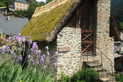
Le moulin de Villar-Loubière - Florence Chalandon ©  History
Villar-Loubière windmill
As you begin the steep climb towards the Col de la Vaurze, don’t miss the unusual Villar windmill, covered in vegetation. Built in 1838, this legacy from past times has been perfectly preserved with its curious horizontal wheel. It was still in use 50 years ago, milling wheat, but also nuts and rapeseed. It was restored in 1979 and is the last working windmill in the Valgaudemar valley.

Les arraches - Olivier Warluzelle - PNE  Geology and geography
Arraches
From the refuge, or during the climb, a peculiar geological formation may catch your eye on the opposite bank, above the old hamlet of Peines. Sedimentary rocks are trapped in the middle of crystalline formations where erosion has created a specific pattern of erosion that looks like a giant tiger has clawed at the rock. This morphology is what gave it the name Arraches.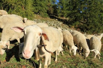
Brebis dans un mélézin - Jean-Philippe Telmon - PNE  Pastoralism
Sheep on the mountain pasture
During your walk, you might come across sheep on the mountain pastures. This is an old form of pastoralism, as proven by the dry stone enclosures that you will see. These are known as 'jas'. You will also notice a rock shelter near to the Clot. The sheep that are in these pastures belong to breeders from the valley or from the Bas Champsaur area.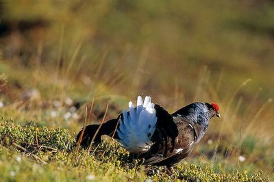
Tétra lyre mâle - Robert Chevalier - PNE  Fauna
FaunaBlack Grouse
The upper limit of the forest is where you are likely to see the black grouse. The female has faith in her bland-coloured feathering that camouflages her in the vegetation, making her difficult to spot. On the other hand, the male, which is black and white with red "eyebrows”, is not so private, particularly during the reproduction season when their cooing and hissing sounds echo in the mountain in the early morning.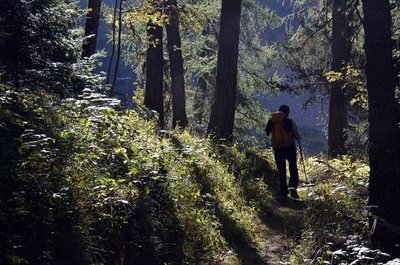
Montée au refuge des Souffles par la forêt de mélèze du Lautier - Bernard Guidoni - PNE  Flora
FloraVariety of the natural environment
This walk is a summary of south facing slopes in the Valgaudemar area. It starts in the warm scree that it more or less vegetated. It then progresses over lawns and moors of juniper, blueberries or bearberries... They give way to mountain ash, whitebeam and amelanchiers indicating that the forest will soon take over. Higher up, the beech forest casts shade on the walkers, next a beautiful larch forest is a sign that the forest environment will give way to the high altitude moors and lawns. The Lautier lake and the surrounding ponds are a haven for aquatic species. Still higher, is the realm of rocks and chamois.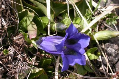
Gentiane - Olivier Warluzelle - PNE FloraVariety of plant life
There is a large variety of plant life along the itinerary, particularly on the slopes above the refuge, due to the exposure, the soil types and the altitude. Marjoram, lis, laserwort, houseleek, stinecrop, gentian, columbine, aconite and many others are present.
details.BAMwidget
Source

Report a problem or an error
If you have found an error on this page or if you have noticed any problems during your hike, please report them to us here: