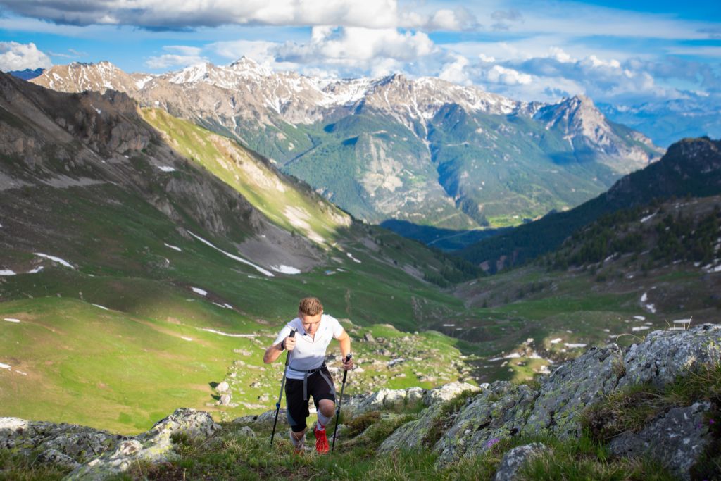
The Pays des Écrins Super Noir (trail no. 15)
Breathtaking panoramas, paths hugging iconic peaks, high lakes, alpine meadows, larch forests… Cover more than 100 kilometres through the Pays de Écrins to discover the diversity of this region in terms of landscapes and flora and fauna
Attachment
- Downloadpdf
topo 15
Credit: JL
3 steps
Description
This trail route takes you on a complete circuit of the Pays des Écrins, through the many valleys that make up this region!
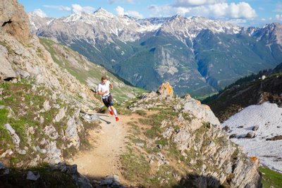
- The first stage crosses the Durance valley before rising uphill towards Montbrison and passing over into the Vallouise valley. The route continues via the Col de Vallouise and on to Ailefroide, offering an unrivalled view of Mont Pelvoux. As you pass through Ailefroide, take the opportunity to admire this ancient hamlet with its alpine pastures, which has lost none of its charm and is surrounded by high granite walls. This stage culminates with a stretch along the Gyr until you come to Vallouise.
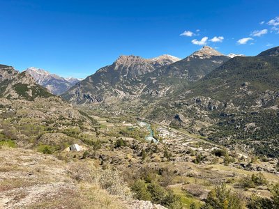
- The next stage runs from Vallouise to Puy Saint-Vincent. After passing through the larch trees at the Col de la Pousterle, you cross another two wild valleys, the valleys of Le Fournel and Freissinières. After running beneath the cliffs of the Tête de Gaulent, the route continues on to Champcella, a pretty crossroads between the valleys of Freissinières and La Durance.
- After passing through La Chapelle de Rame and La Roche-de-Rame, this last stage closes the loop in beautiful fashion with an ascent up to Lac de l'Ascension. You then have to reach Saint-Martin-de-Queyrières to complete this circuit of more than 100 km.
- Departure : L’Iscle de Prelles campsite, Saint-Martin-de-Queyrières
- Arrival : L’Iscle de Prelles campsite, Saint-Martin-de-Queyrières
- Towns crossed : Saint-Martin-de-Queyrières, Puy-Saint-André, Vallouise-Pelvoux, Puy-Saint-Vincent, Les Vigneaux, L'Argentière-la-Bessée, Freissinières, Champcella, and La Roche-de-Rame
Altimetric profile
details.BAMwidget
Recommandations
This route can be undertaken in several Stages, in the form of a rambling circuit.
The GPS track starts in Saint-Martin-de-Queyrières but the trail can be started at any welcome centre (“Base d’Accueil”) within the Pays des Écrins.
The N94 is a dangerous and busy road, take care when crossing it.
Before setting off, it is very important to check the opening periods for this route on the website: https://stationdetrail.com/fr/stations/le-pays-des-ecrins/parcours
Share your photographs on social networks with #stationdetrailecrins
Check weather conditions before setting off
Rescue services contact details: Secours Montagne (Mountain Rescue): +33 (0)4 92 22 22 22 or 112
Show consideration for the work of farmers, livestock keepers and owners
Close all gates behind you
Take your litter home
Do not take shortcuts across pastureland
The trail routes are also suitable for walking
 In mountain pastures, protection dogs are there to protect the herds from predators (wolves, etc.).
When I hike I adapt my behavior by going around the herd and pausing for the dog to identify me.
Find out more about the actions to adopt with the article "Protection dogs: a context and actions to adopt".
Tell us about your meeting by answering this survey.
Information desks
23 Avenue de la République, 05120 L'Argentière-La Bessée

Vallouise Park house
, 05290 Vallouise
Information, documentation, models, exhibitions, screenings, product sales and works of the Park. Guided tours for school, reservation required. The new Park House opened in Vallouise since June 1, and offers visitors an interactive permanent exhibition inviting to explore the area and its heritage. A temporary exhibition space will allow a renewed offer. Finally, the device is completed by an audiovisual room to organize screenings and conferences Free admission. All animations of the Park are free unless otherwise stated.
Transport
Public transport >> www.pacamobilite.fr
Consider car-sharing >> www.blablacar.fr
For more information, ask at the Tourist Information Office nearest to the trail starting point.
Access and parking
10 km from L'Argentière-La Bessée, take the N94.
Parking :
Sensitive areas
- Impacted practices:
- Land, Vertical
- Sensitivity periods:
- JanFebMarAprMayJunJulAugSepOctNovDec
- Contact:
LPO PACA antenne de Briançon
0492219417
hautes-alpes@lpo.fr
Alpine ibex
- Impacted practices:
- Aerial, , Land, Vertical
- Sensitivity periods:
- JunJulAugSep
- Contact:
- Parc National des Écrins
Julien Charron
julien.charron@ecrins-parcnational.fr
Golden eagle
- Impacted practices:
- Aerial, , Vertical
- Sensitivity periods:
- JanFebMarAprMayJunJulAug
- Contact:
- Parc National des Écrins
Julien Charron
julien.charron@ecrins-parcnational.fr
Golden eagle
- Impacted practices:
- Aerial, , Vertical
- Sensitivity periods:
- JanFebMarAprMayJunJulAug
- Contact:
- Parc National des Écrins
Julien Charron
julien.charron@ecrins-parcnational.fr
Golden eagle
- Impacted practices:
- Aerial, , Vertical
- Sensitivity periods:
- JanFebMarAprMayJunJulAug
- Contact:
- Parc National des Écrins
Julien Charron
julien.charron@ecrins-parcnational.fr
Golden eagle
- Impacted practices:
- Aerial, , Vertical
- Sensitivity periods:
- JanFebMarAprMayJunJulAug
- Contact:
- Parc National des Écrins
Julien Charron
julien.charron@ecrins-parcnational.fr
Golden eagle
- Impacted practices:
- Aerial, , Vertical
- Sensitivity periods:
- JanFebMarAprMayJunJulAug
- Contact:
- Parc National des Écrins
Julien Charron
julien.charron@ecrins-parcnational.fr
Peregrine falcon
- Impacted practices:
- Aerial, Vertical
- Sensitivity periods:
- FebMarAprMayJun
- Contact:
- Parc National des Écrins
Julien Charron
julien.charron@ecrins-parcnational.fr
Peregrine falcon
- Impacted practices:
- Aerial, Vertical
- Sensitivity periods:
- FebMarAprMayJun
- Contact:
- Parc National des Écrins
Julien Charron
julien.charron@ecrins-parcnational.fr
Black grouse - winter
- Impacted practices:
- , Land
- Sensitivity periods:
- JanFebMarAprDec
- Contact:
Black grouse - winter
- Impacted practices:
- , Land
- Sensitivity periods:
- JanFebMarAprDec
- Contact:
- Parc national des Ecrins - 0492402010
Black grouse - winter
- Impacted practices:
- , Land
- Sensitivity periods:
- JanFebMarAprDec
- Contact:
- LPO Paca antenne des Hautes-Alpes
0492219417
hautes-alpes@lpo.fr
http://paca.lpo.fr/partias
47 points of interest
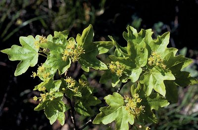
Érable champêtre - Nicollet Bernard - Parc national des Écrins  Flora
FloraThe field maple
This is the smallest member of the family of forest maples, growing to a height of 8 to 15 metres. It can live for up to 150 years. Its leaves have five round lobes; they are winged with wings sticking out in opposite directions. It is not fussy as to the dampness of the soil and it can withstand cold temperatures and drought. It is also an excellent bee forage plant, which can be enhanced by the proximity of a hive.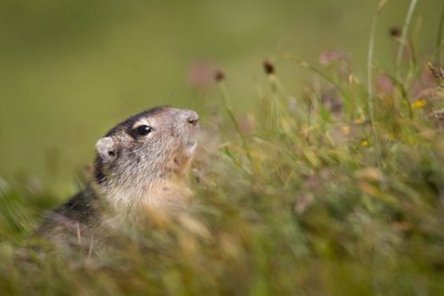
Une marmotte - Thibault Blais Photographie  Fauna
FaunaThe marmot
In the alpine pastures, the iconic marmot utters a loud high-pitched whistle to warn its neighbours of approaching danger: the golden eagle is on the prowl! This medium-sized rodent prefers to live in the high-mountain grasslands in family groups. Their favourite pastimes are gnawing, digging, taking a siesta in the sunshine and performing somersaults. In the winter, the marmot takes refuge in its burrow where it hibernates. It is only seen between the months of April and October. It marks the boundary of its territory by rubbing its cheeks on the rocks or leaving droppings.
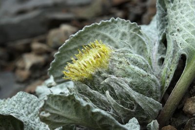
Bérardie laineuse - Cédric Dentan - Parc national des Écrins FloraThe woolly berardia
The woolly berardia is a plant that grows approximately 10 centimetres tall and has a short, almost non-existent stem. This perennial member of the Asteracea family grows in limestone and schist screes. It has veined oval, woolly leaves which are covered in soft hairs. Its 4 to 7 cm compact head with pale yellow flowers stands up from its centre.
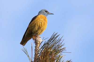
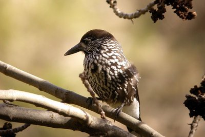
Le monticole de roche - Pascal Saulay - Parc national des Écrins FloraThe common rock thrush
In May, a melodious song rings out from the cliff top. It’s the song of the common rock thrush, appropriately named and a wonderful bird. Although the female is rather dull (an advantage when egg-sitting) the male sports an orange underside and a blue-grey head. A trans-Saharan migratory bird, every year it returns to the mountains of Southern Europe where it frequents the rocky, sunlit slopes. It is not very common and is in decline, so spotting it is even more special!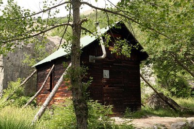
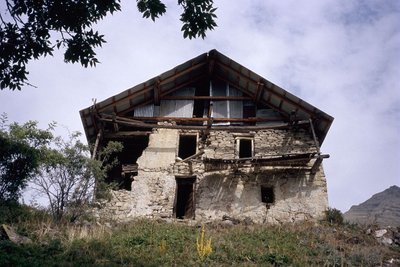
La Cabane de Chouvet - Marie-Geneviève Nicolas - Parc national des Écrins  Vernacular heritage
The Cabane de Chouvet
Discover one of the most famous forest cabins in the Vallouise valley, the Cabane de Chouvet. Surrounded by larches, Scots pines and black pines, this unmanned cabin stands at an altitude of 1,860 metres. On this slope, the mountain land has been under restoration since 1914 to prevent erosion and to combat deforestation.
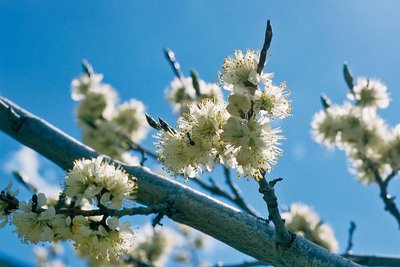
Prunier de Briançon - Bernard Nicollet - Parc national des Écrins FloraThe Briançon plum tree
Not far from the Cabane de Chouvet, some small trees grow which are covered in white flowers in the springtime. This is the Briançon plum tree. Later in the year, it will produce golden plums with a tart flavour, carried on a very short stalk. A species endemic to the southwestern Alps, it has been prized by man because the kernel inside its stone produced a very fine oil, called huile de marmotte (marmot oil).
Les Choulières - Office de tourisme du Pays des Écrins  History
Les Choulières
The French children's song Savez-vous planter les choux? (Do you know how to plant cabbage?) is very appropriate here! In any event, the name Choulières is believed to be a reference to a place planted with cabbages and, by extension, a place where vegetables are grown. The phasing out of crop cultivation in the mountains has altered the landscape: the hay meadows and fields are now used as grazing meadows for increasingly large flocks of sheep.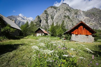
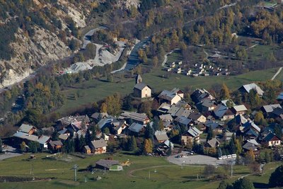
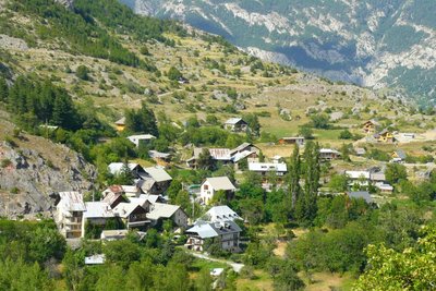
Ailefroide - Jan Novak Photography  Top
TopAilefroide
Formerly an alpine pasture hamlet, Ailefroide lies at the foot of Mont Pelvoux, surrounded by larch woods and granite cliffs. It is the last hamlet in the valley, at the confluence of the valleys of Saint-Pierre and Celse Nière. The name Ailefroide is thought to originate from the term Alpe froide or “cold Alp”, a reference to the lack of sun here in the winter. It is the starting point of numerous trails and is a paradise for climbers. Ailefroide is a legendary destination for mountaineers: a stele commemorates the conquest of Mont Pelvoux in 1828.
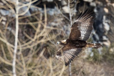
L'aigle royal - Pascal Saulay - Parc national des Écrins FaunaThe golden eagle
A pair of eagles lives in the Ailefroide valley. Every pair has a very large hunting territory, which means there can be no more than one pair in a small valley of this size. This pair has built several eyries in the cliff walls around Ailefroide: just one is occupied every year, after a few refurbishments. The eyries are located at the lower altitudes of the hunting territory, so that the eagles can easily bring heavy prey back to the eaglet.
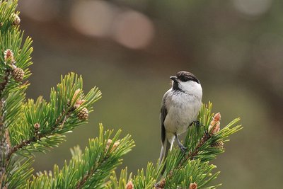
La mésange boréale - Mireille Coulon - Parc national des Écrins FaunaThe willow tit
A soft call, a series of short repetitive notes, is heard in the forest. It's the call of the willow tit, also known as the alpine tit. As for its plumage, it has a greyish brown back, beige underparts, a white head with a black cap and a little black bib, It lives in mountain forests. It is the double of the marsh tit, which tends to live below 1,400 metres.
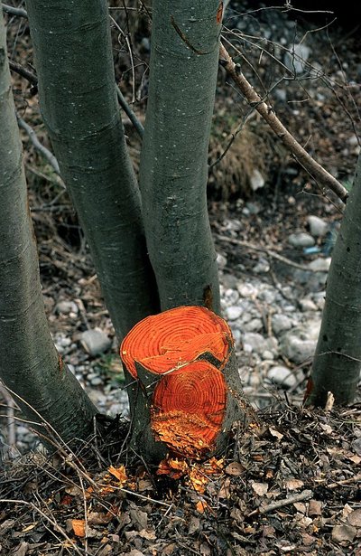
L'aulne blanc - Nicollet Bernard - Parc national des Ecrins FloraThe grey alder
In the valleys of the Alps and the Jura, the grey alder often grows in place of the black alder, present in many parts of France. Like its cousin, it grows on riversides and plays an important role in stabilising the banks. If it is cut down, its wood is bright orange in colour. But why cut it down?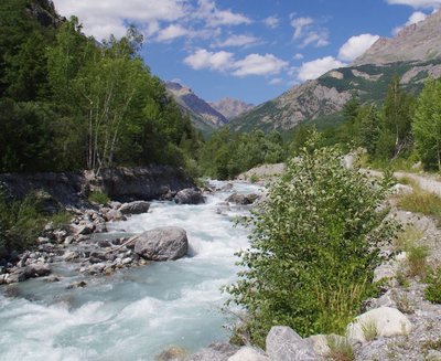
Le Gyr - Office de tourisme du Pays des Écrins  Water
WaterThe Gyr
Humans are decidedly bizarre animals: they build, knock down and start again. To protect the new infrastructures of Pelvoux, the Gyr was dammed. But, not able to flow as it did before, it deepened its bed, thus placing the foundations in danger of damage. And so works were carried out to widen its bed, allowing it to flow more naturally. This is also more favourable for biodiversity, as well as protecting the developed urban areas.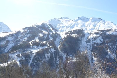
Vue sur la station de Pelvoux-Vallouise - Pelvoux Office de tourisme du Pays des Écrins Vernacular heritageThe ski resort of Pelvoux-Vallouise
The route first leads through the small ski resort of Pelvoux-Vallouise, built in 1982. Very family-focused, in winter it's the ideal place for young children to learn to ski, with small lifts lower down, while their big brothers and sisters can ski higher up.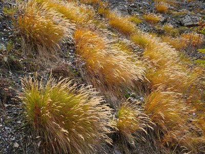
Le calamagrostide argentée - Nicolas Marie-Geneviève - Parc national des Écrins FloraSilver spike grass
A grass grows in large clumps on the embankment: silver spike grass. It is adapted to stony, dry and sunny ground. Its inflorescences reflecting silvery-gold glints create a beautiful effect, but they are particularly noticeable in the late summer, when it forms large shimmering bouquets in the evening sunlight.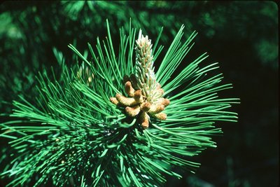
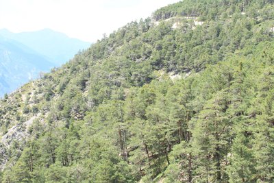
Aiguilles de pin sylvestre - Parc national des Écrins FloraForest of pine and oak
The path now alternates between cleared areas and forested areas. This forest contains Scots pine (recognisable by its orangey coloured trunk, especially at the top), downy oak (its young branches and leaf undersides covered with a fine down), and larch. The Scots pine and downy oak are very drought-tolerant (it is very limey soil here) and can also withstand low temperatures, and they are typical of the montane zone in this part of the Alps.
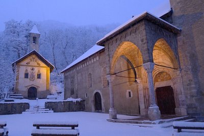
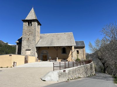
L'église Saint Etienne (à droite) et la chapelle des pénitents (à gauche) - Thierry Maillet - PNE  Architecture
Saint-Étienne de Vallouise Church
Listed and protected as an historic monument since 22 October 1913, the church dedicated to Saint Stephen is one of the most beautiful religious edifices in Hautes-Alpes. It is typical of the Romanesque churches in the Briançon region built in the second half of the 15th century, although its exact construction date is still uncertain.
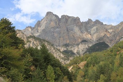
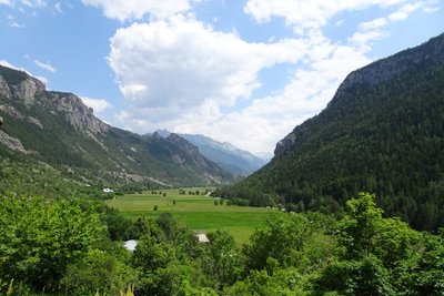
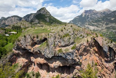
Le massif du Montbrison - Office de tourisme Pays des Écrins  Panorama
The Montbrison massif
The path offers a beautiful overall view of the limestone massif of Montbrison, overlooking the hamlets of Pelvoux with the peaks of the Cime de la Condamine, the Tête des Lauzières, the Pic de Montbrison and the Tête d'Amont.
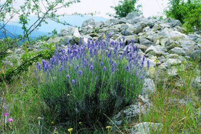
La lavande à feuilles étroites - Jean-Pierre Nicollet - Parc national des Écrins FloraThe narrow-leaved lavender
The path crosses some limestone screes. It is a dry environment. The narrow-leaved lavender grows in sunny areas, a reminder that the Pays de Écrins is in the Southern Alps after all! Not to be confused with the lavandin, this plant naturally grows on rocky slopes in the mountains of the Midi.
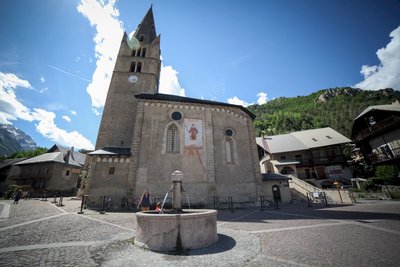
Place de l'Église - Thibaut Blais HistoryThe church in Vallouise
The church of Saint-Étienne dates from the fifteenth and sixteenth centuries. Inside is an altarpiece and a tabernacle in gilded wood dating from the eighteenth century, together with come mural paintings. Not far from the church stands the late sixteenth-century Chapel of the Penitents with a nineteenth-century painted facade.
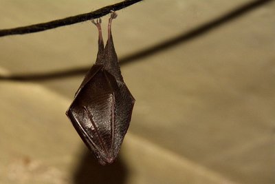
Petit rhinolophe enveloppé dans ses ailes - Mireille Coulon - Parc national des Écrins FaunaThe lesser horseshoe bat
In summer, bats take up residence in the church roof. The species living here is the lesser horseshoe bat, which has been in serious decline over recent decades. Every year, the mothers return after hibernating in caves and each one gives birth to one bat pup. Bats are insectivore mammals threatened by the insecticides used on farmland and on wooden structures and the loss of their hunting habitats and roosts, among other things. They are all protected.
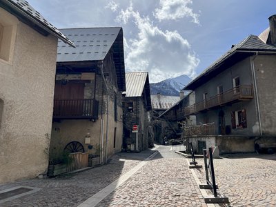
Rue de Champ de Ville - Pierre Nossereau ArchitectureVallouise
Multi-storey houses - typical of the architecture in the valley in the seventeenth and eighteenth centuries - stand on the old village street. The ground floor was reserved for animals, the first floor for habitation and the upper floors for grain storage. People moved from one floor to another by means of balconies interconnected by a staircase. Many of these balconies are arcaded with stone columns. This type of arcaded balcony is found throughout the valley.
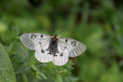
Le semi-apollon - Mireille Coulon - Parc national des Écrins FaunaThe clouded Apollo
This butterfly with hyaline (glass-like) translucent white wings, marked with two black spots, flutters around the clearing or the edges of the forest, where the host plants of its caterpillars grow: the corydalis. Although abundant locally, it is nevertheless a species in sharp decline and is protected.
Vue sur Puy Saint Vincent - Christophe Albert - Parc national des Écrins HistoryThe Sentier du Facteur - the postman's path
In former times, the postman would take this path every day: He would set out from Vallouise, deliver letters in Puy-Saint-Vincent and drop back down to Vallouise, stopping at the hamlets of Parcher on the way. In the winter, when the snow was too deep, the Traversouires (the inhabitants of Puy-Saint-Vincent) donned their snowshoes and wielded their shovels to clear the postman's path down to Vallouise.
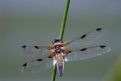
La libellule à quatre taches - Damien Combrisson - Parc national des Écrins FaunaThe four-spotted chaser
Dragonflies can be seen gliding around the lake One of them is relatively easy to identify: the four-spotted chaser. It is called this because there is a spot on each of its four wings. The female lays her eggs on floating vegetation and the larvae are aquatic. The dragonfly feeds primarily on mosquitoes and midges which it catches in mid-air. The male and female also mate while in flight... A real acrobat!
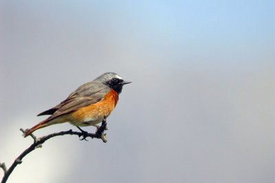
Le rougequeue à front blanc - Damien Combrisson - Parc national des Écrins FaunaThe common redstart
The common redstart can be told apart from its cousin, the black redstart by its white eyebrow (hence its French name which is translated as "white-browed redstart") and its orange breast. At least for the male, since the female of both birds is duller and brownish, but the female common redstart also has an orangey tail. It returns from Africa in early April and searches the areas to find a hollow in a tree or in an old wall where it builds its nest.
La maison de Felix Neff - Manuel Meester - Parc national des Écrins HistoryFélix Neff
Félix Neff was a Swiss Protestant pastor. He was responsible for the Protestant Revival in the Freissinières valley in the seventeenth century. He also set up the first education college for primary school teachers in France, in Dormillouse in 1826. He was also behind new irrigation and house-building techniques, developments which improved the everyday lives of the local people.
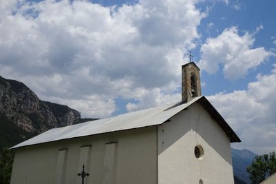
L'église Sainte Marie-Madeleine - Office de tourisme Pays des Écrins Vernacular heritageThe church of Sainte Marie-Madeleine
The church of Sainte Marie-Madeleine was built in the seventeenth century. It is thought to be a former Protestant church which escaped destruction in 1684 when Louis XIV was leading an anti-Protestant drive. The Protestant church is then thought to have undergone works to convert it into a Catholic church.
Freissinières - Office de tourisme Pays des Écrins HistoryFreissinières
The name Freissinières comes from the old word freissinière meaning "black ash". This municipality, which extends as far as the Col des Terres Blanches and the Col de Freissinières, both of which overlook the Champsaur valley, is made up of thirteen hamlets, although none of them are called Freissinières! Archaeological excavations carried out twenty years ago show that sites at high altitude (such as Faravel) were occupied on a seasonal basis from the retreat of the glaciers 12,000 years ago (Upper Palaeolithic period) and that this occupation continued after that.
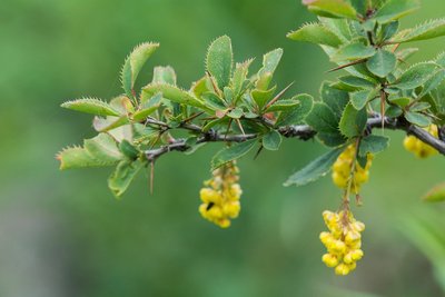
Épine-vinette en fleurs - Mireille Coulon - Parc national des Écrins FloraThe common barberry
The common barberry is a bush with long thorns arranged in threes, and with oval serrated leaves. In spring, it produces clusters of yellow flowers, which later develop into red, oval and elongated berries. These tart fruits are edible and can be made into jellies... if you have the patience to gather them! This shrub grows almost everywhere.
La vallée de Freissinières - Office de tourisme Pays des Écrins HistoryThe Freissinières valley
The valley was created as the result of glacial overdeepening, that is to say, when the glacier came to a halt against the Pallon hard rock bar, it created a depression. When the glaciers retreated, a lake was left behind this rock bar and was gradually filled up by alluvial deposits. From a historical point of view, the Protestant pastor Félix Neff fundamentally altered life in the valley in 1826 by founding a training college for primary school teachers, developing irrigation processes and teaching new crop growing methods, among other things…
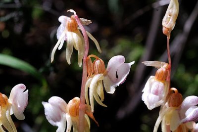
L'épipogon sans feuilles - Mireille Coulon - Parc national des Écrins FloraCool forest
Here, the drought-sensitive fir has established itself among the larches. This forest harbours treasures such as the very rare ghost orchid and the shield-moss, a unique little moss - also rare - which grows on wood in an advanced state of decomposition and thus signals that the natural cycle of the forest is unimpaired.
Cassenoix moucheté - Damien Combrisson - Parc national des Écrins FaunaThe spotted nutcracker
A harsh call sounds from the forest. A jay perhaps? No, a nutcracker, its cousin. With dark, white-spotted plumage, this bird's strong beak can break open hazelnuts (although not walnuts as suggested by its name in French, cassenoix (walnut breaker)) and in particular it can dissect Swiss pine cones in order to reach the pine nuts inside. It inhabits high forests. It buries Swiss pine nuts in the ground to store up food for the winter. When winter comes, it will find the pine nuts again even under a thick layer of snow. Those it forgets will germinate.
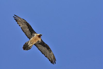
Gypaète barbu adulte en vol - Mireille Coulon - Parc national des Écrins FaunaEagles, vultures and bearded vulture
Numerous species of birds of prey glide around the Crête de Gaulent, scanning the alpine meadows. Might there be something edible down there? The pair of eagles living in this little valley might well choose a marmot. Present in the massif only in the summer and autumn, the griffon vultures keep an eye out for a dead sheep. As for the regal bearded vulture, even larger than the griffons, he picks up the leftovers as he can feed on bones.
Le sentier du Gouffre - Thibault Blais Photographie HistoryThe Sentier du Gouffre - the ravine path
The Sentier du Gouffre has sometimes been described as a Roman road, but we do not know the exact route the Roman road followed. One thing is certain, it used to be used by the villagers to reach their fields and vineyards, and for any other journeys they had to make.
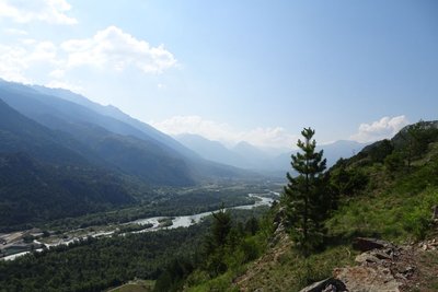
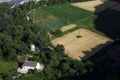
La vallée de la Durance - Office de tourisme Pays des Écrins  Geology and geography
The high Durance valley
Protected from Atlantic influences by the Massif du Pelvoux, the high Durance valley has a very dry climate with wide seasonal temperature fluctuations. It has grasslands very similar to the steppes of Central Europe which are rare in France. It is part of the Natura 2000 “Steppique durancien et queyrassien” (Durance and Queras valley steppes) site.
Plaine de Rame et la Chapelle pris de la cime des Rampes - Jean-Philippe Telmon - Parc national des Écrins HistoryThe lost village
In ancient times, the Durance valley was a key communication corridor. Rama was a kind of staging post on the Roman road. In the Middle Ages, Rama was a small town with a noble's château. But the village was devastated by the capriciousness of the Durance and the Biaysse rivers on numerous occasions and the inhabitants gradually deserted the site, moving to neighbouring villages. The attachment of the parish of Rame to that of La Roche in 1446 is indicative of this decline.
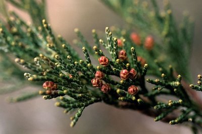
Genévrier thurifère (fleurs femelles) - Bernard Nicollet - Parc national des Écrins FloraJuniperus thurifera or Spanish juniper
This small tree is present in North Africa, the Iberian Peninsula and in a few departments in southern France, including the Hautes-Alpes. It is regarded as a relic from a warmer period far back in history. It has found a refuge in well exposed situations, on warm sunny slopes. Its needles are in the form of scales, lying against the branches. It is a monitored species.
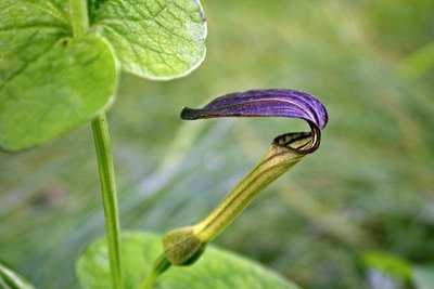
L'aristoloche pistoloche - Damien Combrisson - Parc national des Écrins FloraThe Aristolochia pistolochia
The hamlet of Pallon is in a sunny location. Around the village, a curious plant with long brown trumpet-like flowers grows on the edges of the stone piles in the fields and meadows: the aristolochia pistolochia or birthwort. Of Mediterranean affinity, this plant benefits from the hot dry climate here and is virtually at its northern boundary. It is the host plant of the caterpillars of a rare and protected butterfly: the Spanish festoon.
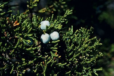
Le genévrier sabine - Bernard Nicollet - Parc national des Écrins FloraThe savin juniper
A low spreading shrub, the savin juniper is very common in stony meadows and uncultivated land on warm slopes. Its dark, matte green leaves in the form of small scales, overlap along the branches. So it isn't spiky... but you still need to be cautious as it is very toxic. For seasoning dishes, better to gather the fruits of the common juniper!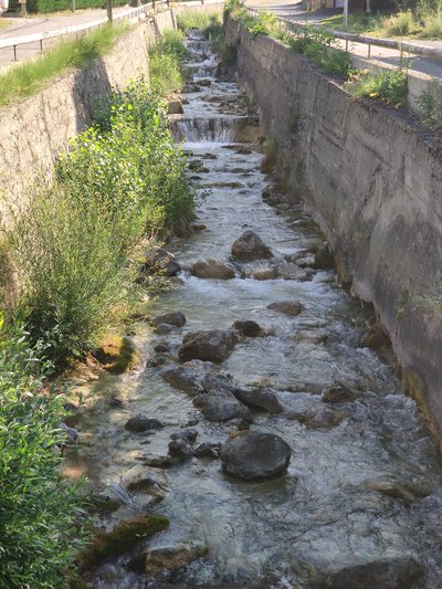
Torrent de Bouchouse - Office de tourisme du Pays des Écrins WaterBouchouse mountain stream
The Bouchouse mountain stream is fed by the Le Pansier and La Pisse mountain streams 1,900 metres above sea level. It crosses the municipality of La Roche-de-Rame, supplying it with water. This mountain stream then flows into the Durance below the municipality.
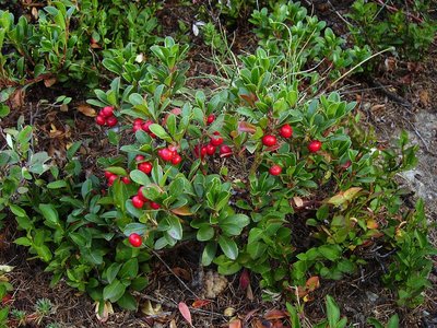
Raisin d'ours - Nicollet Bernard - Parc national des Écrins FloraThe bearberry
The bearberry is a small bush which grows no taller than 20 centimetres. Its small, glossy, evergreen leaves are reminiscent of those of the lingonberry (Vaccinium vitis idaea) but they are not as thick and, above all, its fruits are much less appetising, although they are edible. It will depend on your tastes!
Bois du Truc - Office de tourisme du Pays des Écrins HistoryThe Bois du Truc
The Bois du Truc overlooks the rock beds above the hamlet of Le Bathéou in the municipality of La Roche-de-Rame. In our region, a truc is a large buried rock, a rocky area or an abrupt buttress. So the Bois du Truc is the "wood of the large rock".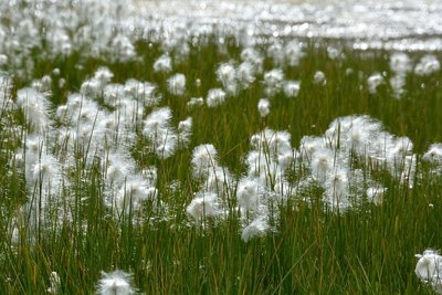
Des linaigrettes - Mireille Coulon - Parc national des Écrins FloraCotton grass
On the water's edge, in the wet meadow, plants with a cottony head sway gently. This is cotton grass, a plant which has insignificant rudimentary flowers but it has fruits that have feathery tufts which aid their dispersal by the wind. The fruits are grouped in such a way that their tufts form a very appealing «pompom»! These plants are well adapted to the mountain climate.
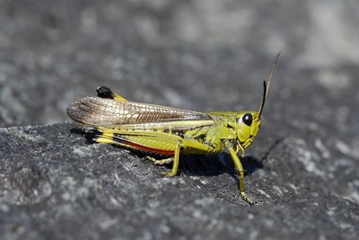
Le criquet ensanglanté - Mireille Coulon - Parc national des Écrins FaunaThe large marsh grasshopper
In the wet areas beside the streams lives the large marsh grasshopper. Its French name, criquet engsanglanté, translates as the "bloodied grasshopper" because the female has purple-red marks which stand out against her general green colour. Her eggs are drought-sensitive so she only lays them in damp soil. When courting the female, the male does not chirp but makes clicking sounds, which he produces by stretching his hind leg in a sudden movement.
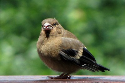
Jeune bouvreuil - Christophe Albert - Parc national des Écrins FaunaThe bullfinch
Gentle and melancholic calls can be heard coming from trees in the forest. They are the calls of the bullfinch, a plump and timid little passerine. The male can be identified from his pinkish red underside, while the female's is beige. Both have a black cap. They often live in small groups, staying in contact with one another through their little calls. It is a year-round resident.
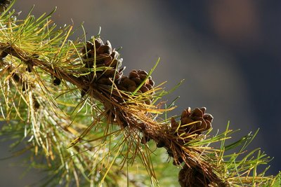
Mélèze avec cônes - Robert Chevalier - Parc national des Écrins FloraThe larch
Golden yellow needles in autumn, purple cones in the spring... The larch offers colour interest throughout the year, and rather suits its title "the tree of light". It drops its soft deciduous needles in autumn and winter. In spring, the slender branches of this conifer are dotted with female flowers, which will develop into cones, and male flowers. The larch thrives on the north-facing slopes and lights up the mountainsides.
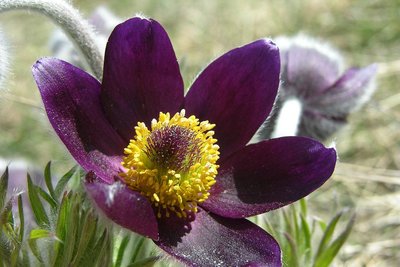
Pulsatille des montagnes - Thierry Maillet - Parc national des Écrins FloraThe alpine anemone
The alpine anemone or the alpine pulsatilla blooms here in the spring. It is a plant with a downy covering of white hairs on the large drooping flowers which are dark purple, contrasting with the bright yellow of the numerous stamens, and with very indented leaves. In summer, its fruits with a long pappus, or tuft, form a feathery seed head atop the stem. Although it is frequently found in localised areas, it is nevertheless a rare species dependent on steppe meadows in the Durance valley.
More information
Source

Report a problem or an error
If you have found an error on this page or if you have noticed any problems during your hike, please report them to us here: