2. From Vallouise to Champcella (stage on the Super Noir - trail no. 15)
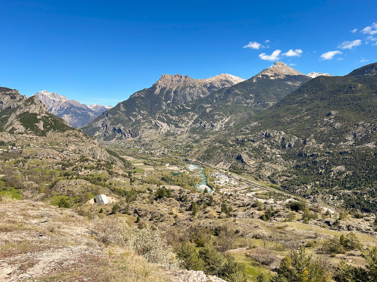
A feature-packed Stage on the Pays des Écrins Super Noir trail, to admire the area's villages and hamlets. Discover the unspoilt character of Vallouise, the high peaks surrounding Puy Saint Vincent, the protected Freissinières valley, the charm of Champcella…
Description
In Vallouise, go straight through the village past the church. On the church square, take the Rue du Champs de Mars and then the "Dessous Ville" road. At the D504 intersection, proceed by turning left. Cross the Gérendoine bridge and continue straight on. Follow the shore of Lac des Allards (and past the Ranch) until you reach Les Alberts.
- At the D4 intersection, turn right and then follow the road towards Station 1400 and Les Prés.
- Turn right and follow the stream Les Alberts. Then join the path which passes underneath the Les Prés chairlift. At the intersection with the road, turn left and continue straight through Puy-Saint-Vincent. Head towards Prey d'Amont and then the Pousterle pass (“Col de la Pousterle”).
- At La Pousterle, turn left towards the mountain stream Le Fournel; cross it and turn left. Continue straight on until you reach the Les Lauzes pass and then Les Aujards. The trail continues up to the Freissinières valley and the valley centre ("Maison de la Vallée").
- From the Maison de la Vallée, go down into the meadow and cross the Biaysse river. Follow the track that runs along the right-hand bank of the river. At the second bridge, turn right. Continue along the edge of the Bois de Monsieur wood heading for the Cabane du Parc and the Cabane du Gourre. Continue straight on until you reach the Val Haute pass and then continue along the side of the Peyron.
- Carry on as far as the Cabane de Tramouillon and back, and continue until you reach the Tramouillon pass and the Cabane de la Selle. Then carry straight on until you reach Champcella.
- Departure : Huttopia campsite, Vallouise
- Arrival : Champcella
- Towns crossed : Vallouise-Pelvoux, Puy-Saint-Vincent, Les Vigneaux, L'Argentière-la-Bessée, Freissinières, and Champcella
Altimetric profile
Recommandations
Before setting off, it is very important to check the opening periods for this route on the website: https://stationdetrail.com/fr/stations/le-pays-des-ecrins/parcours
Check weather conditions before setting off
Rescue services contact details: Secours Montagne (Mountain Rescue): +33 (0)4 92 22 22 22 or 112
Show consideration for the work of farmers, livestock keepers and owners
Close all gates behind you
Take your litter home
Do not take shortcuts across pastureland
The trail routes are also suitable for walking
 In mountain pastures, protection dogs are there to protect the herds from predators (wolves, etc.).
When I hike I adapt my behavior by going around the herd and pausing for the dog to identify me.
Find out more about the actions to adopt with the article "Protection dogs: a context and actions to adopt".
Tell us about your meeting by answering this survey.
Information desks
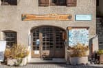
Place de l'Eglise, 05340 Vallouise
Maison du Parc du Briançonnais
Place Médecin-Général Blanchard, 05100 Briançon
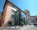
Located at the foot of the medieval town fortified by Vauban, declared World Heritage by UNESCO in 2008, the Maison du Parc Briançon is a welcoming place of information exchange. Three floors of exhibition to discover : the natural and cultural heritage, the museum of the history of skiing in Briançon. Documentation, maps, guidebooks, books and products of the Park. Guided tours for groups by reservation. Free admission.
Transport
Public transport >> www.pacamobilite.fr
Consider car-sharing >> www.blablacar.fr
For more information, ask at the Tourist Information Office nearest to the trail starting point.
Access and parking
10 km from L'Argentière-La Bessée, take the N94.
Parking :
Sensitive areas
Alpine ibex
- Impacted practices:
- Aerial, , Land, Vertical
- Sensitivity periods:
- JunJulAugSep
- Contact:
- Parc National des Écrins
Julien Charron
julien.charron@ecrins-parcnational.fr
Golden eagle
- Impacted practices:
- Aerial, , Vertical
- Sensitivity periods:
- JanFebMarAprMayJunJulAug
- Contact:
- Parc National des Écrins
Julien Charron
julien.charron@ecrins-parcnational.fr
Golden eagle
- Impacted practices:
- Aerial, , Vertical
- Sensitivity periods:
- JanFebMarAprMayJunJulAug
- Contact:
- Parc National des Écrins
Julien Charron
julien.charron@ecrins-parcnational.fr
Golden eagle
- Impacted practices:
- Aerial, , Vertical
- Sensitivity periods:
- JanFebMarAprMayJunJulAug
- Contact:
- Parc National des Écrins
Julien Charron
julien.charron@ecrins-parcnational.fr
Peregrine falcon
- Impacted practices:
- Aerial, Vertical
- Sensitivity periods:
- FebMarAprMayJun
- Contact:
- Parc National des Écrins
Julien Charron
julien.charron@ecrins-parcnational.fr
Peregrine falcon
- Impacted practices:
- Aerial, Vertical
- Sensitivity periods:
- FebMarAprMayJun
- Contact:
- Parc National des Écrins
Julien Charron
julien.charron@ecrins-parcnational.fr
15 points of interest
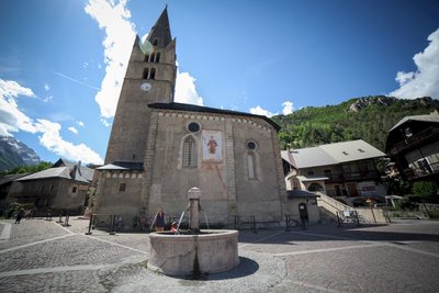
Place de l'Église - Thibaut Blais  History
The church in Vallouise
The church of Saint-Étienne dates from the fifteenth and sixteenth centuries. Inside is an altarpiece and a tabernacle in gilded wood dating from the eighteenth century, together with come mural paintings. Not far from the church stands the late sixteenth-century Chapel of the Penitents with a nineteenth-century painted facade.
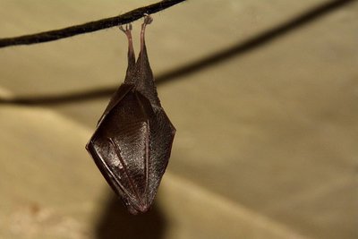
Petit rhinolophe enveloppé dans ses ailes - Mireille Coulon - Parc national des Écrins  Fauna
FaunaThe lesser horseshoe bat
In summer, bats take up residence in the church roof. The species living here is the lesser horseshoe bat, which has been in serious decline over recent decades. Every year, the mothers return after hibernating in caves and each one gives birth to one bat pup. Bats are insectivore mammals threatened by the insecticides used on farmland and on wooden structures and the loss of their hunting habitats and roosts, among other things. They are all protected.
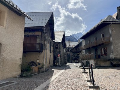
Rue de Champ de Ville - Pierre Nossereau  Architecture
Vallouise
Multi-storey houses - typical of the architecture in the valley in the seventeenth and eighteenth centuries - stand on the old village street. The ground floor was reserved for animals, the first floor for habitation and the upper floors for grain storage. People moved from one floor to another by means of balconies interconnected by a staircase. Many of these balconies are arcaded with stone columns. This type of arcaded balcony is found throughout the valley.
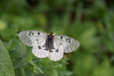
Le semi-apollon - Mireille Coulon - Parc national des Écrins  Fauna
FaunaThe clouded Apollo
This butterfly with hyaline (glass-like) translucent white wings, marked with two black spots, flutters around the clearing or the edges of the forest, where the host plants of its caterpillars grow: the corydalis. Although abundant locally, it is nevertheless a species in sharp decline and is protected.
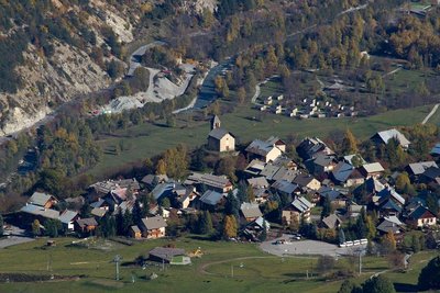
Vue sur Puy Saint Vincent - Christophe Albert - Parc national des Écrins  History
The Sentier du Facteur - the postman's path
In former times, the postman would take this path every day: He would set out from Vallouise, deliver letters in Puy-Saint-Vincent and drop back down to Vallouise, stopping at the hamlets of Parcher on the way. In the winter, when the snow was too deep, the Traversouires (the inhabitants of Puy-Saint-Vincent) donned their snowshoes and wielded their shovels to clear the postman's path down to Vallouise.
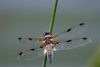
La libellule à quatre taches - Damien Combrisson - Parc national des Écrins  Fauna
FaunaThe four-spotted chaser
Dragonflies can be seen gliding around the lake One of them is relatively easy to identify: the four-spotted chaser. It is called this because there is a spot on each of its four wings. The female lays her eggs on floating vegetation and the larvae are aquatic. The dragonfly feeds primarily on mosquitoes and midges which it catches in mid-air. The male and female also mate while in flight... A real acrobat!
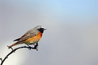
Le rougequeue à front blanc - Damien Combrisson - Parc national des Écrins  Fauna
FaunaThe common redstart
The common redstart can be told apart from its cousin, the black redstart by its white eyebrow (hence its French name which is translated as "white-browed redstart") and its orange breast. At least for the male, since the female of both birds is duller and brownish, but the female common redstart also has an orangey tail. It returns from Africa in early April and searches the areas to find a hollow in a tree or in an old wall where it builds its nest.
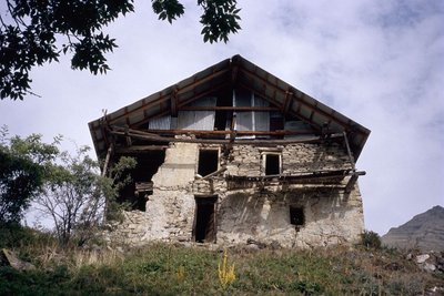
La maison de Felix Neff - Manuel Meester - Parc national des Écrins  History
Félix Neff
Félix Neff was a Swiss Protestant pastor. He was responsible for the Protestant Revival in the Freissinières valley in the seventeenth century. He also set up the first education college for primary school teachers in France, in Dormillouse in 1826. He was also behind new irrigation and house-building techniques, developments which improved the everyday lives of the local people.
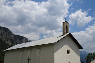
L'église Sainte Marie-Madeleine - Office de tourisme Pays des Écrins  Vernacular heritage
The church of Sainte Marie-Madeleine
The church of Sainte Marie-Madeleine was built in the seventeenth century. It is thought to be a former Protestant church which escaped destruction in 1684 when Louis XIV was leading an anti-Protestant drive. The Protestant church is then thought to have undergone works to convert it into a Catholic church.
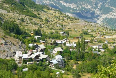
Freissinières - Office de tourisme Pays des Écrins  History
Freissinières
The name Freissinières comes from the old word freissinière meaning "black ash". This municipality, which extends as far as the Col des Terres Blanches and the Col de Freissinières, both of which overlook the Champsaur valley, is made up of thirteen hamlets, although none of them are called Freissinières! Archaeological excavations carried out twenty years ago show that sites at high altitude (such as Faravel) were occupied on a seasonal basis from the retreat of the glaciers 12,000 years ago (Upper Palaeolithic period) and that this occupation continued after that.
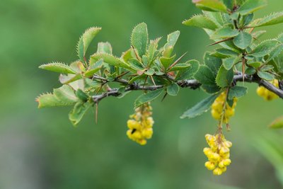
Épine-vinette en fleurs - Mireille Coulon - Parc national des Écrins  Flora
FloraThe common barberry
The common barberry is a bush with long thorns arranged in threes, and with oval serrated leaves. In spring, it produces clusters of yellow flowers, which later develop into red, oval and elongated berries. These tart fruits are edible and can be made into jellies... if you have the patience to gather them! This shrub grows almost everywhere.
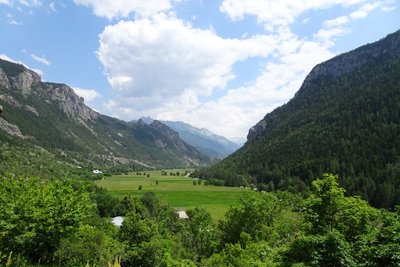
La vallée de Freissinières - Office de tourisme Pays des Écrins  History
The Freissinières valley
The valley was created as the result of glacial overdeepening, that is to say, when the glacier came to a halt against the Pallon hard rock bar, it created a depression. When the glaciers retreated, a lake was left behind this rock bar and was gradually filled up by alluvial deposits. From a historical point of view, the Protestant pastor Félix Neff fundamentally altered life in the valley in 1826 by founding a training college for primary school teachers, developing irrigation processes and teaching new crop growing methods, among other things…
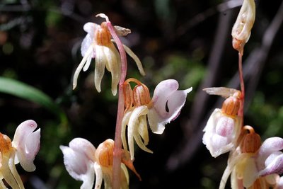
L'épipogon sans feuilles - Mireille Coulon - Parc national des Écrins  Flora
FloraCool forest
Here, the drought-sensitive fir has established itself among the larches. This forest harbours treasures such as the very rare ghost orchid and the shield-moss, a unique little moss - also rare - which grows on wood in an advanced state of decomposition and thus signals that the natural cycle of the forest is unimpaired.
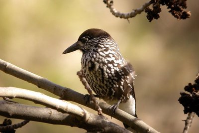
Cassenoix moucheté - Damien Combrisson - Parc national des Écrins  Fauna
FaunaThe spotted nutcracker
A harsh call sounds from the forest. A jay perhaps? No, a nutcracker, its cousin. With dark, white-spotted plumage, this bird's strong beak can break open hazelnuts (although not walnuts as suggested by its name in French, cassenoix (walnut breaker)) and in particular it can dissect Swiss pine cones in order to reach the pine nuts inside. It inhabits high forests. It buries Swiss pine nuts in the ground to store up food for the winter. When winter comes, it will find the pine nuts again even under a thick layer of snow. Those it forgets will germinate.
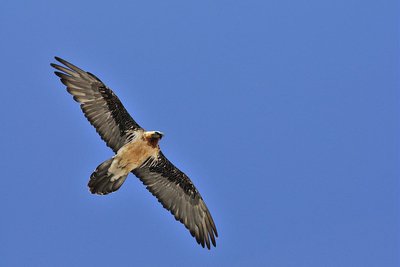
Gypaète barbu adulte en vol - Mireille Coulon - Parc national des Écrins  Fauna
FaunaEagles, vultures and bearded vulture
Numerous species of birds of prey glide around the Crête de Gaulent, scanning the alpine meadows. Might there be something edible down there? The pair of eagles living in this little valley might well choose a marmot. Present in the massif only in the summer and autumn, the griffon vultures keep an eye out for a dead sheep. As for the regal bearded vulture, even larger than the griffons, he picks up the leftovers as he can feed on bones.
Source

Report a problem or an error
If you have found an error on this page or if you have noticed any problems during your hike, please report them to us here:

